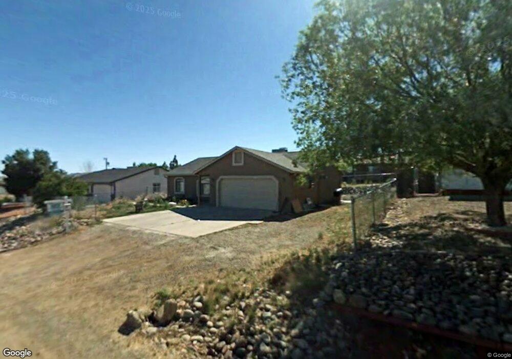
4529 N Phillip Dr Prescott Valley, AZ 86314
Estimated Value: $362,874 - $403,000
3
Beds
2
Baths
1,308
Sq Ft
$295/Sq Ft
Est. Value
About This Home
This home is located at 4529 N Phillip Dr, Prescott Valley, AZ 86314 and is currently estimated at $385,969, approximately $295 per square foot. 4529 N Phillip Dr is a home located in Yavapai County with nearby schools including Mountain View Elementary School, Glassford Hill Middle School, and Bradshaw Mountain High School.
Ownership History
Date
Name
Owned For
Owner Type
Purchase Details
Closed on
Jun 24, 2016
Sold by
Campos Maria Del Socorro and Campos Baltazar
Bought by
Sandoval Dalila and Lopez Maria Campos
Current Estimated Value
Purchase Details
Closed on
Mar 23, 2001
Sold by
Gomez Pablo
Bought by
Campos Baltazar and Campos Maria Delsocorro
Purchase Details
Closed on
Dec 19, 1995
Sold by
Read C J and Read W
Bought by
Gomez Pablo
Home Financials for this Owner
Home Financials are based on the most recent Mortgage that was taken out on this home.
Original Mortgage
$64,800
Interest Rate
7.37%
Mortgage Type
New Conventional
Purchase Details
Closed on
Sep 22, 1995
Sold by
Kabakoff Jeffrey D and Kabakoff Maria V
Bought by
Read C J and Read W
Create a Home Valuation Report for This Property
The Home Valuation Report is an in-depth analysis detailing your home's value as well as a comparison with similar homes in the area
Home Values in the Area
Average Home Value in this Area
Purchase History
| Date | Buyer | Sale Price | Title Company |
|---|---|---|---|
| Sandoval Dalila | -- | None Available | |
| Campos Baltazar | -- | Chicago Title Insurance Co | |
| Gomez Pablo | $81,000 | First American Title Ins | |
| Read C J | $13,500 | First American Title Ins |
Source: Public Records
Mortgage History
| Date | Status | Borrower | Loan Amount |
|---|---|---|---|
| Previous Owner | Gomez Pablo | $64,800 |
Source: Public Records
Tax History Compared to Growth
Tax History
| Year | Tax Paid | Tax Assessment Tax Assessment Total Assessment is a certain percentage of the fair market value that is determined by local assessors to be the total taxable value of land and additions on the property. | Land | Improvement |
|---|---|---|---|---|
| 2026 | $1,299 | $29,702 | -- | -- |
| 2024 | $1,191 | $30,668 | -- | -- |
| 2023 | $1,191 | $25,595 | $0 | $0 |
| 2022 | $1,171 | $20,536 | $2,868 | $17,668 |
| 2021 | $1,224 | $19,009 | $2,883 | $16,126 |
| 2020 | $1,176 | $0 | $0 | $0 |
| 2019 | $1,161 | $0 | $0 | $0 |
| 2018 | $1,104 | $0 | $0 | $0 |
| 2017 | $1,083 | $0 | $0 | $0 |
| 2016 | $1,046 | $0 | $0 | $0 |
| 2015 | $1,031 | $0 | $0 | $0 |
| 2014 | -- | $0 | $0 | $0 |
Source: Public Records
Map
Nearby Homes
- 4500 N Phillip Dr Unit 4
- 4461 N Phillip Dr
- 4395 N Katie Cir W
- 4351 N Romero Cir W Unit 5
- 7316 Spouse Dr
- 8591 E Tracy Dr
- 4441 N Tonto Way
- 3981 N Robert Rd
- 4471 N Romero Cir E Unit E
- 38-A1 N Norman Rd
- 547 N Vermillion Dr
- 4895 N Arnold Dr
- 4870 N Meixner Rd Unit 4
- 4420 N Katie Cir E
- 7869 E Spouse Dr
- 7940 E Loos Dr
- 4112 N Edith Ct
- 4148 N Jay Ct
- 4921 N Miner Rd
- 4881 N Tonto Way
- 4543 N Phillip Dr
- 4515 N Phillip Dr
- 1543 N Phillip Dr
- 4518 N Sauter Dr E
- 4518 N Sauter Dr E Unit 4
- 4534 N Sauter Dr E
- 4500 N Sauter Dr E
- 4500 N Sauter Dr E Unit 4
- 4536 N Phillip Dr
- 4536 N Phillip Dr Unit 4
- 4557 N Phillip Dr
- 4557 N Phillip Dr Unit 4
- 4501 N Phillip Dr
- 4516 N Phillip Dr
- 4550 N Sauter Dr E Unit 1
- 4550 N Sauter Dr E
- 4550 N Sauter Dr E Unit 4
- 4485 N Phillip Dr
- 4485 N Phillip Dr Unit 1
- 4517 N Sauter Dr E