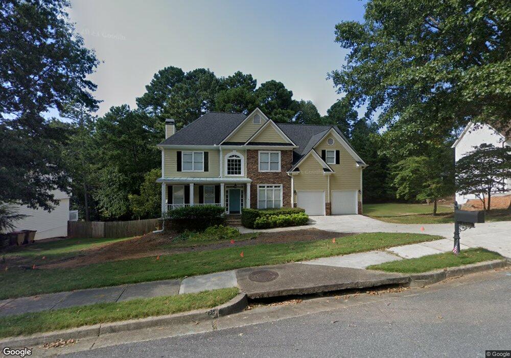
4529 Silver Peak Pkwy Unit 2 Suwanee, GA 30024
Estimated Value: $594,522 - $646,000
4
Beds
3
Baths
2,395
Sq Ft
$260/Sq Ft
Est. Value
About This Home
This home is located at 4529 Silver Peak Pkwy Unit 2, Suwanee, GA 30024 and is currently estimated at $622,631, approximately $259 per square foot. 4529 Silver Peak Pkwy Unit 2 is a home located in Gwinnett County with nearby schools including Level Creek Elementary School, North Gwinnett Middle School, and North Gwinnett High School.
Ownership History
Date
Name
Owned For
Owner Type
Purchase Details
Closed on
May 21, 2025
Sold by
O'Farrell Patrick G
Bought by
Ofarrell Angela Christine and Ofarrell Patrick George
Current Estimated Value
Purchase Details
Closed on
Dec 12, 1997
Sold by
Sharp Development
Bought by
Ofarrell Patrick G and Ofarrell Angela C
Home Financials for this Owner
Home Financials are based on the most recent Mortgage that was taken out on this home.
Original Mortgage
$135,000
Interest Rate
7.26%
Mortgage Type
New Conventional
Create a Home Valuation Report for This Property
The Home Valuation Report is an in-depth analysis detailing your home's value as well as a comparison with similar homes in the area
Home Values in the Area
Average Home Value in this Area
Purchase History
| Date | Buyer | Sale Price | Title Company |
|---|---|---|---|
| Ofarrell Angela Christine | -- | -- | |
| Ofarrell Patrick G | $192,000 | -- |
Source: Public Records
Mortgage History
| Date | Status | Borrower | Loan Amount |
|---|---|---|---|
| Previous Owner | Ofarrell Patrick G | $135,000 |
Source: Public Records
Tax History Compared to Growth
Tax History
| Year | Tax Paid | Tax Assessment Tax Assessment Total Assessment is a certain percentage of the fair market value that is determined by local assessors to be the total taxable value of land and additions on the property. | Land | Improvement |
|---|---|---|---|---|
| 2024 | $4,906 | $210,880 | $39,200 | $171,680 |
| 2023 | $4,906 | $210,880 | $39,200 | $171,680 |
| 2022 | $4,543 | $192,280 | $39,200 | $153,080 |
| 2021 | $3,358 | $148,640 | $29,440 | $119,200 |
| 2020 | $663 | $134,440 | $29,440 | $105,000 |
| 2019 | $3,358 | $128,440 | $35,600 | $92,840 |
| 2018 | $3,358 | $128,440 | $35,600 | $92,840 |
| 2016 | $3,110 | $116,760 | $32,400 | $84,360 |
| 2015 | $2,858 | $103,920 | $27,000 | $76,920 |
| 2014 | $3,265 | $103,920 | $27,000 | $76,920 |
Source: Public Records
Map
Nearby Homes
- 4544 Silver Peak Pkwy
- 4335 Landover Way Unit 3
- 735 Amberton Close
- 755 Amberton Close Unit 2
- 837 Village Manor Place
- 858 Red Rock Ct
- 4569 Campenille Trace
- 1199 Bennett Creek Overlook
- 1179 Bennett Creek Overlook
- 1119 Bennett Creek Overlook
- 1309 Bennett Creek Overlook
- 655 Grove Manor Ct
- 4592 Campenille Ct
- 4282 Goldfield Trace Unit 4
- 780 Village Field Ct
- 3450 Commander
- 4339 Lansfaire Terrace Unit 4
- 4539 Silver Peak Pkwy Unit 4539
- 4539 Silver Peak Pkwy Unit 2
- 4539 Silver Peak Pkwy
- 4539 Silver Peak Pkwy Unit 41
- 4519 Silver Peak Pkwy Unit 2
- 4549 Silver Peak Pkwy
- 717 White Rock Ct
- 4360 Landover Way Unit 3
- 4504 Silver Peak Pkwy
- 4350 Landover Way Unit 88
- 4350 Landover Way
- 4340 Landover Way
- 4534 Silver Peak Pkwy
- 4350 Lanover Way
- 4350 Landover Way NW
- 4544 Silver Peak Pkwy Unit 47
- 4380 Landover Way
- 4559 Silver Peak Pkwy Unit 4559
- 4559 Silver Peak Pkwy
- 4559 Silver Peak Pkwy