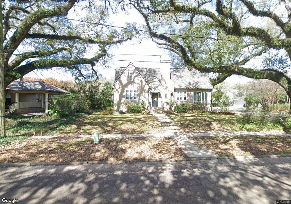
453 L S U Ave Baton Rouge, LA 70808
Highlands/Perkins NeighborhoodEstimated Value: $511,000 - $638,000
4
Beds
3
Baths
2,978
Sq Ft
$196/Sq Ft
Est. Value
About This Home
This home is located at 453 L S U Ave, Baton Rouge, LA 70808 and is currently estimated at $583,080, approximately $195 per square foot. 453 L S U Ave is a home located in East Baton Rouge Parish with nearby schools including University Terrace Elementary School, Glasgow Middle School, and Mckinley Senior High School.
Ownership History
Date
Name
Owned For
Owner Type
Purchase Details
Closed on
Apr 16, 2021
Sold by
Hawie John W and Hawie Tammie Lee
Bought by
Harger Matthew Bennett
Current Estimated Value
Home Financials for this Owner
Home Financials are based on the most recent Mortgage that was taken out on this home.
Original Mortgage
$483,075
Outstanding Balance
$436,158
Interest Rate
3%
Mortgage Type
New Conventional
Estimated Equity
$146,922
Purchase Details
Closed on
Mar 6, 2009
Sold by
Mclaughlin Edwin J
Bought by
Hawie John W
Create a Home Valuation Report for This Property
The Home Valuation Report is an in-depth analysis detailing your home's value as well as a comparison with similar homes in the area
Home Values in the Area
Average Home Value in this Area
Purchase History
| Date | Buyer | Sale Price | Title Company |
|---|---|---|---|
| Harger Matthew Bennett | $508,500 | Commerce Title & Abstract Co | |
| Hawie John W | $365,000 | -- |
Source: Public Records
Mortgage History
| Date | Status | Borrower | Loan Amount |
|---|---|---|---|
| Open | Harger Matthew Bennett | $483,075 |
Source: Public Records
Tax History Compared to Growth
Tax History
| Year | Tax Paid | Tax Assessment Tax Assessment Total Assessment is a certain percentage of the fair market value that is determined by local assessors to be the total taxable value of land and additions on the property. | Land | Improvement |
|---|---|---|---|---|
| 2024 | $4,869 | $48,310 | $8,000 | $40,310 |
| 2023 | $4,869 | $48,310 | $8,000 | $40,310 |
| 2022 | $5,768 | $48,310 | $8,000 | $40,310 |
| 2021 | $4,720 | $40,460 | $8,000 | $32,460 |
| 2020 | $4,689 | $40,460 | $8,000 | $32,460 |
| 2019 | $4,421 | $36,500 | $8,000 | $28,500 |
| 2018 | $4,366 | $36,500 | $8,000 | $28,500 |
| 2017 | $4,366 | $36,500 | $8,000 | $28,500 |
| 2016 | $3,480 | $36,500 | $8,000 | $28,500 |
| 2015 | $3,483 | $36,500 | $8,000 | $28,500 |
| 2014 | $3,471 | $36,500 | $8,000 | $28,500 |
| 2013 | -- | $36,500 | $8,000 | $28,500 |
Source: Public Records
Map
Nearby Homes
- 452 Cornell Ave
- 505 Lsu Ave
- 335 Cornell Ave
- 405 Delgado Dr
- 424 Centenary Dr
- 225 Amherst Ave
- 4411 Highland Rd
- 544 Polytech Dr
- 141 E Boyd Dr Unit 308
- 141 E Boyd Dr Unit 209
- 4637 Burbank Dr Unit 206
- 255 E Boyd Dr Unit 211
- 255 E Boyd Dr Unit 110
- 990 Stanford Ave Unit 504
- 990 Stanford Ave Unit 415
- 990 Stanford Ave Unit 316
- 990 Stanford Ave Unit 307
- 990 Stanford Ave Unit 207
- 4852 Highland Rd
- 921 Carriage Way