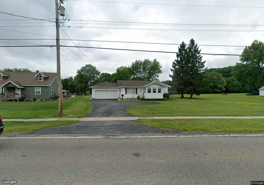
453 N High St Cortland, OH 44410
Estimated Value: $154,179 - $180,000
3
Beds
1
Bath
1,112
Sq Ft
$151/Sq Ft
Est. Value
About This Home
This home is located at 453 N High St, Cortland, OH 44410 and is currently estimated at $167,795, approximately $150 per square foot. 453 N High St is a home located in Trumbull County with nearby schools including Lakeview Elementary School, Lakeview Middle School, and Lakeview High School.
Ownership History
Date
Name
Owned For
Owner Type
Purchase Details
Closed on
Jul 27, 2009
Sold by
Stevens George L and Stevens Delores A
Bought by
Stevens George L and Stevens Delores A
Current Estimated Value
Purchase Details
Closed on
Jul 11, 2001
Sold by
Mazey Ronald S
Bought by
Stevens George L and Stevens Delores A
Purchase Details
Closed on
Mar 16, 1998
Sold by
Williams Nelvan L and Stein Earl W
Bought by
Mazey Ronald
Purchase Details
Closed on
Mar 19, 1997
Sold by
Christen Robert
Bought by
Williams Nelvan L and Stein Earl W
Purchase Details
Closed on
Jan 1, 1990
Bought by
Georgianna and Georgianna Robert
Create a Home Valuation Report for This Property
The Home Valuation Report is an in-depth analysis detailing your home's value as well as a comparison with similar homes in the area
Home Values in the Area
Average Home Value in this Area
Purchase History
| Date | Buyer | Sale Price | Title Company |
|---|---|---|---|
| Stevens George L | -- | Attorney | |
| Stevens George L | $2,000 | Attorney | |
| Stevens George L | $99,000 | -- | |
| Mazey Ronald | $115,000 | -- | |
| Williams Nelvan L | $22,000 | -- | |
| Georgianna | -- | -- |
Source: Public Records
Tax History Compared to Growth
Tax History
| Year | Tax Paid | Tax Assessment Tax Assessment Total Assessment is a certain percentage of the fair market value that is determined by local assessors to be the total taxable value of land and additions on the property. | Land | Improvement |
|---|---|---|---|---|
| 2024 | $1,853 | $45,010 | $7,770 | $37,240 |
| 2023 | $1,853 | $45,010 | $7,770 | $37,240 |
| 2022 | $1,451 | $31,850 | $7,070 | $24,780 |
| 2021 | $1,457 | $31,850 | $7,070 | $24,780 |
| 2020 | $1,464 | $31,850 | $7,070 | $24,780 |
| 2019 | $1,231 | $27,720 | $7,070 | $20,650 |
| 2018 | $1,236 | $27,720 | $7,070 | $20,650 |
| 2017 | $1,235 | $27,720 | $7,070 | $20,650 |
| 2016 | $1,518 | $31,290 | $7,070 | $24,220 |
| 2015 | $1,512 | $31,290 | $7,070 | $24,220 |
| 2014 | $1,330 | $31,290 | $7,070 | $24,220 |
| 2013 | $1,318 | $30,700 | $7,070 | $23,630 |
Source: Public Records
Map
Nearby Homes
- 101 Elizabeth Ct
- 0 N High St
- 288 Butternut Cir
- 400 Tournament Trail Unit 400
- 300 N Mecca St
- 525 Sycamore Trail
- 507 Tournament Trail
- 20 Harneds Landing Unit 20
- 404 Cherry Hill Ln
- 428 Cherry Hill Ln
- 163 N Mecca St Unit 167
- 121 Fairway Dr
- 124 Saint Andrews
- 160 Saint Andrews
- 4869 Phillips Rice Rd
- 0 St Andrews Unit 5113795
- 278 Rosewae Ave
- 167 S Mecca St
- 151 Cedar Cir
- 105 Diamond Way Unit 105