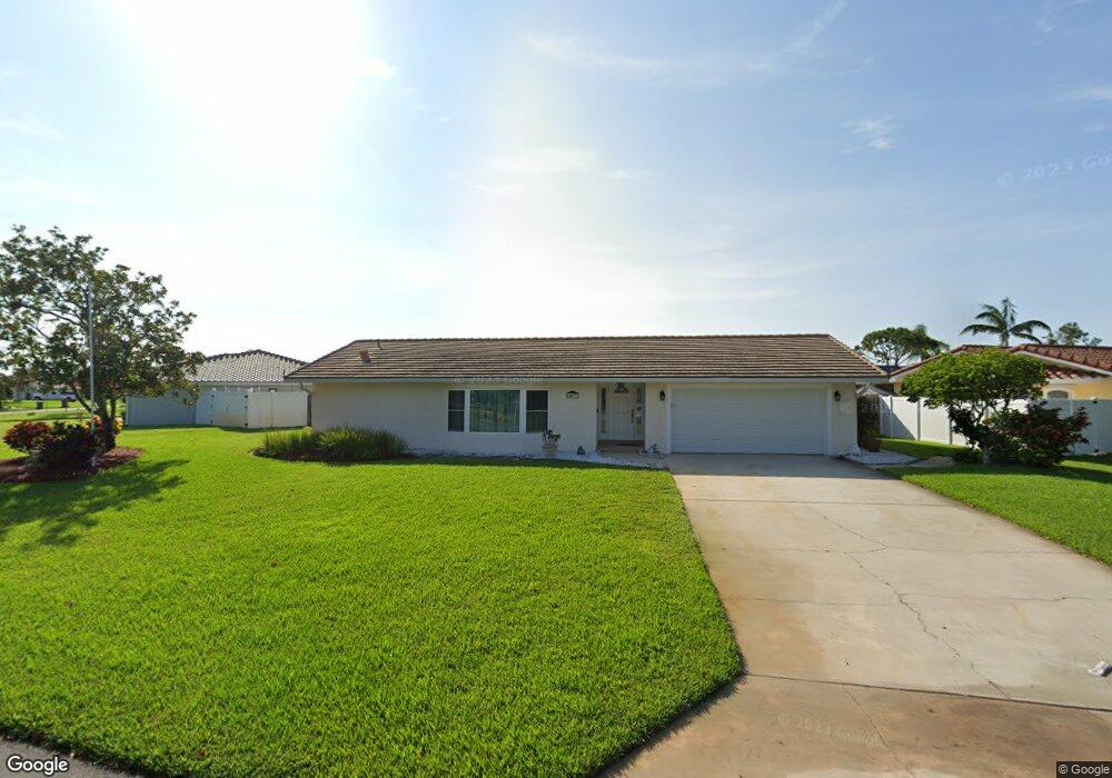
453 Red Sail Way Satellite Beach, FL 32937
Estimated Value: $620,196 - $904,000
4
Beds
2
Baths
2,514
Sq Ft
$318/Sq Ft
Est. Value
About This Home
This home is located at 453 Red Sail Way, Satellite Beach, FL 32937 and is currently estimated at $799,799, approximately $318 per square foot. 453 Red Sail Way is a home located in Brevard County with nearby schools including Sea Park Elementary School, Satellite Senior High School, and DeLaura Middle School.
Ownership History
Date
Name
Owned For
Owner Type
Purchase Details
Closed on
Dec 23, 2024
Sold by
Chandler Lisle and Chandler Julia
Bought by
Chandler Lisle and Chandler Julia
Current Estimated Value
Purchase Details
Closed on
Mar 19, 2010
Sold by
Wadeson Douglas A and Wadeson Ann M
Bought by
Chandler Lisle and Chandler Julia
Purchase Details
Closed on
Jan 30, 1997
Sold by
Terry James R
Bought by
Wadeson Douglas A and Wadeson Ann M
Home Financials for this Owner
Home Financials are based on the most recent Mortgage that was taken out on this home.
Original Mortgage
$202,500
Interest Rate
7.77%
Create a Home Valuation Report for This Property
The Home Valuation Report is an in-depth analysis detailing your home's value as well as a comparison with similar homes in the area
Home Values in the Area
Average Home Value in this Area
Purchase History
| Date | Buyer | Sale Price | Title Company |
|---|---|---|---|
| Chandler Lisle | $100 | None Listed On Document | |
| Chandler Lisle | $100 | None Listed On Document | |
| Chandler Lisle | $330,000 | Alliance Title Insurance Age | |
| Wadeson Douglas A | $225,000 | -- |
Source: Public Records
Mortgage History
| Date | Status | Borrower | Loan Amount |
|---|---|---|---|
| Previous Owner | Wadeson Douglas A | $202,500 |
Source: Public Records
Tax History Compared to Growth
Tax History
| Year | Tax Paid | Tax Assessment Tax Assessment Total Assessment is a certain percentage of the fair market value that is determined by local assessors to be the total taxable value of land and additions on the property. | Land | Improvement |
|---|---|---|---|---|
| 2025 | $5,308 | $468,710 | -- | -- |
| 2024 | $5,274 | $428,430 | -- | -- |
| 2023 | $5,274 | $425,150 | $0 | $0 |
| 2022 | $5,190 | $489,720 | $0 | $0 |
| 2021 | $4,591 | $348,290 | $0 | $0 |
| 2020 | $4,398 | $331,340 | $0 | $0 |
| 2019 | $4,568 | $339,010 | $0 | $0 |
| 2018 | $4,600 | $333,300 | $0 | $0 |
| 2017 | $3,827 | $268,620 | $0 | $0 |
| 2016 | $3,902 | $263,100 | $175,500 | $87,600 |
| 2015 | $4,024 | $261,280 | $175,500 | $85,780 |
| 2014 | $4,056 | $259,210 | $162,000 | $97,210 |
Source: Public Records
Map
Nearby Homes
- 471 Lighthouse Landing St
- 428 Penguin Dr
- 142 Lanternback Island Dr
- 465 Cardinal Dr
- 124 Lanternback Island Dr
- 458 Sandpiper Dr
- 333 S Patrick Dr Unit 11
- 419 Lanternback Island Dr
- 418 Sandpiper Dr
- 435 Sandpiper Dr
- 49 Sorrento Ct
- 349 W Arlington St
- 406 Skylark Blvd
- 484 Lanternback Island Dr
- 341 W Arlington St
- 341 Lanternback Island Dr
- 406 Thrush Dr
- 444 Blue Jay Ln Unit 13
- 432 Blue Jay Ln Unit 62
- 407 Ibis Ln Unit 46
- 449 Red Sail Way
- 457 Red Sail Way
- 445 Red Sail Way
- 461 Red Sail Way
- 472 Red Sail Way
- 441 Red Sail Way
- 452 Red Sail Way
- 456 Sailfish Cove
- 480 Red Sail Way
- 476 Red Sail Way
- 448 Red Sail Way
- 465 Sailfish Cove
- 460 Sailfish Cove
- 465 Red Sail Way
- 437 Red Sail Way
- 444 Red Sail Way
- 484 Red Sail Way
- 464 Sailfish Cove
- 447 Lighthouse Landing St
- 440 Red Sail Way