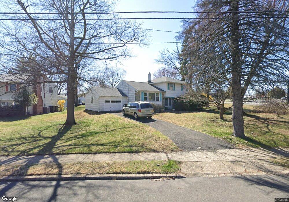
453 Robin Rd Hatboro, PA 19040
Estimated Value: $411,000 - $465,000
4
Beds
2
Baths
1,516
Sq Ft
$287/Sq Ft
Est. Value
About This Home
This home is located at 453 Robin Rd, Hatboro, PA 19040 and is currently estimated at $435,291, approximately $287 per square foot. 453 Robin Rd is a home located in Montgomery County with nearby schools including Upper Moreland Intermediate School, Upper Moreland Primary School, and Upper Moreland Middle School.
Ownership History
Date
Name
Owned For
Owner Type
Purchase Details
Closed on
Dec 30, 2014
Sold by
Sutton Carole J
Bought by
Sutton Carole J
Current Estimated Value
Purchase Details
Closed on
Apr 12, 2005
Sold by
Not Provided
Bought by
Sutton Carole J and Skonetski Georgia
Purchase Details
Closed on
Apr 8, 2005
Sold by
Not Provided
Bought by
Sutton Carole J and Skonetski Georgia
Purchase Details
Closed on
Jan 28, 2003
Sold by
Roling Harold F and Roling Eleanor M
Bought by
Roling Eleanor M and Sutton Carole J
Create a Home Valuation Report for This Property
The Home Valuation Report is an in-depth analysis detailing your home's value as well as a comparison with similar homes in the area
Home Values in the Area
Average Home Value in this Area
Purchase History
| Date | Buyer | Sale Price | Title Company |
|---|---|---|---|
| Sutton Carole J | -- | None Available | |
| Sutton Carole J | $168,806 | T A Title Insurance Co | |
| Sutton Carole J | $168,806 | T A Title Insurance Co | |
| Roling Eleanor M | -- | -- | |
| Roling Eleanor M | -- | -- | |
| Roling Eleanor M | -- | -- |
Source: Public Records
Tax History
| Year | Tax Paid | Tax Assessment Tax Assessment Total Assessment is a certain percentage of the fair market value that is determined by local assessors to be the total taxable value of land and additions on the property. | Land | Improvement |
|---|---|---|---|---|
| 2025 | $5,496 | $115,620 | $48,940 | $66,680 |
| 2024 | $5,496 | $115,620 | $48,940 | $66,680 |
| 2023 | $5,268 | $115,620 | $48,940 | $66,680 |
| 2022 | $4,954 | $115,620 | $48,940 | $66,680 |
| 2021 | $4,887 | $115,620 | $48,940 | $66,680 |
| 2020 | $4,726 | $115,620 | $48,940 | $66,680 |
| 2019 | $4,622 | $115,620 | $48,940 | $66,680 |
Source: Public Records
Map
Nearby Homes
- 165 W Moreland Ave
- 227 Milton Ave
- 233a Milton Ave
- 258 Garden Ave
- 2625 Horsham Rd
- 330 Windsor Ave
- 2411 Horsham Rd
- 550 N York Rd Unit 1-A
- 106 Yorkshire Way
- 201 Castello Ave
- 474 Easton Rd
- 501 Windover Rd
- 216 Columbia Ave
- 2703 Parkside Ave
- 213 Green Lane Terrace
- 473 3rd Ave
- 237 Byberry Rd
- 465 Jacksonville Rd
- 407 W Moreland Ave
- 410 Avenue D
- 449 Robin Rd
- 3905 Blair Mill Rd
- 116 Blair Mill Rd
- 445 Robin Rd
- 456 Robin Rd
- 3901 Blair Mill Rd
- 452 Robin Rd
- 4048 W Moreland Ave
- 441 Robin Rd
- 448 Robin Rd
- 4044 W Moreland Ave
- 3917 Blair Mill Rd
- 444 Robin Rd
- 437 Robin Rd
- 4040 W Moreland Ave
- 118 Blair Mill Rd
- 440 Robin Rd
- 433 Robin Rd
- 443 Mallard Rd
- 4036 W Moreland Ave
Your Personal Tour Guide
Ask me questions while you tour the home.