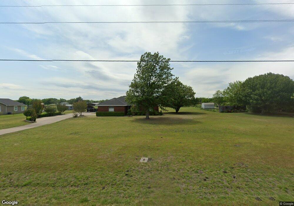
453 Rockport Rd Sherman, TX 75092
Estimated Value: $291,000 - $386,000
3
Beds
2
Baths
1,189
Sq Ft
$284/Sq Ft
Est. Value
About This Home
This home is located at 453 Rockport Rd, Sherman, TX 75092 and is currently estimated at $337,359, approximately $283 per square foot. 453 Rockport Rd is a home located in Grayson County with nearby schools including S&S Consolidated Elementary School, S&S Consolidated Middle School, and S. & S. Cons H.S..
Ownership History
Date
Name
Owned For
Owner Type
Purchase Details
Closed on
May 16, 2008
Sold by
Dayton Wayne
Bought by
Capps Ronnie C
Current Estimated Value
Home Financials for this Owner
Home Financials are based on the most recent Mortgage that was taken out on this home.
Original Mortgage
$92,650
Outstanding Balance
$58,613
Interest Rate
5.86%
Mortgage Type
Purchase Money Mortgage
Estimated Equity
$278,746
Purchase Details
Closed on
Feb 15, 2005
Sold by
Denson Martha E and Denson Michael
Bought by
Dayton Wayne
Create a Home Valuation Report for This Property
The Home Valuation Report is an in-depth analysis detailing your home's value as well as a comparison with similar homes in the area
Home Values in the Area
Average Home Value in this Area
Purchase History
| Date | Buyer | Sale Price | Title Company |
|---|---|---|---|
| Capps Ronnie C | -- | Chapin Title Co Inc | |
| Dayton Wayne | -- | -- |
Source: Public Records
Mortgage History
| Date | Status | Borrower | Loan Amount |
|---|---|---|---|
| Open | Capps Ronnie C | $92,650 |
Source: Public Records
Tax History Compared to Growth
Tax History
| Year | Tax Paid | Tax Assessment Tax Assessment Total Assessment is a certain percentage of the fair market value that is determined by local assessors to be the total taxable value of land and additions on the property. | Land | Improvement |
|---|---|---|---|---|
| 2025 | $506 | $266,782 | -- | -- |
| 2024 | $3,621 | $242,529 | $0 | $0 |
| 2023 | $505 | $220,481 | $0 | $0 |
| 2022 | $3,371 | $200,437 | $0 | $0 |
| 2021 | $3,466 | $189,730 | $27,286 | $162,444 |
| 2020 | $3,249 | $202,276 | $27,286 | $174,990 |
| 2019 | $3,202 | $207,719 | $27,286 | $180,433 |
| 2018 | $2,666 | $155,521 | $27,286 | $128,235 |
| 2017 | $2,441 | $141,510 | $27,286 | $114,224 |
| 2016 | $2,147 | $117,863 | $22,307 | $95,556 |
| 2015 | $1,297 | $99,537 | $18,020 | $81,517 |
| 2014 | $1,427 | $97,784 | $17,506 | $80,278 |
Source: Public Records
Map
Nearby Homes
- 1171 Rockport Rd
- 6514 Joyce Ln
- 00 Primrose Ln
- 3356 Old Dorchester Rd
- 586 Pleasant Home Rd
- 2615 Rolling Hills Dr
- 1401 Cimmaron Trail
- 1404 Tejas Dr
- 10.96 Acres Wible Rd
- 750 Wible Rd
- TBD Wible Rd
- 1426 S Raven Dr
- 1407 Swan Ridge Dr
- 4501 Hawk Ln
- 4507 Falcon Dr
- 6935 S Farm To Market Road 1417
- 1415 Mallard Dr
- 2134 Peggeys Cove
- 3508 Ballam St
- 1412 Ascot Ave
- 417 Rockport Rd
- 481 Rockport Rd
- 389 Rockport Rd
- 509 Rockport Rd
- 365 Rockport Rd
- 563 Rockport Rd
- 543 Rockport Rd
- 386 Rockport Rd
- 340 Rockport Rd
- 312 Rockport Rd
- 303 Rockport Rd
- 288 Rockport Rd
- 328 Choctaw Est Cir
- 320 Choctaw Est Cir
- 282 Rockport Rd
- 32 Preston Meadows Rd
- 284 Choctaw Est Cir
- 284 Choctaw Est Cir Unit LAND
- 284 Choctaw Est Cir
- 94 Preston Meadows Rd