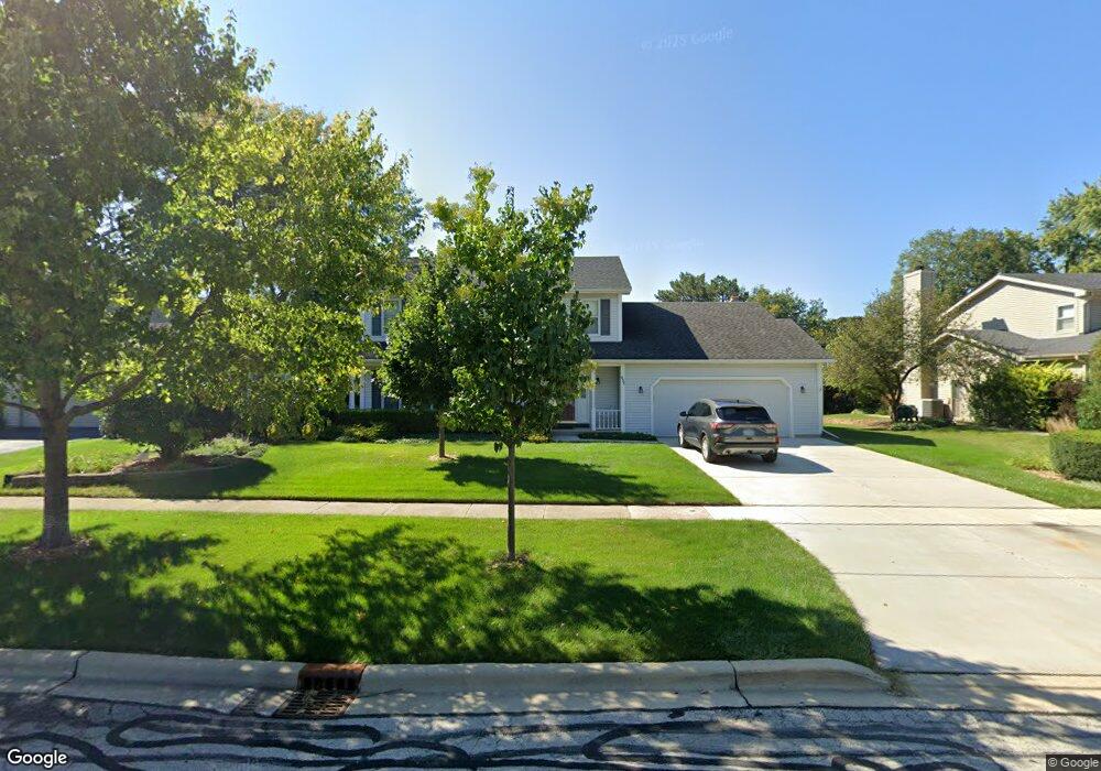
453 S Raddant Rd Batavia, IL 60510
Southeast Batavia NeighborhoodEstimated Value: $436,762 - $518,000
4
Beds
--
Bath
2,200
Sq Ft
$217/Sq Ft
Est. Value
About This Home
This home is located at 453 S Raddant Rd, Batavia, IL 60510 and is currently estimated at $478,441, approximately $217 per square foot. 453 S Raddant Rd is a home located in Kane County with nearby schools including J B Nelson Elementary School, Sam Rotolo Middle School, and Batavia Sr High School.
Ownership History
Date
Name
Owned For
Owner Type
Purchase Details
Closed on
Dec 10, 2021
Sold by
Anderson Philip M and Anderson Kristl M
Bought by
Anderson Philip M and Anderson Kristl M
Current Estimated Value
Purchase Details
Closed on
Sep 29, 2007
Sold by
Anderson Philip M and Anderson Kristi M
Bought by
Anderson Philip M and Anderson Kristl M
Purchase Details
Closed on
Jan 29, 1999
Sold by
Anderson Philip M
Bought by
Anderson Philip M and Anderson Kristl M
Home Financials for this Owner
Home Financials are based on the most recent Mortgage that was taken out on this home.
Original Mortgage
$90,000
Interest Rate
6.88%
Purchase Details
Closed on
Oct 18, 1996
Sold by
Anderson Melissa
Bought by
Anderson Philip M
Create a Home Valuation Report for This Property
The Home Valuation Report is an in-depth analysis detailing your home's value as well as a comparison with similar homes in the area
Home Values in the Area
Average Home Value in this Area
Purchase History
| Date | Buyer | Sale Price | Title Company |
|---|---|---|---|
| Anderson Philip M | -- | None Listed On Document | |
| Anderson Philip M | -- | Attorney | |
| Anderson Philip M | -- | Chicago Title Insurance Co | |
| Anderson Philip M | -- | First American Title Ins Co | |
| Anderson Philip M | -- | -- |
Source: Public Records
Mortgage History
| Date | Status | Borrower | Loan Amount |
|---|---|---|---|
| Previous Owner | Anderson Philip M | $90,000 |
Source: Public Records
Tax History Compared to Growth
Tax History
| Year | Tax Paid | Tax Assessment Tax Assessment Total Assessment is a certain percentage of the fair market value that is determined by local assessors to be the total taxable value of land and additions on the property. | Land | Improvement |
|---|---|---|---|---|
| 2024 | $9,229 | $132,724 | $18,887 | $113,837 |
| 2023 | $8,759 | $120,461 | $17,142 | $103,319 |
| 2022 | $8,675 | $112,581 | $16,021 | $96,560 |
| 2021 | $7,799 | $106,772 | $15,194 | $91,578 |
| 2020 | $8,038 | $104,720 | $14,902 | $89,818 |
| 2019 | $7,903 | $99,012 | $14,374 | $84,638 |
| 2018 | $7,585 | $95,240 | $13,826 | $81,414 |
| 2017 | $7,230 | $87,099 | $13,370 | $73,729 |
| 2016 | $7,073 | $84,563 | $12,981 | $71,582 |
| 2015 | -- | $82,637 | $12,685 | $69,952 |
| 2014 | -- | $80,036 | $12,286 | $67,750 |
| 2013 | -- | $81,039 | $16,278 | $64,761 |
Source: Public Records
Map
Nearby Homes
- Lot 1 Center St
- 621 Young Ave
- 1136 Pine Ct
- 1025 E Wilson St
- 637 E Wilson St
- 1017 Willow Ln Unit 2
- 817 Woodland Hills Rd
- 428 E Wilson St
- 129 S Prairie St
- 1267 Foxglove Dr
- 1273 Foxglove Dr
- 1277 Foxglove Dr
- 1283 Foxglove Dr
- 1285 Foxglove Dr
- Lot 4 Manchester Ave
- 133 Mayflower Dr
- 943 Orchard Ct
- 1384 Foxglove Dr
- 304 Manchester Ave
- 4 Mayflower Dr
- 501 S Raddant Rd
- 443 S Raddant Rd
- 424 Churchill Ct
- 509 S Raddant Rd
- 422 Churchill Ct
- 433 S Raddant Rd
- 518 Carlson Ct
- 462 S Raddant Rd
- 452 S Raddant Rd
- 500 S Raddant Rd
- 442 S Raddant Rd
- 519 S Raddant Rd
- 426 Churchill Ct
- 423 S Raddant Rd
- 520 Carlson Ct
- 516 Carlson Ct
- 508 S Raddant Rd
- 432 S Raddant Rd
- 527 S Raddant Rd
- 465 Appleton Dr