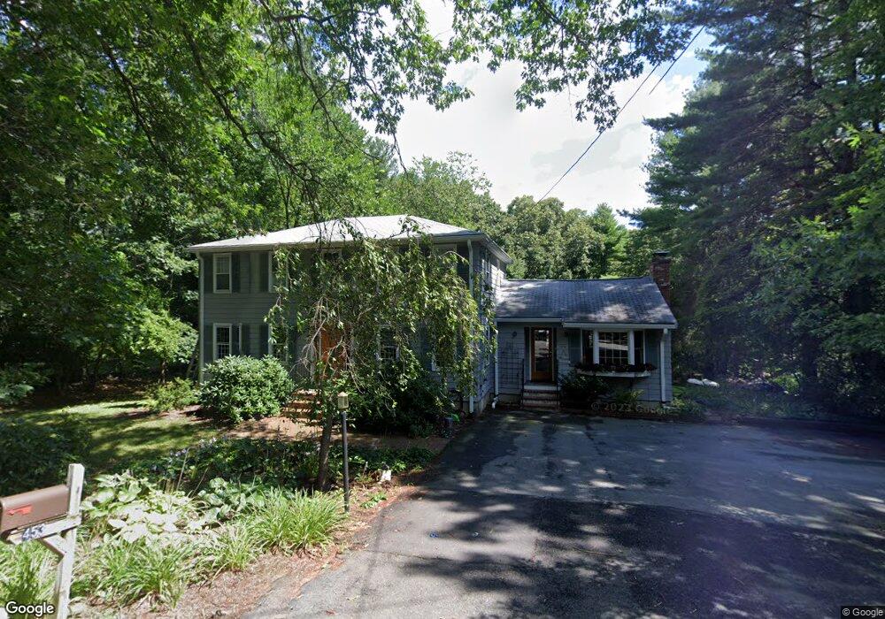
453 Sudbury St Marlborough, MA 01752
Estimated Value: $632,000 - $756,000
4
Beds
2
Baths
2,104
Sq Ft
$327/Sq Ft
Est. Value
About This Home
This home is located at 453 Sudbury St, Marlborough, MA 01752 and is currently estimated at $687,165, approximately $326 per square foot. 453 Sudbury St is a home located in Middlesex County with nearby schools including Marlborough High School.
Ownership History
Date
Name
Owned For
Owner Type
Purchase Details
Closed on
Feb 1, 2024
Sold by
Miller Mark W and Speevack Cynthia
Bought by
Miller Speevack Ft and Miller
Current Estimated Value
Purchase Details
Closed on
Sep 26, 2002
Sold by
Palmer George E and Palmer Judith A
Bought by
Miller Mark W and Speevack Cynthia
Home Financials for this Owner
Home Financials are based on the most recent Mortgage that was taken out on this home.
Original Mortgage
$300,700
Interest Rate
6.25%
Mortgage Type
Purchase Money Mortgage
Create a Home Valuation Report for This Property
The Home Valuation Report is an in-depth analysis detailing your home's value as well as a comparison with similar homes in the area
Home Values in the Area
Average Home Value in this Area
Purchase History
| Date | Buyer | Sale Price | Title Company |
|---|---|---|---|
| Miller Speevack Ft | -- | None Available | |
| Miller Mark W | $391,500 | -- |
Source: Public Records
Mortgage History
| Date | Status | Borrower | Loan Amount |
|---|---|---|---|
| Previous Owner | Miller Mark W | $300,700 |
Source: Public Records
Tax History Compared to Growth
Tax History
| Year | Tax Paid | Tax Assessment Tax Assessment Total Assessment is a certain percentage of the fair market value that is determined by local assessors to be the total taxable value of land and additions on the property. | Land | Improvement |
|---|---|---|---|---|
| 2025 | $5,940 | $602,400 | $229,000 | $373,400 |
| 2024 | $5,659 | $552,600 | $208,200 | $344,400 |
| 2023 | $6,071 | $526,100 | $179,500 | $346,600 |
| 2022 | $5,912 | $450,600 | $170,900 | $279,700 |
| 2021 | $5,629 | $421,500 | $142,500 | $279,000 |
| 2020 | $5,673 | $400,100 | $135,700 | $264,400 |
| 2019 | $5,477 | $389,300 | $133,000 | $256,300 |
| 2018 | $5,090 | $347,900 | $115,400 | $232,500 |
| 2017 | $4,876 | $318,300 | $113,300 | $205,000 |
| 2016 | $4,696 | $306,100 | $113,300 | $192,800 |
| 2015 | $4,774 | $302,900 | $115,500 | $187,400 |
Source: Public Records
Map
Nearby Homes
- 16 Minehan Ln
- 3 Stonehill Rd
- 551 Sudbury St
- 618 Sudbury St
- 168 Blanchette Dr
- 28 Stetson Dr
- 1 Red Oak Dr
- 123 Dutton Rd
- 17 Mcneil Cir
- 38 Collins Dr
- 111 Hager St
- 100 Parmenter Rd
- 492 Stow Rd
- 11 Red Horse Path
- 688 Boston Post Rd E Unit 202
- 688 Boston Post Rd E Unit 304
- 688 Boston Post Rd E Unit 100
- 688 Boston Post Rd E Unit 324
- 688 Boston Post Rd E Unit 228
- 114 Linda Cir
- 439 Sudbury St
- 463 Sudbury St
- 460 Sudbury St
- 452 Sudbury St
- 1 Turner Ridge Rd
- 476 Sudbury St
- 476 Sudbury St Unit 476
- 438 Sudbury St
- 3 Turner Ridge Rd
- 2 Minehan Ln
- 2 Turner Ridge Rd
- 414 Sudbury St
- 490 Sudbury St
- 36 Prendiville Way
- 5 Turner Ridge Rd
- 4 Turner Ridge Rd
- 413 Sudbury St
- 58 Prendiville Way
- 72 Prendiville Way
- 400 Sudbury St