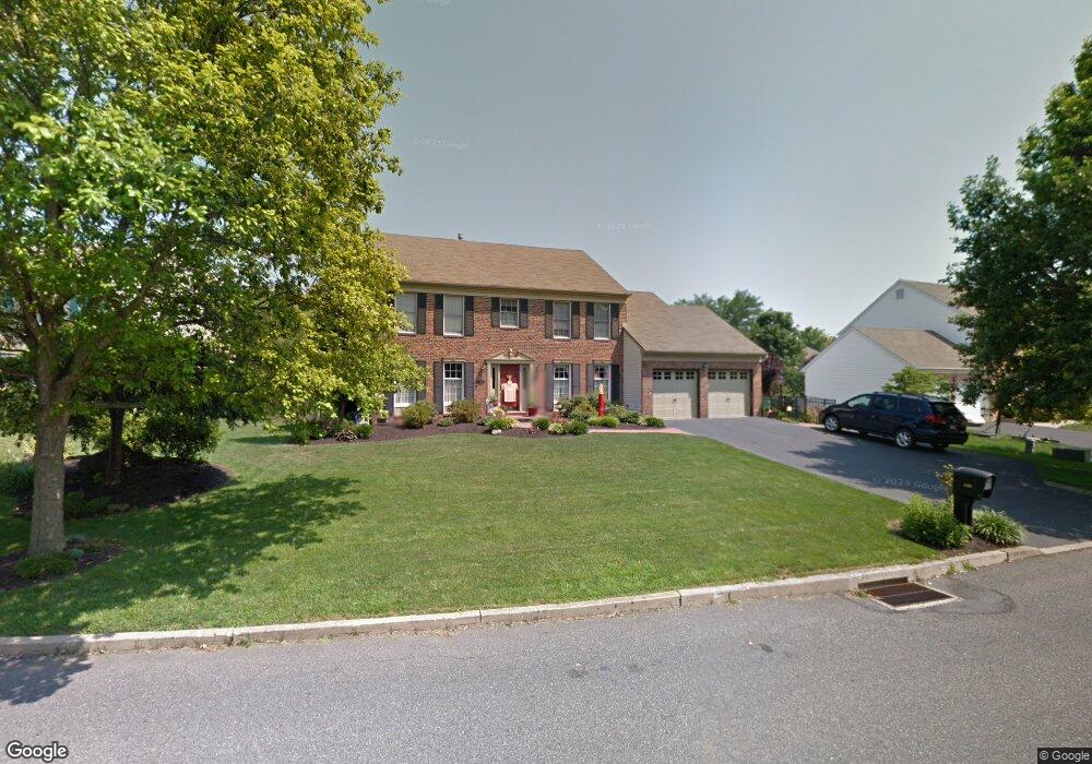
4530 Kathi Dr Bethlehem, PA 18017
Estimated Value: $564,000 - $655,000
4
Beds
3
Baths
2,666
Sq Ft
$229/Sq Ft
Est. Value
About This Home
This home is located at 4530 Kathi Dr, Bethlehem, PA 18017 and is currently estimated at $609,870, approximately $228 per square foot. 4530 Kathi Dr is a home located in Northampton County with nearby schools including Hanover Elementary School, Nitschmann Middle School, and Liberty High School.
Ownership History
Date
Name
Owned For
Owner Type
Purchase Details
Closed on
Oct 27, 2020
Sold by
Graffis Dale W and Graffis Michele L
Bought by
Mitchell Georgia J and Mitchell Kip Robert
Current Estimated Value
Home Financials for this Owner
Home Financials are based on the most recent Mortgage that was taken out on this home.
Original Mortgage
$342,400
Outstanding Balance
$304,687
Interest Rate
2.8%
Mortgage Type
New Conventional
Estimated Equity
$305,183
Purchase Details
Closed on
Jul 21, 2004
Sold by
Scott Paul
Bought by
Graffis Dale
Home Financials for this Owner
Home Financials are based on the most recent Mortgage that was taken out on this home.
Original Mortgage
$256,000
Interest Rate
6.28%
Mortgage Type
New Conventional
Purchase Details
Closed on
Jun 1, 1989
Bought by
Scott Paul R and Scott Ann M
Create a Home Valuation Report for This Property
The Home Valuation Report is an in-depth analysis detailing your home's value as well as a comparison with similar homes in the area
Home Values in the Area
Average Home Value in this Area
Purchase History
| Date | Buyer | Sale Price | Title Company |
|---|---|---|---|
| Mitchell Georgia J | $428,000 | Lighthouse Abstract Ltd | |
| Graffis Dale | $320,000 | -- | |
| Scott Paul R | $235,400 | -- |
Source: Public Records
Mortgage History
| Date | Status | Borrower | Loan Amount |
|---|---|---|---|
| Open | Mitchell Georgia J | $342,400 | |
| Previous Owner | Graffis Dale | $256,000 |
Source: Public Records
Tax History
| Year | Tax Paid | Tax Assessment Tax Assessment Total Assessment is a certain percentage of the fair market value that is determined by local assessors to be the total taxable value of land and additions on the property. | Land | Improvement |
|---|---|---|---|---|
| 2025 | $1,177 | $109,000 | $25,700 | $83,300 |
| 2024 | $7,946 | $109,000 | $25,700 | $83,300 |
| 2023 | $7,973 | $109,000 | $25,700 | $83,300 |
| 2022 | $7,898 | $109,000 | $25,700 | $83,300 |
| 2021 | $7,834 | $109,000 | $25,700 | $83,300 |
| 2020 | $7,844 | $109,000 | $25,700 | $83,300 |
| 2019 | $7,812 | $109,000 | $25,700 | $83,300 |
| 2018 | $7,657 | $109,000 | $25,700 | $83,300 |
| 2017 | $7,603 | $109,000 | $25,700 | $83,300 |
| 2016 | -- | $109,000 | $25,700 | $83,300 |
| 2015 | -- | $109,000 | $25,700 | $83,300 |
| 2014 | -- | $109,000 | $25,700 | $83,300 |
Source: Public Records
Map
Nearby Homes
- 4410 Greenfield Rd
- 1225 Brentwood Ave
- 5602 Grace Ave
- 6800 Gwenmawr Rd
- 7018 Oak Ln
- 4628 Cheryl Dr
- 7022 Oak Ln
- 4644 Cheryl Dr
- 4754 Cheryl Dr
- 3901 Post Dr
- 6822 Sycamore Dr
- 0 Jade Ln
- 0 0 Jade Ln
- 58 Colonial Rd
- 5444 Loyal Dr
- 6960 Constitution Dr
- 3429 Park Place
- 5762 Frederick Dr
- 5762 Frederick Dr
- 5773 Lawrence St
- 4536 Kathi Dr
- 4526 Kathi Dr
- 4523 Virginia Dr
- 4529 Virginia Dr
- 4540 Kathi Dr
- 4520 Kathi Dr
- 4529 Kathi Dr
- 4533 Kathi Dr
- 4523 Kathi Dr
- 4519 Virginia Dr
- 4539 Kathi Dr
- 4537 Virginia Dr
- 4519 Kathi Dr
- 4514 Kathi Dr
- 4513 Virginia Dr
- 4416 Tracey Ln
- 4513 Kathi Dr
- 4530 Virginia Dr
- 4607 Virginia Dr
- 4538 Virginia Dr
Your Personal Tour Guide
Ask me questions while you tour the home.