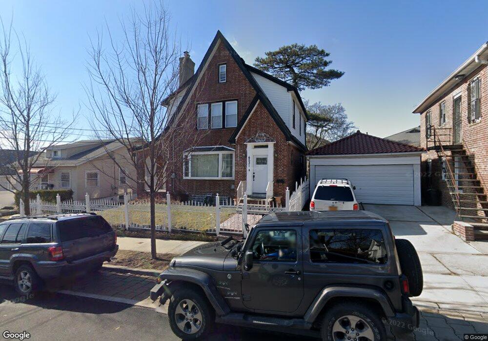
4531 Wilder Ave Bronx, NY 10466
Wakefield NeighborhoodEstimated Value: $562,906 - $710,000
Studio
--
Bath
1,673
Sq Ft
$383/Sq Ft
Est. Value
About This Home
This home is located at 4531 Wilder Ave, Bronx, NY 10466 and is currently estimated at $640,727, approximately $382 per square foot. 4531 Wilder Ave is a home located in Bronx County with nearby schools including P.S. 68 - Bronx, One World Middle School At Edenwald, and Baychester Middle School.
Ownership History
Date
Name
Owned For
Owner Type
Purchase Details
Closed on
Sep 15, 2003
Sold by
Herman Dennis Esq
Bought by
Js Holdings Ny Llc
Current Estimated Value
Purchase Details
Closed on
Oct 13, 2000
Sold by
Lyons Larry
Bought by
Hall Carlton and Hall Roselee
Home Financials for this Owner
Home Financials are based on the most recent Mortgage that was taken out on this home.
Original Mortgage
$224,795
Interest Rate
7.69%
Mortgage Type
FHA
Purchase Details
Closed on
Aug 24, 1999
Sold by
Federal National Mortgage Association
Bought by
Lyons Larry
Purchase Details
Closed on
Nov 12, 1998
Sold by
Stinson Carol and Glenn Joe
Bought by
Federal National Mortgage Association
Create a Home Valuation Report for This Property
The Home Valuation Report is an in-depth analysis detailing your home's value as well as a comparison with similar homes in the area
Home Values in the Area
Average Home Value in this Area
Purchase History
| Date | Buyer | Sale Price | Title Company |
|---|---|---|---|
| Js Holdings Ny Llc | $274,001 | -- | |
| Hall Carlton | $225,000 | -- | |
| Lyons Larry | $145,000 | -- | |
| Federal National Mortgage Association | $139,500 | -- |
Source: Public Records
Mortgage History
| Date | Status | Borrower | Loan Amount |
|---|---|---|---|
| Previous Owner | Hall Carlton | $224,795 |
Source: Public Records
Tax History
| Year | Tax Paid | Tax Assessment Tax Assessment Total Assessment is a certain percentage of the fair market value that is determined by local assessors to be the total taxable value of land and additions on the property. | Land | Improvement |
|---|---|---|---|---|
| 2025 | $4,832 | $28,858 | $6,492 | $22,366 |
| 2024 | $4,832 | $28,858 | $6,130 | $22,728 |
| 2023 | $4,841 | $28,639 | $6,248 | $22,391 |
| 2022 | $4,436 | $34,500 | $8,220 | $26,280 |
| 2021 | $4,354 | $29,220 | $8,220 | $21,000 |
| 2020 | $4,074 | $28,200 | $8,220 | $19,980 |
| 2019 | $4,027 | $26,160 | $8,220 | $17,940 |
| 2018 | $3,887 | $23,866 | $7,586 | $16,280 |
| 2017 | $4,111 | $22,516 | $7,542 | $14,974 |
| 2016 | $3,797 | $21,242 | $7,995 | $13,247 |
| 2015 | $2,253 | $20,040 | $9,120 | $10,920 |
| 2014 | $2,253 | $20,040 | $9,120 | $10,920 |
Source: Public Records
Map
Nearby Homes
- 4534 Hoxie St
- 820 Penfield St
- 837 Penfield St
- 4817 Wilder Ave
- 4525 Monticello Ave
- 134 Vista Place
- 4740 White Plains Rd
- 137 S 14th Ave
- 148 S 13th Ave
- 999 E 241st St
- 4519 Seton Ave
- 4450 Hill Ave
- 4425 Wilder Ave
- 4432 Baychester Ave
- 109 Vista Place
- 4615 Furman Ave
- 679 E 241st St
- 4425 Edson Ave
- 2015 Nereid Ave
- 4810 Osgood St
- 4529 Wilder Ave
- 4535 Wilder Ave
- 4540 Hoxie St
- 4523 Wilder Ave
- 4530 Hoxie St
- 4546 Hoxie St
- 850 Cranford Ave
- 4528 Wilder Ave
- 4526 Wilder Ave
- 4526 Hoxie St
- 4519 Wilder Ave
- 854 Cranford Ave
- 4522 Wilder Ave
- 4520 Wilder Ave
- 858 Cranford Ave
- 4522 Hoxie St
- 4518 Wilder Ave
- 4601 Wilder Ave
- 4515 Wilder Ave
- 828 Cranford Ave
Your Personal Tour Guide
Ask me questions while you tour the home.