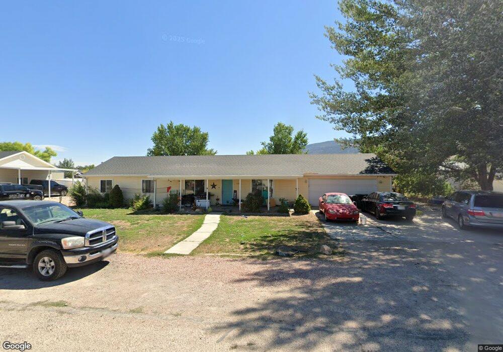
4532 N 1170 E Cedar City, UT 84721
Estimated Value: $339,000 - $387,000
--
Bed
--
Bath
1,539
Sq Ft
$241/Sq Ft
Est. Value
About This Home
This home is located at 4532 N 1170 E, Cedar City, UT 84721 and is currently estimated at $371,668, approximately $241 per square foot. 4532 N 1170 E is a home located in Iron County with nearby schools including Enoch School, Cedar Middle School, and Cedar City High School.
Ownership History
Date
Name
Owned For
Owner Type
Purchase Details
Closed on
Nov 23, 2020
Sold by
Rose Anthony and Rose Misty L
Bought by
Macias Christopher
Current Estimated Value
Home Financials for this Owner
Home Financials are based on the most recent Mortgage that was taken out on this home.
Original Mortgage
$252,273
Outstanding Balance
$224,487
Interest Rate
2.8%
Mortgage Type
FHA
Estimated Equity
$147,181
Purchase Details
Closed on
Jun 29, 2005
Sold by
Carter Jason J and Carter Patty A
Bought by
Wallis Darlin J and Wallis Nicole B
Home Financials for this Owner
Home Financials are based on the most recent Mortgage that was taken out on this home.
Original Mortgage
$161,500
Interest Rate
5.51%
Mortgage Type
New Conventional
Create a Home Valuation Report for This Property
The Home Valuation Report is an in-depth analysis detailing your home's value as well as a comparison with similar homes in the area
Home Values in the Area
Average Home Value in this Area
Purchase History
| Date | Buyer | Sale Price | Title Company |
|---|---|---|---|
| Macias Christopher | -- | Security Escrow & Ttl Ins Ag | |
| Wallis Darlin J | -- | -- |
Source: Public Records
Mortgage History
| Date | Status | Borrower | Loan Amount |
|---|---|---|---|
| Open | Macias Christopher | $252,273 | |
| Previous Owner | Wallis Darlin J | $161,500 |
Source: Public Records
Tax History Compared to Growth
Tax History
| Year | Tax Paid | Tax Assessment Tax Assessment Total Assessment is a certain percentage of the fair market value that is determined by local assessors to be the total taxable value of land and additions on the property. | Land | Improvement |
|---|---|---|---|---|
| 2025 | $1,297 | $177,757 | $45,650 | $132,107 |
| 2023 | $1,311 | $167,760 | $41,130 | $126,630 |
| 2022 | $1,320 | $154,290 | $39,175 | $115,115 |
| 2021 | $1,018 | $118,990 | $23,045 | $95,945 |
| 2020 | $1,053 | $108,160 | $14,935 | $93,225 |
| 2019 | $1,016 | $99,120 | $13,490 | $85,630 |
| 2018 | $1,020 | $96,665 | $13,490 | $83,175 |
| 2017 | $863 | $85,845 | $13,490 | $72,355 |
| 2016 | $822 | $76,070 | $11,345 | $64,725 |
| 2015 | $832 | $72,820 | $0 | $0 |
| 2014 | $818 | $67,265 | $0 | $0 |
Source: Public Records
Map
Nearby Homes
- 4594 N Utah Trail
- 4594 Utah Trail
- 4652 N Marshal Trail
- 1271 E Southern Homestead Blvd
- 4509 N Gold Dust Trail St
- 60 acre ft Priority Date 1951
- 3 acre ft
- 7 acre ft Priority Date 1963
- 1010 E Midvalley Rd
- 1040 E Midvalley Rd
- 7 Acre Ft 1963 Priority Date
- 5202 N Tomahawk Dr
- 1570 Stage Coach Ln
- 985 E Winchester Dr
- 4302 N Tomahawk Dr
- 4228 N Tomahawk Dr Unit Lot 7 Sunview Estate
- 5203 N Tomahawk Dr
- 4211 N Tomahawk Dr Unit Lot 11 Sunview Estat
- 4725 N Mule Train Dr
- 0 Lot 85 Phase 2 Unit 25-266405
- 4532 Quickdraw Ln
- 4532 Quickdraw Ln
- 4542 N Quickdraw
- 4510 N 1170 E
- 4542 N 1170 E
- 4537 N Tumbleweed Dr
- 4533 N Quickdraw
- 4513 N Tumbleweed Dr
- 4545 N Tumbleweed Dr
- 4494 N 1170 E
- 4558 N 1170 E
- 4558 Quickdraw Ln
- 4533 N 1170 E
- 4509 N 1170 E
- 4541 N 1170 E
- 4501 N Tumbleweed Dr
- 4501 N Tumbleweed Dr Unit 4501 N 1230 E
- 4563 N Tumbleweed Dr
- 4497 Quickdraw Ln Unit A-0840-0010-0008
- 4559 Quickdraw Ln