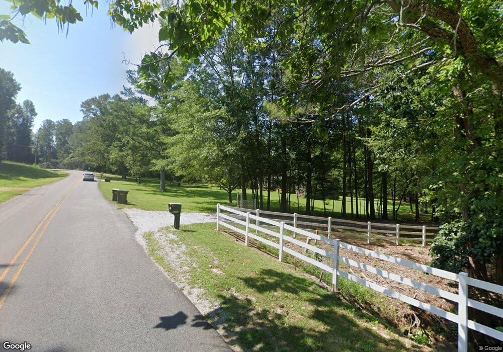
4533 Day Rd SW Decatur, AL 35603
Estimated Value: $362,000 - $578,549
--
Bed
4
Baths
3,184
Sq Ft
$147/Sq Ft
Est. Value
About This Home
This home is located at 4533 Day Rd SW, Decatur, AL 35603 and is currently estimated at $469,516, approximately $147 per square foot. 4533 Day Rd SW is a home located in Morgan County with nearby schools including Danville-Neel Elementary School, Danville Middle School, and Danville High School.
Ownership History
Date
Name
Owned For
Owner Type
Purchase Details
Closed on
Aug 25, 2022
Sold by
Baker Edward M and Baker Teresa L
Bought by
Wahl Patricia A
Current Estimated Value
Home Financials for this Owner
Home Financials are based on the most recent Mortgage that was taken out on this home.
Original Mortgage
$660,000
Outstanding Balance
$630,993
Interest Rate
5.51%
Estimated Equity
-$161,477
Purchase Details
Closed on
May 4, 2017
Sold by
Wells Fargo Bank N A
Bought by
Baker Teresa L and Baker Edward M
Purchase Details
Closed on
Jun 26, 2015
Sold by
Hamlin Thomas and Hamlin Cynthia
Bought by
Wells Fargo Bank N A
Create a Home Valuation Report for This Property
The Home Valuation Report is an in-depth analysis detailing your home's value as well as a comparison with similar homes in the area
Home Values in the Area
Average Home Value in this Area
Purchase History
| Date | Buyer | Sale Price | Title Company |
|---|---|---|---|
| Wahl Patricia A | $660,000 | Judge Alan P | |
| Wahl Patricia A | $660,000 | None Listed On Document | |
| Baker Teresa L | $157,500 | None Available | |
| Wells Fargo Bank N A | $173,672 | None Available |
Source: Public Records
Mortgage History
| Date | Status | Borrower | Loan Amount |
|---|---|---|---|
| Open | Wahl Patricia A | $660,000 | |
| Closed | Wahl Patricia A | $660,000 |
Source: Public Records
Tax History Compared to Growth
Tax History
| Year | Tax Paid | Tax Assessment Tax Assessment Total Assessment is a certain percentage of the fair market value that is determined by local assessors to be the total taxable value of land and additions on the property. | Land | Improvement |
|---|---|---|---|---|
| 2024 | -- | $43,200 | $9,230 | $33,970 |
| 2023 | $0 | $41,320 | $8,560 | $32,760 |
| 2022 | $991 | $37,220 | $7,780 | $29,440 |
| 2021 | $882 | $30,390 | $5,810 | $24,580 |
| 2020 | $882 | $53,030 | $5,810 | $47,220 |
| 2019 | $882 | $29,440 | $0 | $0 |
| 2015 | $1,057 | $29,700 | $0 | $0 |
| 2014 | $1,057 | $29,700 | $0 | $0 |
| 2013 | -- | $27,900 | $0 | $0 |
Source: Public Records
Map
Nearby Homes
- 0 Bird Spring Rd Unit 23365767
- 94 Herring Rd
- 0 Danville Rd Unit 11494669
- 13.24 Herring Rd
- 6.31 Acres Herring Rd
- 4316 Danville Rd SW
- 4417 Dogwood Dr SW
- 1727 Chestnut Mountain Rd SW
- 4709 Danville Rd
- 4306 Dogwood Dr SW
- 4302 Dogwood Dr SW
- 903 Jessie Dr SW
- 11 acres Austinville Flint Rd SW
- 517 Austinville Flint Rd SW
- 513 Austinville Flint Rd SW
- 509 Austinville Flint Rd SW
- 505 Austinville Flint Rd SW
- 501 Austinville Flint Rd SW
- 1618 Lake Cove Dr SW
- 419 Austinville Flint Rd SW
- 4533 Day Rd SW
- 4533 Day Rd SW
- 4519 Day Rd SW
- 1128 Bird Spring Rd SW
- 11 Mountain Edge Pvt Dr
- 11 Mountain Edge Private Dr
- 957 Bird Spring Rd SW
- 4535 Day Rd SW
- 4541 Day Rd SW
- 33 Mountain Edge Pvt Dr
- 4515 Day Rd SW
- 4515 Day Rd SW
- 4621 Cricket Lane Pvt Dr
- 0 Bird Spring Rd Unit 322690
- 0 Bird Spring Rd Unit 265380
- 0 Bird Spring Rd Unit 934764
- Lot 4 Bird Spring Rd
- 4511 Day Rd SW
- 4511 Day Rd SW
- 4631 Cricket Lane Pvt Dr
