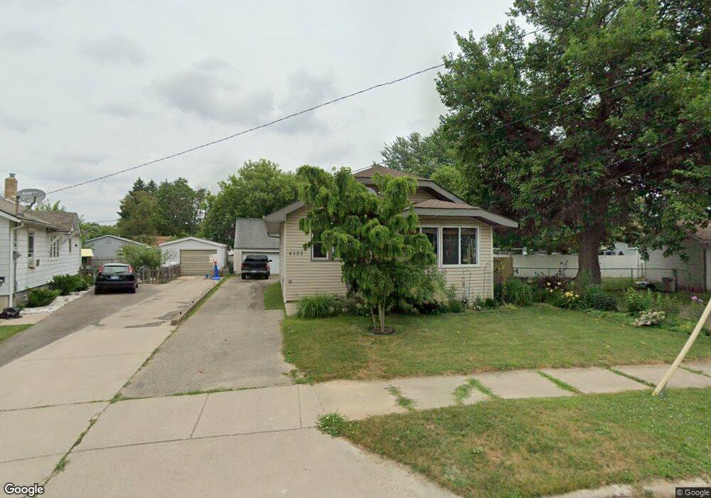
4533 Keats St Flint, MI 48507
Circle Drive NeighborhoodEstimated Value: $75,000 - $97,000
3
Beds
1
Bath
1,013
Sq Ft
$80/Sq Ft
Est. Value
About This Home
This home is located at 4533 Keats St, Flint, MI 48507 and is currently estimated at $81,238, approximately $80 per square foot. 4533 Keats St is a home located in Genesee County with nearby schools including Freeman Elementary School, Flint Southwestern Classical Academy, and International Academy of Flint (K-12).
Ownership History
Date
Name
Owned For
Owner Type
Purchase Details
Closed on
Feb 27, 2009
Sold by
St James Brenda L
Bought by
Dimick Scott A and St James Brenda L
Current Estimated Value
Home Financials for this Owner
Home Financials are based on the most recent Mortgage that was taken out on this home.
Original Mortgage
$53,000
Interest Rate
5.14%
Mortgage Type
New Conventional
Purchase Details
Closed on
Sep 16, 1999
Sold by
Furze Brenden
Bought by
Stjames Brenda
Create a Home Valuation Report for This Property
The Home Valuation Report is an in-depth analysis detailing your home's value as well as a comparison with similar homes in the area
Home Values in the Area
Average Home Value in this Area
Purchase History
| Date | Buyer | Sale Price | Title Company |
|---|---|---|---|
| Dimick Scott A | -- | Centennial Title Ins Agency | |
| Stjames Brenda | -- | Stewart Title Guaranty Compa |
Source: Public Records
Mortgage History
| Date | Status | Borrower | Loan Amount |
|---|---|---|---|
| Closed | Dimick Scott A | $53,000 |
Source: Public Records
Tax History
| Year | Tax Paid | Tax Assessment Tax Assessment Total Assessment is a certain percentage of the fair market value that is determined by local assessors to be the total taxable value of land and additions on the property. | Land | Improvement |
|---|---|---|---|---|
| 2025 | $898 | $32,300 | $0 | $0 |
| 2024 | $817 | $35,300 | $0 | $0 |
| 2023 | $804 | $29,400 | $0 | $0 |
| 2022 | $0 | $23,900 | $0 | $0 |
| 2021 | $834 | $16,400 | $0 | $0 |
| 2020 | $755 | $13,800 | $0 | $0 |
| 2019 | $738 | $11,400 | $0 | $0 |
| 2018 | $731 | $10,900 | $0 | $0 |
| 2017 | $711 | $0 | $0 | $0 |
| 2016 | $707 | $0 | $0 | $0 |
| 2015 | -- | $0 | $0 | $0 |
| 2014 | -- | $0 | $0 | $0 |
| 2012 | -- | $13,000 | $0 | $0 |
Source: Public Records
Map
Nearby Homes
- 338 Browning Ave
- 4205 Red Arrow Rd
- 4127 Custer Ave
- 530 McKeighan Ave
- 4526 Milton Dr
- 416 Burroughs Ave
- 617 McKeighan Ave
- 326 Burroughs Ave
- 621 Lochhead Ave
- 352 Buckingham Ave
- 361 Buckingham Ave
- 3442 Griffith Ct
- 621 Burroughs Ave
- 802 McKeighan Ave
- 630 Buckingham Ave
- 818 Dell Ave
- 1483 Carman St
- 1453 Carman St
- 1450 Carman St
- 3512 Barcey Ct
- 4529 Keats St
- 4537 Keats St
- 407 Tennyson Ave
- 4506 Pengelly Rd
- 4525 Keats St
- 4510 Pengelly Rd
- 4502 Pengelly Rd
- 413 Tennyson Ave
- 4514 Pengelly Rd
- 4430 Pengelly Rd
- 4521 Keats St
- 359 Tennyson Ave
- 4518 Pengelly Rd
- 4428 Pengelly Rd
- 415 Tennyson Ave
- 4520 Pengelly Rd
- 4513 Keats St
- 4516 Keats St
- 4424 Pengelly Rd
- 406 Tennyson Ave
Your Personal Tour Guide
Ask me questions while you tour the home.