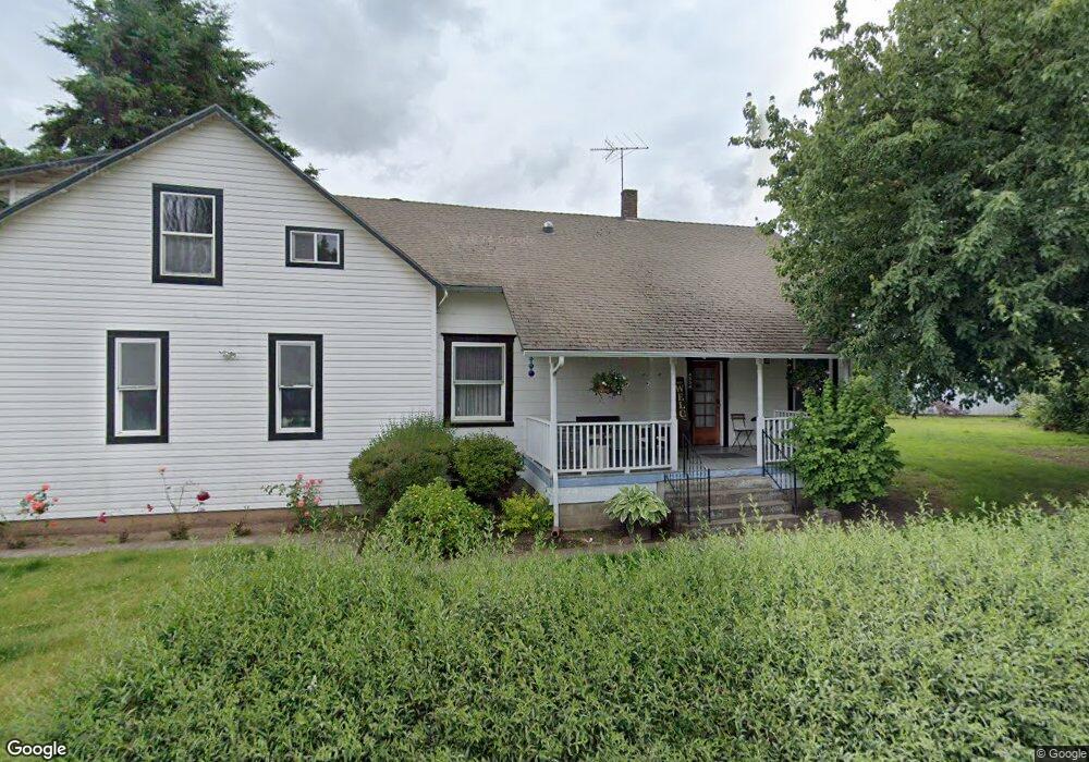
4534 5th St Hubbard, OR 97032
Estimated Value: $578,483 - $659,000
4
Beds
2
Baths
2,489
Sq Ft
$249/Sq Ft
Est. Value
About This Home
This home is located at 4534 5th St, Hubbard, OR 97032 and is currently estimated at $618,742, approximately $248 per square foot. 4534 5th St is a home located in Marion County with nearby schools including North Marion Primary School, North Marion Middle School, and North Marion High School.
Ownership History
Date
Name
Owned For
Owner Type
Purchase Details
Closed on
May 18, 2010
Sold by
Mcgladrey Mark W and Mcgladrey Judith A
Bought by
Valenzuela Monica and Valenzuela Alejandro E
Current Estimated Value
Home Financials for this Owner
Home Financials are based on the most recent Mortgage that was taken out on this home.
Original Mortgage
$295,914
Outstanding Balance
$190,840
Interest Rate
4.37%
Mortgage Type
FHA
Estimated Equity
$427,902
Create a Home Valuation Report for This Property
The Home Valuation Report is an in-depth analysis detailing your home's value as well as a comparison with similar homes in the area
Purchase History
| Date | Buyer | Sale Price | Title Company |
|---|---|---|---|
| Valenzuela Monica | $299,900 | Multiple |
Source: Public Records
Mortgage History
| Date | Status | Borrower | Loan Amount |
|---|---|---|---|
| Open | Valenzuela Monica | $295,914 |
Source: Public Records
Tax History
| Year | Tax Paid | Tax Assessment Tax Assessment Total Assessment is a certain percentage of the fair market value that is determined by local assessors to be the total taxable value of land and additions on the property. | Land | Improvement |
|---|---|---|---|---|
| 2025 | $2,501 | $227,270 | -- | -- |
| 2024 | $2,501 | $220,660 | -- | -- |
| 2023 | $2,410 | $214,240 | $0 | $0 |
| 2022 | $2,295 | $208,000 | $0 | $0 |
| 2021 | $2,208 | $201,950 | $0 | $0 |
| 2020 | $2,169 | $196,070 | $0 | $0 |
| 2019 | $1,943 | $190,360 | $0 | $0 |
| 2018 | $1,945 | $0 | $0 | $0 |
| 2017 | $1,822 | $0 | $0 | $0 |
| 2016 | $1,782 | $0 | $0 | $0 |
| 2015 | $1,747 | $0 | $0 | $0 |
| 2014 | $1,672 | $0 | $0 | $0 |
Source: Public Records
Map
Nearby Homes
- 2367 Dorsey Dr
- 2469 Dorsey Dr
- 2366 Baines Blvd
- 2514 Baines Blvd
- 2542 Baines Blvd
- 2782 Nina Place
- 18767 Highway 99e
- 2276 B St
- 3370 Maple St
- 3370 Maple St Unit 44
- 3289 Ash St Unit 61
- 18767 Oregon 99e
- 2922 Walnut Ct
- 2601 N Lydia Loop
- 13264 Daiquiri Lake Dr NE
- 13032 Mapleleaf Ct NE
- 12602 Fry Rd NE
- 19931 Fobert Rd NE
- 11842 NE Chateau Dr
- 16688 Highway 99e NE Unit 54
Your Personal Tour Guide
Ask me questions while you tour the home.