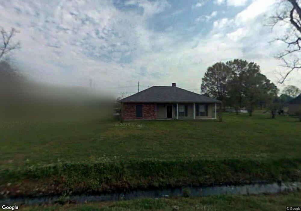
4534 Raymond Labauve Rd Brusly, LA 70719
West Baton Rouge Parish NeighborhoodEstimated Value: $321,000 - $361,000
Studio
--
Bath
2,089
Sq Ft
$161/Sq Ft
Est. Value
About This Home
This home is located at 4534 Raymond Labauve Rd, Brusly, LA 70719 and is currently estimated at $337,334, approximately $161 per square foot. 4534 Raymond Labauve Rd is a home located in West Baton Rouge Parish with nearby schools including Brusly Elementary School, Lukeville Upper Elementary School, and Brusly Middle School.
Ownership History
Date
Name
Owned For
Owner Type
Purchase Details
Closed on
May 31, 2006
Sold by
Thomas Scott A
Bought by
Moore Aaron S and Moore Mary N
Current Estimated Value
Home Financials for this Owner
Home Financials are based on the most recent Mortgage that was taken out on this home.
Original Mortgage
$32,600
Outstanding Balance
$19,177
Interest Rate
6.58%
Mortgage Type
Stand Alone Second
Estimated Equity
$318,157
Create a Home Valuation Report for This Property
The Home Valuation Report is an in-depth analysis detailing your home's value as well as a comparison with similar homes in the area
Home Values in the Area
Average Home Value in this Area
Purchase History
| Date | Buyer | Sale Price | Title Company |
|---|---|---|---|
| Moore Aaron S | $163,000 | None Available |
Source: Public Records
Mortgage History
| Date | Status | Borrower | Loan Amount |
|---|---|---|---|
| Open | Moore Aaron S | $32,600 | |
| Open | Moore Aaron S | $130,400 |
Source: Public Records
Tax History
| Year | Tax Paid | Tax Assessment Tax Assessment Total Assessment is a certain percentage of the fair market value that is determined by local assessors to be the total taxable value of land and additions on the property. | Land | Improvement |
|---|---|---|---|---|
| 2024 | $1,904 | $27,160 | $4,950 | $22,210 |
| 2023 | $1,818 | $25,010 | $4,400 | $20,610 |
| 2022 | $2,623 | $25,010 | $4,400 | $20,610 |
| 2021 | $2,682 | $25,010 | $4,400 | $20,610 |
| 2020 | $2,438 | $22,510 | $3,960 | $18,550 |
| 2019 | $2,157 | $19,120 | $2,260 | $16,860 |
| 2018 | $2,196 | $19,120 | $2,260 | $16,860 |
| 2017 | $1,792 | $16,890 | $2,260 | $14,630 |
| 2015 | $1,433 | $16,680 | $2,050 | $14,630 |
| 2014 | $1,409 | $16,680 | $2,050 | $14,630 |
| 2013 | $1,174 | $13,900 | $2,050 | $11,850 |
Source: Public Records
Map
Nearby Homes
- 4632 Mckenzie Ln
- 6423 Choctaw Rd
- 6358 Union Dr
- 4123 Choctaw Rd
- Yucca III A Plan at Sugar Mill Plantation
- Trillium IV B Plan at Sugar Mill Plantation
- Trillium IV A Plan at Sugar Mill Plantation
- Roses V B Plan at Sugar Mill Plantation
- Romeno V B Plan at Sugar Mill Plantation
- Klein III B Plan at Sugar Mill Plantation
- Renoir IV A Plan at Sugar Mill Plantation
- Cezanne V A Plan at Sugar Mill Plantation
- 4966 Trinity Dr
- 4646 Longwood Dr
- 4822 Longwood Dr
- 4858 Viola Farms Dr
- 4958 Trinity Dr
- 4964 Trinity Dr
- 4961 Trinity Dr
- 4434 Olivia Dr
- 0 Raymond Labauve Rd
- 4488 Raymond Labauve Rd
- 6255 Rambin Rd
- 4584 Raymond Labauve Rd
- 4444 Raymond Labauve Rd
- 6252 Rambin Rd
- 4489 Raymond Labauve Dr
- 4525 Raymond Labauve Rd
- 4555 Raymond Labauve Rd
- 4555 Raymond Labaure
- 4555 Raymond Labauve Dr
- 4555 Raymond Labaure None
- 6020 Rambin Rd
- 4611 Raymond Labauve Rd
- 4638 Raymond Labauve Rd
- 4467 Raymond Labauve Rd
- 4444 Tres Ln
- 4646 Raymond Labauve Rd
- 4447 Raymond Labauve Dr
- 4612 Mckenzie Ln