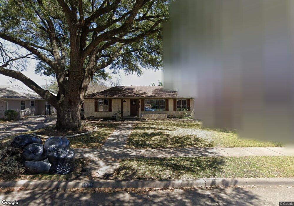
4534 Saint Landry Dr Dallas, TX 75214
Northeast Dallas NeighborhoodEstimated Value: $726,000 - $849,000
3
Beds
2
Baths
1,808
Sq Ft
$420/Sq Ft
Est. Value
About This Home
This home is located at 4534 Saint Landry Dr, Dallas, TX 75214 and is currently estimated at $760,224, approximately $420 per square foot. 4534 Saint Landry Dr is a home located in Dallas County with nearby schools including Lakewood Elementary School, J L Long Middle School, and Woodrow Wilson High School.
Ownership History
Date
Name
Owned For
Owner Type
Purchase Details
Closed on
Jun 27, 2016
Sold by
Jennings Jamie Dennis and Jennings Farrah Morey
Bought by
Cortez Alisa M
Current Estimated Value
Home Financials for this Owner
Home Financials are based on the most recent Mortgage that was taken out on this home.
Original Mortgage
$360,000
Outstanding Balance
$287,296
Interest Rate
3.57%
Mortgage Type
New Conventional
Estimated Equity
$472,928
Purchase Details
Closed on
Jun 2, 2010
Sold by
Trese Steven M and Trese Julie L
Bought by
Jennings Jamie Dennis and Jennings Farrah Morey
Home Financials for this Owner
Home Financials are based on the most recent Mortgage that was taken out on this home.
Original Mortgage
$264,000
Interest Rate
3.75%
Mortgage Type
New Conventional
Purchase Details
Closed on
Mar 1, 2005
Sold by
Aulds Ryan
Bought by
Trese Steven M
Home Financials for this Owner
Home Financials are based on the most recent Mortgage that was taken out on this home.
Original Mortgage
$172,400
Interest Rate
4.5%
Mortgage Type
Purchase Money Mortgage
Purchase Details
Closed on
Nov 11, 2002
Sold by
Campos Stuart Sigfrido and Decampos Maria E Garcia
Bought by
Aulds Ryan
Home Financials for this Owner
Home Financials are based on the most recent Mortgage that was taken out on this home.
Original Mortgage
$160,000
Interest Rate
6%
Purchase Details
Closed on
Jun 29, 1995
Sold by
Collins Thomas J
Bought by
Campos Stuart Sigfrido and Decampos Maria E Garcia
Home Financials for this Owner
Home Financials are based on the most recent Mortgage that was taken out on this home.
Original Mortgage
$80,000
Interest Rate
7.79%
Purchase Details
Closed on
Nov 9, 1994
Sold by
Larsen Richard A and Larsen Susan Randall
Bought by
Collins Thomas J
Home Financials for this Owner
Home Financials are based on the most recent Mortgage that was taken out on this home.
Original Mortgage
$84,550
Interest Rate
7.37%
Create a Home Valuation Report for This Property
The Home Valuation Report is an in-depth analysis detailing your home's value as well as a comparison with similar homes in the area
Home Values in the Area
Average Home Value in this Area
Purchase History
| Date | Buyer | Sale Price | Title Company |
|---|---|---|---|
| Cortez Alisa M | -- | Lawyers Title | |
| Jennings Jamie Dennis | -- | Ctc | |
| Trese Steven M | -- | Ctic | |
| Aulds Ryan | -- | -- | |
| Campos Stuart Sigfrido | -- | -- | |
| Collins Thomas J | -- | -- |
Source: Public Records
Mortgage History
| Date | Status | Borrower | Loan Amount |
|---|---|---|---|
| Open | Cortez Alisa M | $360,000 | |
| Previous Owner | Jennings Jamie Dennis | $264,000 | |
| Previous Owner | Trese Steven M | $172,400 | |
| Previous Owner | Aulds Ryan | $160,000 | |
| Previous Owner | Campos Stuart Sigfrido | $80,000 | |
| Previous Owner | Collins Thomas J | $84,550 | |
| Closed | Trese Steven M | $21,550 |
Source: Public Records
Tax History Compared to Growth
Tax History
| Year | Tax Paid | Tax Assessment Tax Assessment Total Assessment is a certain percentage of the fair market value that is determined by local assessors to be the total taxable value of land and additions on the property. | Land | Improvement |
|---|---|---|---|---|
| 2025 | $11,200 | $721,990 | $405,300 | $316,690 |
| 2024 | $11,200 | $690,080 | $300,000 | $390,080 |
| 2023 | $11,200 | $600,890 | $300,000 | $300,890 |
| 2022 | $15,025 | $600,890 | $300,000 | $300,890 |
| 2021 | $12,806 | $485,440 | $200,000 | $285,440 |
| 2020 | $13,169 | $485,440 | $200,000 | $285,440 |
| 2019 | $13,406 | $471,180 | $200,000 | $271,180 |
| 2018 | $12,812 | $471,180 | $200,000 | $271,180 |
| 2017 | $10,744 | $395,120 | $200,000 | $195,120 |
| 2016 | $10,086 | $370,920 | $200,000 | $170,920 |
| 2015 | $6,857 | $318,410 | $100,000 | $218,410 |
| 2014 | $6,857 | $308,700 | $100,000 | $208,700 |
Source: Public Records
Map
Nearby Homes
- 6537 Patrick Dr
- 6711 Vada Dr
- 6720 Braeburn Dr
- 6802 Vada Dr
- 4323 Ashford Dr
- 6746 Braeburn Dr
- 6529 Trammel Dr
- 6446 Lange Cir
- 6527 Axton Cir
- 6474 Sudbury Dr
- 6644 Santa Anita Dr
- 6529 Saint Moritz Ave
- 6811 Patrick Dr
- 6660 Santa Anita Dr
- 6923 Inverness Ln
- 6415 Axton Ln
- 6665 Santa Anita Dr
- 6984 Santa Barbara Dr
- 6804 Santa Maria Ln
- 6612 E Mockingbird Ln
- 4530 Saint Landry Dr
- 4540 Saint Landry Dr
- 4524 Saint Landry Dr
- 4544 Saint Landry Dr
- 4603 Surf Dr
- 4563 Surf Dr
- 6530 Prince St
- 4607 Surf Dr
- 4557 Surf Dr
- 4611 Surf Dr
- 4518 Saint Landry Dr
- 6531 Prince St
- 4550 Saint Landry Dr
- 6522 Prince St
- 4551 Surf Dr
- 4617 Surf Dr
- 4517 Saint Landry Dr
- 4554 Saint Landry Dr
- 6605 Vada Dr
- 4621 Surf Dr