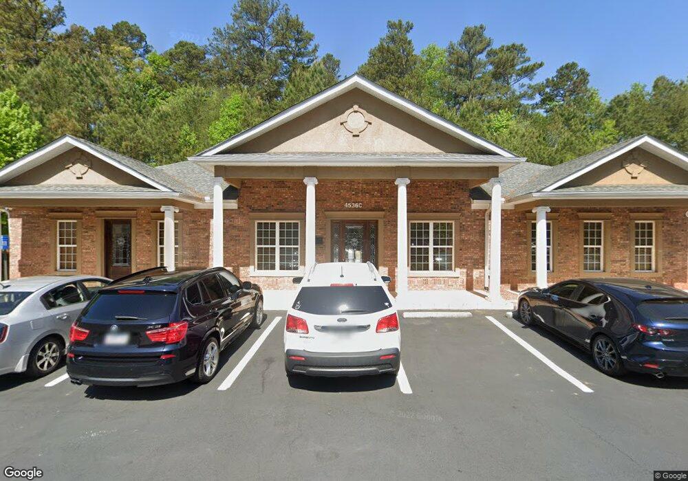
4536 Nelson Brogdon Blvd Unit E-200 Buford, GA 30518
Estimated Value: $824,156
--
Bed
--
Bath
3,000
Sq Ft
$275/Sq Ft
Est. Value
About This Home
This home is located at 4536 Nelson Brogdon Blvd Unit E-200, Buford, GA 30518 and is currently estimated at $824,156, approximately $274 per square foot. 4536 Nelson Brogdon Blvd Unit E-200 is a home located in Gwinnett County with nearby schools including Sugar Hill Elementary School, Lanier Middle School, and Lanier High School.
Ownership History
Date
Name
Owned For
Owner Type
Purchase Details
Closed on
Jul 21, 2023
Sold by
T Shell Sugar Hill Llc
Bought by
Nrs Fortune Property Llc
Current Estimated Value
Home Financials for this Owner
Home Financials are based on the most recent Mortgage that was taken out on this home.
Original Mortgage
$624,000
Outstanding Balance
$368,681
Interest Rate
6.67%
Mortgage Type
New Conventional
Estimated Equity
$455,475
Purchase Details
Closed on
Nov 30, 2005
Sold by
Commercial Contractors Ents Inc
Bought by
T Shell Sugar Hill Llc
Home Financials for this Owner
Home Financials are based on the most recent Mortgage that was taken out on this home.
Original Mortgage
$544,000
Interest Rate
6.04%
Mortgage Type
Commercial
Create a Home Valuation Report for This Property
The Home Valuation Report is an in-depth analysis detailing your home's value as well as a comparison with similar homes in the area
Home Values in the Area
Average Home Value in this Area
Purchase History
| Date | Buyer | Sale Price | Title Company |
|---|---|---|---|
| Nrs Fortune Property Llc | $780,000 | -- | |
| T Shell Sugar Hill Llc | $624,000 | -- |
Source: Public Records
Mortgage History
| Date | Status | Borrower | Loan Amount |
|---|---|---|---|
| Open | Nrs Fortune Property Llc | $624,000 | |
| Previous Owner | T Shell Sugar Hill Llc | $544,000 |
Source: Public Records
Tax History Compared to Growth
Tax History
| Year | Tax Paid | Tax Assessment Tax Assessment Total Assessment is a certain percentage of the fair market value that is determined by local assessors to be the total taxable value of land and additions on the property. | Land | Improvement |
|---|---|---|---|---|
| 2025 | $1,086 | $310,240 | $400 | $309,840 |
| 2024 | $10,827 | $310,240 | $400 | $309,840 |
| 2023 | $10,827 | $278,000 | $400 | $277,600 |
| 2022 | $9,604 | $274,400 | $400 | $274,000 |
| 2021 | $5,826 | $163,200 | $32,640 | $130,560 |
| 2020 | $6,487 | $163,200 | $32,640 | $130,560 |
| 2019 | $6,260 | $163,200 | $32,640 | $130,560 |
| 2018 | $6,285 | $163,200 | $32,640 | $130,560 |
| 2016 | $6,688 | $173,880 | $67,960 | $105,920 |
| 2015 | $6,767 | $173,880 | $67,960 | $105,920 |
| 2014 | $6,806 | $173,880 | $67,960 | $105,920 |
Source: Public Records
Map
Nearby Homes
- 4506 Magnolia Club Cir
- 1402 Frontier Dr
- 1135 W Roberts Dr
- 1182 Edwin Ln
- 4557 Duncan Dr
- 4548 Duncan Dr
- 4648 Pine Tree Cir Unit B
- 4648 Pine Tree # B Cir
- 4519 Cheeley Dr
- 4860 White St
- 4864 White St
- 4862 White St
- The Murphy Plan at White Street
- 4264 Buford Valley Way
- 4173 Chatham Ridge Dr
- 4225 Hidden Meadow Cir
- 4687 Riley Run Ct Unit 1
- 1179 Chatham Rd
- 4536 Nelson Brogdon Blvd Unit BUILDING E
- 4536 Nelson Brogdon Blvd Unit B
- 4536 Nelson Brogdon Blvd
- 4540 Nelson Brogdon Blvd
- 4501 S Roberts Dr
- 4481 S Roberts Dr
- 4511 S Roberts Dr
- 1382 Frontier Dr
- 4521 S Roberts Dr
- 4530 Nelson Brogdon Blvd Unit C
- 4530 Nelson Brogdon Blvd Unit D
- 1431 Frontier Dr
- 1372 Frontier Dr
- 4531 S Roberts Dr
- 4472 S Roberts Dr
- 4471 S Roberts Dr
- 4510 Nelson Brogdon Blvd
- 1421 Frontier Dr
- 4502 S Roberts Dr
- 1362 Frontier Dr