Estimated Value: $304,000 - $398,260
About This Home
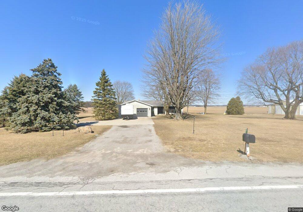
This home is located at 4537 State Route 81, Ada, OH 45810 and is currently estimated at $363,815, approximately $213 per square foot. 4537 State Route 81 is a home located in Hardin County with nearby schools including Ada Elementary School and Ada High School.
Ownership History
We collect this data history from publicly available records. To have your information removed, we recommend requesting removal directly through your county’s website.
Purchase Details
Home Financials for this Owner
Home Financials are based on the most recent Mortgage that was taken out on this home.Purchase Details
Home Financials for this Owner
Home Financials are based on the most recent Mortgage that was taken out on this home.Purchase Details
Home Financials for this Owner
Home Financials are based on the most recent Mortgage that was taken out on this home.Purchase Details
Home Financials for this Owner
Home Financials are based on the most recent Mortgage that was taken out on this home.Purchase History
We collect this data history from publicly available records. To have your information removed, we recommend requesting removal directly through your county’s website.
| Date | Buyer | Sale Price | Title Company |
|---|---|---|---|
| $384,400 | Golden Key Title | ||
| $384,400 | Golden Key Title | ||
| -- | Mid-American Title | ||
| $228,000 | Stewart Title Co | ||
| $161,000 | -- |
Mortgage History
We collect this data history from publicly available records. To have your information removed, we recommend requesting removal directly through your county’s website.
| Date | Status | Borrower | Loan Amount |
|---|---|---|---|
| Open | $307,500 | ||
| Closed | $307,500 | ||
| Previous Owner | $308,750 | ||
| Previous Owner | $216,600 | ||
| Previous Owner | $158,860 |
Tax History
We collect this data history from publicly available records. To have your information removed, we recommend requesting removal directly through your county’s website.
| Year | Tax Paid | Tax Assessment Tax Assessment Total Assessment is a certain percentage of the fair market value that is determined by local assessors to be the total taxable value of land and additions on the property. | Land | Improvement |
|---|---|---|---|---|
| 2025 | $2,935 | $78,730 | $12,680 | $66,050 |
| 2024 | $2,935 | $78,730 | $12,680 | $66,050 |
| 2023 | $2,917 | $78,730 | $12,680 | $66,050 |
| 2022 | $2,623 | $60,470 | $6,770 | $53,700 |
| 2021 | $2,893 | $60,470 | $6,770 | $53,700 |
| 2020 | $2,935 | $60,470 | $6,770 | $53,700 |
| 2019 | $2,190 | $55,240 | $6,560 | $48,680 |
| 2018 | $2,140 | $55,240 | $6,560 | $48,680 |
| 2017 | $2,085 | $55,240 | $6,560 | $48,680 |
| 2016 | $1,668 | $47,920 | $6,040 | $41,880 |
| 2015 | $2,002 | $47,920 | $6,040 | $41,880 |
| 2014 | $1,628 | $47,920 | $6,040 | $41,880 |
| 2013 | $1,734 | $48,210 | $6,040 | $42,170 |
Map
- 503 E North Ave
- 547 E Lincoln Ave Unit Rear
- 425 Liberty St
- 510 E Lehr Ave Unit 510R
- 420 N Simon St
- 746 N Main St Unit 61
- 746 N Main St Unit 63
- 746 N Main St Unit 9
- 746 N Main St Unit 39
- 222 E Montford Ave
- 569 N Johnson St
- 407 Ream St
- 128 E Montford Ave
- 423 N Johnson St
- 314 E University Ave
- 530 N Main St
- 768 N Main St Unit 1-5
- 406 N Main St
- 549 N Gilbert St
- 120 W Buckeye Ave Unit 122
- 4537 State Route 81
- 4690 State Route 81
- 4474 State Route 81
- 4537 Sr
- 4912 State Route 81
- 4268 State Route 81
- 4236 State Route 81
- 2939 County Road 65
- N/A St Route
- 4172 St Route
- 4172 State Route 81
- 4172 Ohio 81
- 4136 State Route 81
- 2810 County Road 65
- 2810 Cr
- 4577 County Road 44
- 4577 Cr
- 3182 County Road 65
- 4823 County Road 44
- 3048 Township Road 55
Ask me questions while you tour the home.