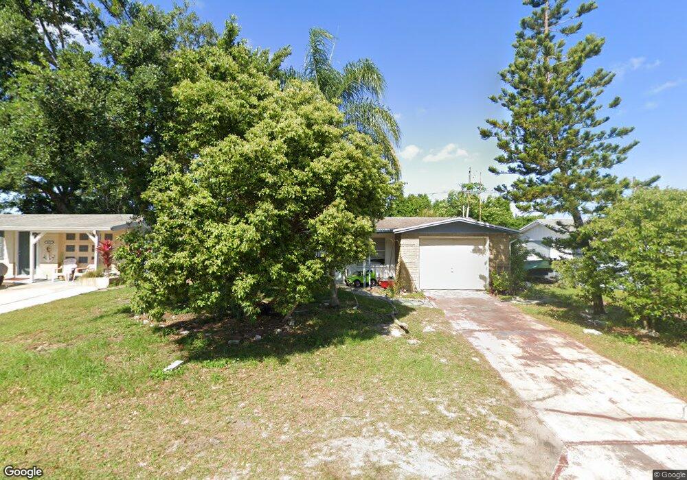
4539 Blanche St New Port Richey, FL 34652
Estimated Value: $182,000 - $214,000
2
Beds
1
Bath
980
Sq Ft
$202/Sq Ft
Est. Value
About This Home
This home is located at 4539 Blanche St, New Port Richey, FL 34652 and is currently estimated at $197,985, approximately $202 per square foot. 4539 Blanche St is a home located in Pasco County with nearby schools including Mittye P. Locke Elementary School, Richey Elementary School, and Gulf Middle School.
Ownership History
Date
Name
Owned For
Owner Type
Purchase Details
Closed on
Jul 17, 2024
Sold by
Marhut Properties I Llc and Marhut 1 Properties Llc
Bought by
Marhut Properties I Llc
Current Estimated Value
Purchase Details
Closed on
Dec 1, 2016
Bought by
Marhut Properties Llc
Purchase Details
Closed on
Apr 1, 2010
Sold by
Chanov Michael and Chanov Constantin
Bought by
Marhut Properties Llc and A Juled Properties Llc
Purchase Details
Closed on
Sep 23, 2002
Sold by
Chanov Kiprian and Chanov Maria
Bought by
Chanov Michael and Chanov Constantin
Create a Home Valuation Report for This Property
The Home Valuation Report is an in-depth analysis detailing your home's value as well as a comparison with similar homes in the area
Home Values in the Area
Average Home Value in this Area
Purchase History
| Date | Buyer | Sale Price | Title Company |
|---|---|---|---|
| Marhut Properties I Llc | -- | Master Title Service | |
| Marhut Properties Llc | $49,300 | -- | |
| Marhut Properties Llc | -- | Attorney | |
| Marhut Properties Llc | $35,000 | Attorney | |
| Chanov Michael | -- | -- |
Source: Public Records
Tax History Compared to Growth
Tax History
| Year | Tax Paid | Tax Assessment Tax Assessment Total Assessment is a certain percentage of the fair market value that is determined by local assessors to be the total taxable value of land and additions on the property. | Land | Improvement |
|---|---|---|---|---|
| 2025 | $1,890 | $159,068 | $30,938 | $128,130 |
| 2024 | $1,890 | $152,248 | $29,453 | $122,795 |
| 2023 | $1,933 | $60,260 | $0 | $0 |
| 2022 | $1,521 | $108,034 | $19,602 | $88,432 |
| 2021 | $1,205 | $82,455 | $13,860 | $68,595 |
| 2020 | $1,188 | $68,201 | $6,930 | $61,271 |
| 2019 | $1,134 | $60,972 | $6,930 | $54,042 |
| 2018 | $1,024 | $51,498 | $6,930 | $44,568 |
| 2017 | $757 | $34,033 | $6,930 | $27,103 |
| 2016 | $710 | $33,179 | $6,930 | $26,249 |
| 2015 | $704 | $32,131 | $6,930 | $25,201 |
| 2014 | $674 | $31,520 | $6,930 | $24,590 |
Source: Public Records
Map
Nearby Homes
- 4526 Annette St
- 4520 Iris Dr
- 4608 Kennedy Dr
- 4746 Azalea Dr Unit 107
- 4746 Azalea Dr Unit 209
- 4746 Azalea Dr Unit 201
- 4746 Azalea Dr Unit 105
- 4614 Croton Dr
- 4742 Azalea Dr Unit 106
- 4548 Somerset Place
- 4744 Azalea Dr Unit 203
- 5330 Poinsettia Dr
- 4453 Terry Loop
- 5316 Drift Tide Dr
- 5419 Palm Dr Unit 130
- 4424 Terry Loop
- 5753 10th Ave
- 5646 Ashen Ave
- 4618 Pirate Place
- 4923 Azalea Dr
- 4533 Blanche St
- 4547 Blanche St
- 4542 Grand Central Ave Unit B
- 4542 Grand Central Ave
- 4534 Grand Central Ave
- 4527 Blanche St
- 5406 Mac Arthur Ave
- 4538 Blanche St
- 5352 Mac Arthur Ave
- 4526 Grand Central Ave
- 4532 Blanche St
- 4544 Blanche St
- 4521 Blanche St
- 4526 Blanche St
- 4550 Blanche St
- 4520 Grand Central Ave
- 4539 Annette St
- 4545 Grand Central Ave
- 4533 Grand Central Ave
- 4533 Annette St