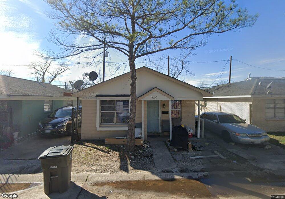
4539 Lelay Cir Houston, TX 77022
Independence Heights NeighborhoodEstimated Value: $140,781 - $231,000
2
Beds
1
Bath
862
Sq Ft
$206/Sq Ft
Est. Value
About This Home
This home is located at 4539 Lelay Cir, Houston, TX 77022 and is currently estimated at $177,945, approximately $206 per square foot. 4539 Lelay Cir is a home located in Harris County with nearby schools including Kennedy Elementary School, Williams Middle, and Booker T Washington Sr High.
Ownership History
Date
Name
Owned For
Owner Type
Purchase Details
Closed on
Feb 1, 2012
Sold by
Mixon Melody
Bought by
4539 Lelay Circle Llc
Current Estimated Value
Purchase Details
Closed on
Mar 15, 2006
Sold by
Self Help Ventures Fund
Bought by
Mixon Melody
Home Financials for this Owner
Home Financials are based on the most recent Mortgage that was taken out on this home.
Original Mortgage
$28,800
Interest Rate
6.19%
Mortgage Type
Fannie Mae Freddie Mac
Purchase Details
Closed on
Nov 2, 2005
Sold by
Bank Of America Na
Bought by
Self Help Ventures Fund
Purchase Details
Closed on
Sep 6, 2005
Sold by
Graves Michelle Ann and Graves Bryson
Bought by
Bank Of America Na
Purchase Details
Closed on
Dec 18, 1998
Sold by
Drennan Ulrick
Bought by
Graves Michelle Ann
Home Financials for this Owner
Home Financials are based on the most recent Mortgage that was taken out on this home.
Original Mortgage
$43,165
Interest Rate
6.92%
Mortgage Type
Purchase Money Mortgage
Create a Home Valuation Report for This Property
The Home Valuation Report is an in-depth analysis detailing your home's value as well as a comparison with similar homes in the area
Home Values in the Area
Average Home Value in this Area
Purchase History
| Date | Buyer | Sale Price | Title Company |
|---|---|---|---|
| 4539 Lelay Circle Llc | -- | None Available | |
| 4539 Lelay Circle Llc | -- | None Available | |
| Mixon Melody | -- | First American Title | |
| Self Help Ventures Fund | -- | -- | |
| Bank Of America Na | $50,439 | -- | |
| Graves Michelle Ann | -- | American Title Co |
Source: Public Records
Mortgage History
| Date | Status | Borrower | Loan Amount |
|---|---|---|---|
| Previous Owner | Mixon Melody | $28,800 | |
| Previous Owner | Graves Michelle Ann | $43,165 | |
| Closed | 4539 Lelay Circle Llc | $0 |
Source: Public Records
Tax History Compared to Growth
Tax History
| Year | Tax Paid | Tax Assessment Tax Assessment Total Assessment is a certain percentage of the fair market value that is determined by local assessors to be the total taxable value of land and additions on the property. | Land | Improvement |
|---|---|---|---|---|
| 2025 | $2,015 | $95,077 | $33,707 | $61,370 |
| 2024 | $2,015 | $96,298 | $33,707 | $62,591 |
| 2023 | $2,015 | $96,298 | $33,707 | $62,591 |
| 2022 | $2,120 | $96,298 | $33,707 | $62,591 |
| 2021 | $1,422 | $61,021 | $13,879 | $47,142 |
| 2020 | $1,478 | $61,021 | $13,879 | $47,142 |
| 2019 | $1,293 | $51,098 | $13,879 | $37,219 |
| 2018 | $1,135 | $44,869 | $13,879 | $30,990 |
| 2017 | $1,135 | $44,869 | $13,879 | $30,990 |
| 2016 | $782 | $30,945 | $4,957 | $25,988 |
| 2015 | $796 | $30,945 | $4,957 | $25,988 |
| 2014 | $796 | $30,945 | $4,957 | $25,988 |
Source: Public Records
Map
Nearby Homes
- 144 Knightsbridge Park Ln
- 147 Knightsbridge Park Ln
- 107 W Whitney St Unit E
- 107 W Whitney St Unit C
- 4423 Yale St
- 225 Noras Ln Unit E
- 310 Walthall Dr
- 115 E Thornton Rd
- 8901 N Main St
- 4510 Old Yale St Unit A
- 312 Walthall Dr
- 4435 Whitney Oak Ln
- 315 E Whitney St
- 0 Victoria Unit 54691087
- 4605 Yale St Unit C
- 4605 Yale St Unit A
- 4605 Yale St Unit J
- 303 Victoria Dr
- 320 Thornton Rd
- 0 E 45th St
- 4535 Lelay Cir
- 4538 Pecan Park Cir
- 4542 Pecan Park Cir
- 4534 Pecan Park Cir
- 4531 Lelay Cir
- 4547 Lelay Cir
- 4546 Pecan Park Cir
- 4530 Pecan Park Cir
- 4538 Lelay Cir
- 4534 Lelay Cir
- 4542 Lelay Cir
- 4527 Lelay Cir
- 4530 Lelay Cir
- 4526 Pecan Park Cir
- 4546 Lelay Cir
- 4551 Lelay Cir
- 4555 Lelay Cir
- 4526 Lelay Cir
- 4550 Pecan Park Cir
- 4523 Lelay Cir