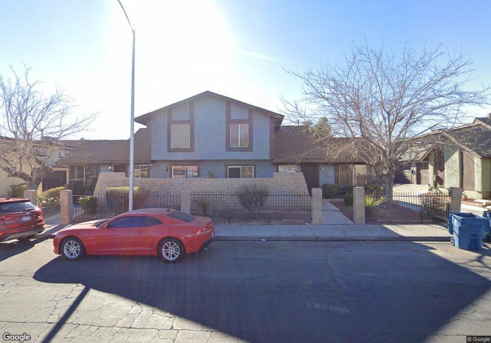
4539 Sirius Ave Las Vegas, NV 89102
Richfield NeighborhoodEstimated Value: $178,000 - $277,000
3
Beds
3
Baths
1,365
Sq Ft
$179/Sq Ft
Est. Value
About This Home
This home is located at 4539 Sirius Ave, Las Vegas, NV 89102 and is currently estimated at $244,058, approximately $178 per square foot. 4539 Sirius Ave is a home located in Clark County with nearby schools including Rex Bell Elementary School, James Cashman Middle School, and Ed W Clark High School.
Ownership History
Date
Name
Owned For
Owner Type
Purchase Details
Closed on
Apr 12, 1999
Sold by
Rushfield Morton and Rushfield Sally
Bought by
Gomez Jose and Gomez Maria E
Current Estimated Value
Home Financials for this Owner
Home Financials are based on the most recent Mortgage that was taken out on this home.
Original Mortgage
$63,200
Interest Rate
7.05%
Create a Home Valuation Report for This Property
The Home Valuation Report is an in-depth analysis detailing your home's value as well as a comparison with similar homes in the area
Home Values in the Area
Average Home Value in this Area
Purchase History
| Date | Buyer | Sale Price | Title Company |
|---|---|---|---|
| Gomez Jose | $79,500 | United Title |
Source: Public Records
Mortgage History
| Date | Status | Borrower | Loan Amount |
|---|---|---|---|
| Previous Owner | Gomez Jose | $63,200 |
Source: Public Records
Tax History Compared to Growth
Tax History
| Year | Tax Paid | Tax Assessment Tax Assessment Total Assessment is a certain percentage of the fair market value that is determined by local assessors to be the total taxable value of land and additions on the property. | Land | Improvement |
|---|---|---|---|---|
| 2025 | $728 | $50,642 | $27,300 | $23,342 |
| 2024 | $708 | $50,642 | $27,300 | $23,342 |
| 2023 | $708 | $46,480 | $24,150 | $22,330 |
| 2022 | $687 | $39,974 | $18,200 | $21,774 |
| 2021 | $667 | $34,910 | $16,800 | $18,110 |
| 2020 | $645 | $35,056 | $15,750 | $19,306 |
| 2019 | $626 | $32,174 | $12,600 | $19,574 |
| 2018 | $608 | $28,921 | $9,800 | $19,121 |
| 2017 | $829 | $27,971 | $8,750 | $19,221 |
| 2016 | $577 | $26,984 | $7,350 | $19,634 |
| 2015 | $574 | $22,097 | $5,250 | $16,847 |
| 2014 | $558 | $20,242 | $4,200 | $16,042 |
Source: Public Records
Map
Nearby Homes
- 4511 Sirius Ave
- 4565 Sirius Ave
- 4501 Buena Vista Dr
- 3165 Batavia Dr
- 4504 Del Oro Dr
- 3142 Juanita Dr
- 4530 Sparky Dr Unit A
- 3217 Arville St
- 3253 Savalli St Unit D
- 4451 Rich Dr Unit D
- 4444 W Desert Inn Rd Unit A
- 3275 Arville St Unit C
- 4730 S Pioneer Ave
- 4622 Scott Ave
- 3113 Black Forest Dr
- 4017 Edgeford Place
- 4015 Edgeford Place
- 4364 Tara Ave Unit 2
- 4348 Tara Ave Unit 2
- 4316 Tara Ave Unit 4
- 4535 Sirius Ave
- 4541 Sirius Ave
- 4549 Sirius Ave
- 4551 Sirius Ave
- 4525 Sirius Ave
- 4555 Sirius Ave
- 4527 Sirius Ave
- 4557 Sirius Ave
- 4542 Buena Vista Dr
- 4538 Buena Vista Dr
- 4519 Sirius Ave
- 4521 Sirius Ave
- 4528 Buena Vista Dr
- 4567 Sirius Ave
- 4540 Buena Vista Dr
- 4536 Buena Vista Dr
- 4522 Buena Vista Dr
- 4522 Buena Vista Dr
- 4552 Buena Vista Dr