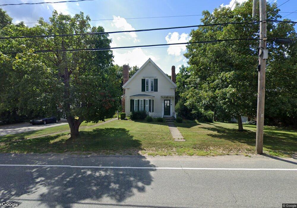
454 Adams St Abington, MA 02351
Estimated Value: $538,000 - $586,000
3
Beds
1
Bath
1,435
Sq Ft
$396/Sq Ft
Est. Value
About This Home
This home is located at 454 Adams St, Abington, MA 02351 and is currently estimated at $567,745, approximately $395 per square foot. 454 Adams St is a home located in Plymouth County with nearby schools including Beaver Brook Elementary School, Abington Middle School, and Woodsdale School.
Ownership History
Date
Name
Owned For
Owner Type
Purchase Details
Closed on
Oct 28, 1994
Sold by
Szcesuil Paul A and Franklin Robert M
Bought by
Slayter Donald F
Current Estimated Value
Purchase Details
Closed on
Aug 7, 1992
Sold by
Belcher Donald E
Bought by
Szcesuil Paul A
Create a Home Valuation Report for This Property
The Home Valuation Report is an in-depth analysis detailing your home's value as well as a comparison with similar homes in the area
Home Values in the Area
Average Home Value in this Area
Purchase History
| Date | Buyer | Sale Price | Title Company |
|---|---|---|---|
| Slayter Donald F | $120,000 | -- | |
| Szcesuil Paul A | $105,000 | -- |
Source: Public Records
Mortgage History
| Date | Status | Borrower | Loan Amount |
|---|---|---|---|
| Open | Szcesuil Paul A | $220,000 | |
| Closed | Szcesuil Paul A | $10,000 | |
| Closed | Szcesuil Paul A | $215,000 |
Source: Public Records
Tax History Compared to Growth
Tax History
| Year | Tax Paid | Tax Assessment Tax Assessment Total Assessment is a certain percentage of the fair market value that is determined by local assessors to be the total taxable value of land and additions on the property. | Land | Improvement |
|---|---|---|---|---|
| 2025 | $6,321 | $484,000 | $253,000 | $231,000 |
| 2024 | $6,222 | $465,000 | $231,300 | $233,700 |
| 2023 | $6,166 | $433,900 | $202,900 | $231,000 |
| 2022 | $5,968 | $392,100 | $179,300 | $212,800 |
| 2021 | $5,585 | $338,900 | $163,900 | $175,000 |
| 2020 | $5,683 | $334,300 | $159,300 | $175,000 |
| 2019 | $5,347 | $307,500 | $152,400 | $155,100 |
| 2018 | $6,184 | $296,500 | $152,400 | $144,100 |
| 2017 | $5,032 | $274,200 | $152,400 | $121,800 |
| 2016 | $4,798 | $267,600 | $145,800 | $121,800 |
| 2015 | $4,542 | $267,200 | $145,800 | $121,400 |
Source: Public Records
Map
Nearby Homes
- 120 Glen St
- 57 Battery St
- 1077 Bedford St
- 29 West St
- 1085 Bedford St
- 1353 Washington St
- 20 Cleverly St Unit B2
- 0 Bedford St
- 1210 Washington St
- 28 Sylvan Ct
- 46 Wardson Cir
- 676 Bedford St
- 27 Fir Rd
- 40 Fir Rd Unit 386
- 28 Nevens Cir
- 20 Birch St
- 337 Randolph St
- 11 Chestnut Cir
- 5 Chamberlain St
- 11 Hawthorne St
- 466 Adams St
- 455 Adams St
- 470 Adams St
- 440 Adams St
- 430 Adams St
- 471 Adams St
- 423 Adams St
- 481 Adams St
- 418 Adams St
- 56 Townsend St Unit B9
- 56 Townsend St Unit A8
- 56 Townsend St Unit A7
- 56 Townsend St Unit A6
- 56 Townsend St Unit A5
- 56 Townsend St Unit A4
- 56 Townsend St Unit D32
- 56 Townsend St Unit D31
- 56 Townsend St Unit D30
- 56 Townsend St Unit A3
- 56 Townsend St Unit D29