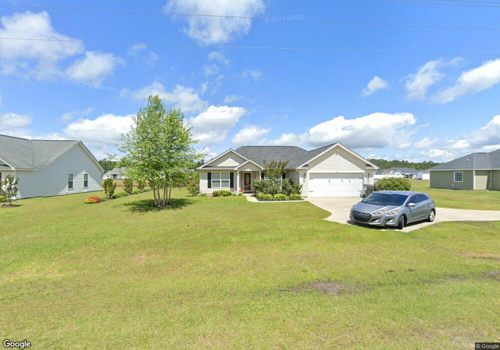
454 Frye Rd Unit Lot 73 Galivants Ferry, SC 29544
Estimated Value: $247,000 - $261,000
3
Beds
2
Baths
1,850
Sq Ft
$136/Sq Ft
Est. Value
About This Home
This home is located at 454 Frye Rd Unit Lot 73, Galivants Ferry, SC 29544 and is currently estimated at $252,444, approximately $136 per square foot. 454 Frye Rd Unit Lot 73 is a home located in Horry County with nearby schools including Aynor Elementary School, Aynor Middle School, and Aynor High School.
Ownership History
Date
Name
Owned For
Owner Type
Purchase Details
Closed on
Mar 31, 2017
Sold by
Rossi Adrian Dorman
Bought by
Paul David and Thurston Ann M
Current Estimated Value
Home Financials for this Owner
Home Financials are based on the most recent Mortgage that was taken out on this home.
Original Mortgage
$135,988
Outstanding Balance
$113,286
Interest Rate
4.25%
Mortgage Type
FHA
Estimated Equity
$139,158
Purchase Details
Closed on
Aug 27, 2014
Sold by
Wilson Adrian D and Dorman Rossi Adrian
Bought by
Dorman Rossi Adrian
Purchase Details
Closed on
Oct 22, 2010
Sold by
Trinity Residential Builders
Bought by
Wilson Adrian D
Create a Home Valuation Report for This Property
The Home Valuation Report is an in-depth analysis detailing your home's value as well as a comparison with similar homes in the area
Home Values in the Area
Average Home Value in this Area
Purchase History
| Date | Buyer | Sale Price | Title Company |
|---|---|---|---|
| Paul David | $138,500 | -- | |
| Dorman Rossi Adrian | -- | -- | |
| Wilson Adrian D | $128,400 | -- |
Source: Public Records
Mortgage History
| Date | Status | Borrower | Loan Amount |
|---|---|---|---|
| Open | Paul David | $135,988 |
Source: Public Records
Tax History Compared to Growth
Tax History
| Year | Tax Paid | Tax Assessment Tax Assessment Total Assessment is a certain percentage of the fair market value that is determined by local assessors to be the total taxable value of land and additions on the property. | Land | Improvement |
|---|---|---|---|---|
| 2024 | $993 | $9,562 | $2,331 | $7,231 |
| 2023 | $993 | $5,777 | $1,165 | $4,612 |
| 2021 | $877 | $15,166 | $3,059 | $12,107 |
| 2020 | $821 | $15,166 | $3,059 | $12,107 |
| 2019 | $821 | $15,166 | $3,059 | $12,107 |
| 2018 | $768 | $13,965 | $2,730 | $11,235 |
| 2017 | $0 | $11,400 | $669 | $10,731 |
| 2016 | -- | $11,400 | $669 | $10,731 |
| 2015 | $687 | $4,757 | $669 | $4,088 |
| 2014 | -- | $4,757 | $669 | $4,088 |
Source: Public Records
Map
Nearby Homes
- 157 Blue Jacket Dr
- 250 Blue Jacket Dr
- 409 Saint John Rd
- 405 Saint John Rd
- 375 5th Ave
- 365 5th Ave
- 355 5th Ave
- 843 7th Ave
- ELLE Plan at Jordanville Farms
- DEVON Plan at Jordanville Farms
- ARIA Plan at Jordanville Farms
- CAMERON Plan at Jordanville Farms
- MANNING Plan at Jordanville Farms
- CALI Plan at Jordanville Farms
- HELENA Plan at Jordanville Farms
- GALEN Plan at Jordanville Farms
- 1015 Garden Sprout Dr
- 1009 Garden Sprout Dr
- 1012 Garden Sprout Dr
- 1168 Saint John Rd
- 454 Frye Rd
- 456 Frye Rd
- 456 Frye Rd Unit Lot 73
- 450 Frye Rd
- 450 Frye Rd Unit Lot 72
- 101 Blue Jacket Dr Unit Maplewood
- 101 Blue Jacket Dr
- 105 Blue Jacket Dr Unit Maplewood
- 105 Blue Jacket Dr
- 109 Blue Jacket Dr
- 200 Farmers Grove Dr Unit Cedar
- 204 Farmers Grove Dr Unit Pecan
- 317 Millbrook Ct
- 317 Millbrook Cir
- 113 Blue Jacket Dr
- 208 Farmers Grove Dr Unit Willow
- 321 Millbrook Cir
- 313 Millbrook Cir
- 309 Millbrook Cir
- 309 Millbrook Cir Unit Lot 86