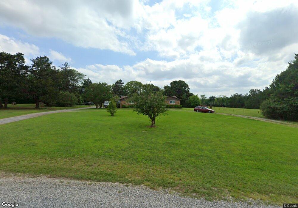
454 Lariat Dr Denison, TX 75021
Estimated Value: $285,730 - $296,000
3
Beds
2
Baths
1,539
Sq Ft
$189/Sq Ft
Est. Value
About This Home
This home is located at 454 Lariat Dr, Denison, TX 75021 and is currently estimated at $290,865, approximately $188 per square foot. 454 Lariat Dr is a home located in Grayson County with nearby schools including Lamar Elementary School, Scott Middle School, and Denison High School.
Ownership History
Date
Name
Owned For
Owner Type
Purchase Details
Closed on
Nov 21, 2023
Sold by
Puente Felipe Jesus
Bought by
Puente Felipe Jesus and Puente Felipe Jesus
Current Estimated Value
Purchase Details
Closed on
Dec 17, 2020
Sold by
Keene Gladys Christine
Bought by
Puente Felipe and Behner Patricia
Home Financials for this Owner
Home Financials are based on the most recent Mortgage that was taken out on this home.
Original Mortgage
$171,000
Interest Rate
2.7%
Mortgage Type
New Conventional
Create a Home Valuation Report for This Property
The Home Valuation Report is an in-depth analysis detailing your home's value as well as a comparison with similar homes in the area
Home Values in the Area
Average Home Value in this Area
Purchase History
| Date | Buyer | Sale Price | Title Company |
|---|---|---|---|
| Puente Felipe Jesus | -- | None Listed On Document | |
| Puente Felipe | -- | Grayson County Title |
Source: Public Records
Mortgage History
| Date | Status | Borrower | Loan Amount |
|---|---|---|---|
| Previous Owner | Puente Felipe | $171,000 |
Source: Public Records
Tax History Compared to Growth
Tax History
| Year | Tax Paid | Tax Assessment Tax Assessment Total Assessment is a certain percentage of the fair market value that is determined by local assessors to be the total taxable value of land and additions on the property. | Land | Improvement |
|---|---|---|---|---|
| 2025 | $889 | $145,694 | -- | -- |
| 2024 | $2,139 | $132,449 | $0 | $0 |
| 2023 | $1,272 | $120,408 | $0 | $0 |
| 2022 | $1,891 | $109,462 | $0 | $0 |
| 2021 | $1,866 | $99,511 | $42,888 | $56,623 |
| 2020 | $3,334 | $167,495 | $45,411 | $122,084 |
| 2019 | $3,563 | $167,769 | $45,411 | $122,358 |
| 2018 | $3,304 | $153,926 | $45,411 | $108,515 |
| 2017 | $3,165 | $146,481 | $42,521 | $103,960 |
| 2016 | $3,007 | $139,175 | $30,496 | $108,679 |
| 2015 | $424 | $129,829 | $42,512 | $87,317 |
| 2014 | $572 | $126,384 | $45,583 | $80,801 |
Source: Public Records
Map
Nearby Homes
- 21 Chaparral Estates Dr
- TBD N Highway 69
- 1513 Desvoignes Rd
- 230 Frosty Hollow Rd
- 248 Karen Dr
- TBD Johnson Rd
- 1651 Desvoignes Rd
- 413 Rolling Acres Rd
- 1747 Desvoignes Rd
- 3105 U S 69
- 249 Martin Dr
- TBD Cross Timber Estates Dr
- 66 Shady Woods Ln
- 732 E Bullock St
- 721 E Bullock St
- 1805 Arthur Rd
- 715 E Hanna St
- 705 E Hanna St
- 105 Cumberland Cir
- 40 Cumberland Cir
- 433 Lariat Dr
- 418 Lariat Dr
- 179 Rawhide Trail
- 528 Lariat Dr
- 161 Rawhide Trail
- 561 Lariat Dr
- 592 Lariat Dr
- 101 Rawhide Trail
- 206 Rawhide Trail
- 193 Rawhide Trail
- 609 Lariat Dr
- 628 Lariat Dr
- 280 Lariat Dr
- 41 Rawhide Trail
- 279 Lariat Dr
- 49 Tumbleweed Trail
- 652 Lariat Dr
- 290 Rawhide Trail
- 147 Tumbleweed Trail
- 203 Lariat Dr