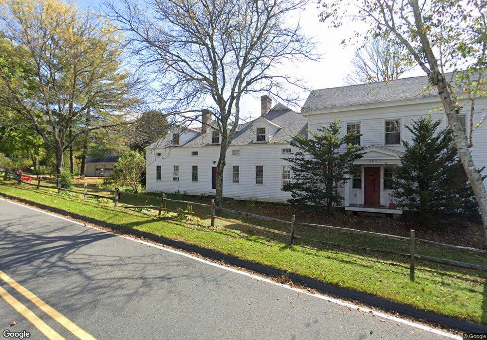
454 Main Rd Unit 4 Monterey, MA 01245
Estimated Value: $232,000 - $435,000
1
Bed
1
Bath
1,516
Sq Ft
$204/Sq Ft
Est. Value
About This Home
This home is located at 454 Main Rd Unit 4, Monterey, MA 01245 and is currently estimated at $309,981, approximately $204 per square foot. 454 Main Rd Unit 4 is a home located in Berkshire County with nearby schools including Mt. Everett High School.
Ownership History
Date
Name
Owned For
Owner Type
Purchase Details
Closed on
Jul 9, 2025
Sold by
Moran Susan F
Bought by
Susan F Moran Ret and Moran
Current Estimated Value
Purchase Details
Closed on
May 16, 2022
Sold by
Mendelson Channing T
Bought by
Fagan-Moran Susan
Purchase Details
Closed on
Feb 19, 2010
Sold by
Lindsay Margaret
Bought by
Slater Deborah R
Purchase Details
Closed on
May 21, 2003
Sold by
Balinsky Corey and Balinsky Edward
Bought by
Plucknett Janet F
Home Financials for this Owner
Home Financials are based on the most recent Mortgage that was taken out on this home.
Original Mortgage
$116,000
Interest Rate
5.86%
Mortgage Type
Purchase Money Mortgage
Purchase Details
Closed on
Oct 23, 2001
Sold by
Schneider Robert J and Schneider Mary C
Bought by
Kuder Susan R and Mendelsohn Channing T
Purchase Details
Closed on
May 15, 1997
Sold by
Brookbend Inc
Bought by
Balinsky Edward and Balinsky Sally
Purchase Details
Closed on
Jan 5, 1996
Sold by
Brookbend Inc
Bought by
Schneider Robert J and Schneider Mary C
Create a Home Valuation Report for This Property
The Home Valuation Report is an in-depth analysis detailing your home's value as well as a comparison with similar homes in the area
Home Values in the Area
Average Home Value in this Area
Purchase History
| Date | Buyer | Sale Price | Title Company |
|---|---|---|---|
| Susan F Moran Ret | -- | -- | |
| Susan F Moran Ret | -- | -- | |
| Fagan-Moran Susan | $7,900 | None Available | |
| Fagan-Moran Susan | $7,900 | None Available | |
| Slater Deborah R | $200,000 | -- | |
| Slater Deborah R | $200,000 | -- | |
| Plucknett Janet F | $145,000 | -- | |
| Plucknett Janet F | $145,000 | -- | |
| Kuder Susan R | $61,000 | -- | |
| Kuder Susan R | $61,000 | -- | |
| Balinsky Edward | $66,500 | -- | |
| Schneider Robert J | $37,000 | -- |
Source: Public Records
Mortgage History
| Date | Status | Borrower | Loan Amount |
|---|---|---|---|
| Previous Owner | Plucknett Janet F | $116,000 |
Source: Public Records
Tax History Compared to Growth
Tax History
| Year | Tax Paid | Tax Assessment Tax Assessment Total Assessment is a certain percentage of the fair market value that is determined by local assessors to be the total taxable value of land and additions on the property. | Land | Improvement |
|---|---|---|---|---|
| 2025 | $1,282 | $199,100 | $0 | $199,100 |
| 2024 | $1,220 | $199,100 | $0 | $199,100 |
| 2023 | $1,287 | $211,400 | $0 | $211,400 |
| 2022 | $1,539 | $211,400 | $0 | $211,400 |
| 2021 | $1,537 | $211,400 | $0 | $211,400 |
| 2020 | $1,571 | $211,400 | $0 | $211,400 |
| 2019 | $1,564 | $211,400 | $0 | $211,400 |
| 2018 | $1,486 | $201,300 | $0 | $201,300 |
| 2017 | $1,469 | $201,300 | $0 | $201,300 |
| 2016 | $1,258 | $201,300 | $0 | $201,300 |
| 2015 | $1,192 | $201,300 | $0 | $201,300 |
Source: Public Records
Map
Nearby Homes
- 470 Main Rd
- 535 Main Rd
- 104 Hupi Rd
- 139 Tyringham Rd
- 0 Gould Rd
- 10 Art School Rd
- 0 Sandisfield Rd
- 0 Norwalk Acres Rd Unit 242782
- 1 Main Rd
- 14 Norwalk Acres Rd
- 76 Corashire Rd
- 8 Hemlock Rd
- 0 Pine St
- 123 Bock Way
- 0 Jamie Ln
- 14 Blue Hill Rd
- 85 Main Rd
- 16 Heberts Cove
- 141 Stevens Lake Way
- 0 Massachusetts 57
- 454 Main Rd Unit 8
- 454 Main Rd Unit 6
- 454 Main Rd Unit 5
- 454 Main Rd Unit 7
- 454 Main Rd Unit 9
- 454 Main Rd Unit 3
- 454 Main Rd Unit 1
- 454 Main Rd
- 0 Lake View Ave Unit 73074591
- 0 Norwalk Unit 73008841
- 455 Main Rd
- 0 Main St
- 453 Main Rd
- 457 Main Rd
- 4 Tyringham Rd
- 448 Main Rd
- 449 Main Rd
- 434 Main Rd
- 3 Tyringham Rd
- 460 Main Rd