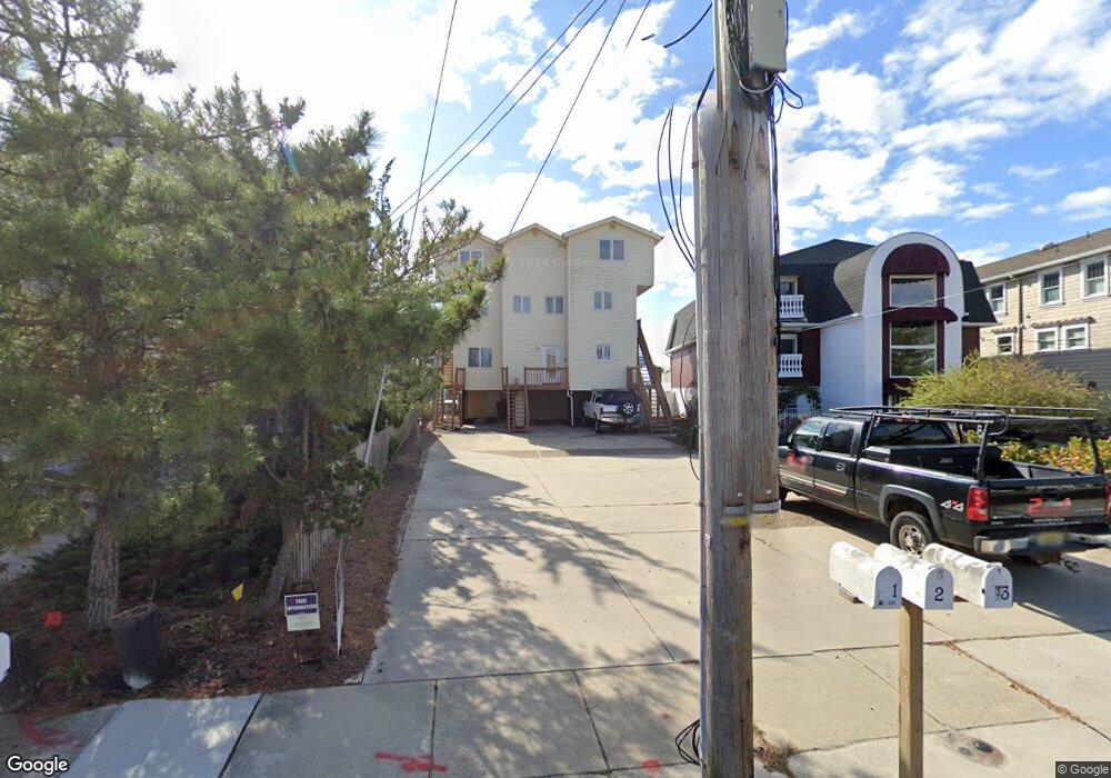
454 W Shore Dr Unit 1 Brigantine, NJ 08203
Estimated Value: $867,000 - $896,000
--
Bed
3
Baths
1,677
Sq Ft
$525/Sq Ft
Est. Value
About This Home
This home is located at 454 W Shore Dr Unit 1, Brigantine, NJ 08203 and is currently estimated at $880,436, approximately $525 per square foot. 454 W Shore Dr Unit 1 is a home located in Atlantic County with nearby schools including Brigantine Community School and Brigantine Elementary School.
Ownership History
Date
Name
Owned For
Owner Type
Purchase Details
Closed on
Oct 17, 2024
Sold by
Rosenberg Howard A and Rosenberg Janis B
Bought by
Rosenberg Joint Living Trust and Rosenberg
Current Estimated Value
Purchase Details
Closed on
May 30, 2001
Sold by
Black Derek P and Black Doris E
Bought by
Rosenberg Howard A and Rosenberg Janis B
Home Financials for this Owner
Home Financials are based on the most recent Mortgage that was taken out on this home.
Original Mortgage
$230,000
Interest Rate
7.09%
Mortgage Type
Purchase Money Mortgage
Purchase Details
Closed on
Sep 30, 1997
Sold by
Mcdonnell Bruce A
Bought by
Black Derek P and Black Doris E
Home Financials for this Owner
Home Financials are based on the most recent Mortgage that was taken out on this home.
Original Mortgage
$181,350
Interest Rate
7.52%
Purchase Details
Closed on
Nov 6, 1990
Sold by
Mcinc Bruce
Bought by
Mcdonnell Bruce A
Create a Home Valuation Report for This Property
The Home Valuation Report is an in-depth analysis detailing your home's value as well as a comparison with similar homes in the area
Home Values in the Area
Average Home Value in this Area
Purchase History
| Date | Buyer | Sale Price | Title Company |
|---|---|---|---|
| Rosenberg Joint Living Trust | -- | None Listed On Document | |
| Rosenberg Howard A | $342,500 | -- | |
| Black Derek P | $201,500 | The Title Company | |
| Mcdonnell Bruce A | $260,000 | -- |
Source: Public Records
Mortgage History
| Date | Status | Borrower | Loan Amount |
|---|---|---|---|
| Previous Owner | Rosenberg Howard A | $230,000 | |
| Previous Owner | Black Derek P | $181,350 |
Source: Public Records
Tax History Compared to Growth
Tax History
| Year | Tax Paid | Tax Assessment Tax Assessment Total Assessment is a certain percentage of the fair market value that is determined by local assessors to be the total taxable value of land and additions on the property. | Land | Improvement |
|---|---|---|---|---|
| 2025 | $9,041 | $480,900 | $318,800 | $162,100 |
| 2024 | $9,041 | $480,900 | $318,800 | $162,100 |
| 2023 | $8,353 | $480,900 | $318,800 | $162,100 |
| 2022 | $8,353 | $480,900 | $318,800 | $162,100 |
| 2021 | $8,204 | $480,900 | $318,800 | $162,100 |
| 2020 | $8,118 | $480,900 | $318,800 | $162,100 |
| 2019 | $8,190 | $480,900 | $318,800 | $162,100 |
| 2018 | $8,353 | $480,900 | $318,800 | $162,100 |
| 2017 | $8,488 | $480,900 | $318,800 | $162,100 |
| 2016 | $8,483 | $480,900 | $318,800 | $162,100 |
| 2015 | $8,526 | $480,900 | $318,800 | $162,100 |
| 2014 | $8,209 | $480,900 | $318,800 | $162,100 |
Source: Public Records
Map
Nearby Homes
- 468 W Shore Dr
- 150 9th St S
- 510 Lafayette Blvd
- 502 Caverly Dr
- 159 Sheridan Square
- 136 5th St S
- 116 Bayshore Ave
- 303 Lafayette Place
- 222 8th St S
- 223 8th St S
- 29 Cummings Place
- 1306 Bayshore Ave
- 250 11th St S
- 800 W Brigantine Ave Unit 217
- 1202 Sheridan Blvd Unit 203
- 900 W Brigantine Ave
- 1000 W Brigantine Ave Unit 4
- 6th Rum Point Ct
- 1507 Sheridan Blvd
- 321 6th St S Unit 2
- 454 W Shore Dr
- 454 W Shore Dr Unit 3
- 456 W Shore Dr
- 450 W Shore Dr
- 450 W Shore Dr Unit F
- 448 W Shore Dr
- 444 W Shore Dr Unit 5
- 444 W Shore Dr
- 444 W Shore Dr
- 444 W Shore Dr
- 444 W Shore Dr
- 444 W Shore Dr Unit 6
- 464 W Shore Dr
- 453 W Shore Dr
- 451 W Shore Dr
- 455 W Shore Dr
- 819 Bayshore Ave
- 821 Bayshore Ave
- 825 Bayshore Ave Unit 825
- 823 Bayshore Ave