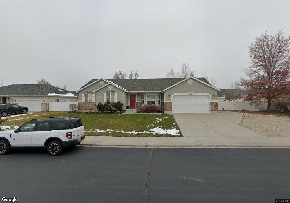
4540 Landmark Cir Pleasant Grove, UT 84062
Estimated Value: $639,000 - $704,000
4
Beds
3
Baths
1,638
Sq Ft
$414/Sq Ft
Est. Value
About This Home
This home is located at 4540 Landmark Cir, Pleasant Grove, UT 84062 and is currently estimated at $678,126, approximately $413 per square foot. 4540 Landmark Cir is a home located in Utah County with nearby schools including Deerfield Elementary School, Mountain Ridge Junior High School, and Lone Peak High School.
Ownership History
Date
Name
Owned For
Owner Type
Purchase Details
Closed on
Aug 10, 2020
Sold by
Berdan Elizabeth Marie Young and Berdan Elizabeth
Bought by
Allred Ashlee D
Current Estimated Value
Home Financials for this Owner
Home Financials are based on the most recent Mortgage that was taken out on this home.
Original Mortgage
$269,000
Outstanding Balance
$215,079
Interest Rate
3%
Mortgage Type
New Conventional
Estimated Equity
$463,047
Purchase Details
Closed on
Aug 17, 2012
Sold by
Bardin Greg J and Bardin Jill W
Bought by
Berdan Jeffery and Berdan Elizabeth
Home Financials for this Owner
Home Financials are based on the most recent Mortgage that was taken out on this home.
Original Mortgage
$229,900
Interest Rate
3.56%
Mortgage Type
New Conventional
Purchase Details
Closed on
Oct 23, 1998
Sold by
G & G Investments Inc
Bought by
Bardin Greg and Bardin Jill
Create a Home Valuation Report for This Property
The Home Valuation Report is an in-depth analysis detailing your home's value as well as a comparison with similar homes in the area
Home Values in the Area
Average Home Value in this Area
Purchase History
| Date | Buyer | Sale Price | Title Company |
|---|---|---|---|
| Allred Ashlee D | -- | Vanguard Title Ins Agcy Llc | |
| Berdan Jeffery | -- | Neridian Title Co | |
| Bardin Greg | -- | -- |
Source: Public Records
Mortgage History
| Date | Status | Borrower | Loan Amount |
|---|---|---|---|
| Open | Allred Ashlee D | $269,000 | |
| Previous Owner | Berdan Jeffery | $229,900 |
Source: Public Records
Tax History Compared to Growth
Tax History
| Year | Tax Paid | Tax Assessment Tax Assessment Total Assessment is a certain percentage of the fair market value that is determined by local assessors to be the total taxable value of land and additions on the property. | Land | Improvement |
|---|---|---|---|---|
| 2025 | $2,669 | $333,795 | $251,700 | $355,200 |
| 2024 | $2,669 | $316,140 | $0 | $0 |
| 2023 | $2,492 | $317,075 | $0 | $0 |
| 2022 | $2,609 | $324,225 | $0 | $0 |
| 2021 | $2,334 | $432,100 | $152,700 | $279,400 |
| 2020 | $2,176 | $393,100 | $141,400 | $251,700 |
| 2019 | $1,971 | $369,700 | $133,900 | $235,800 |
| 2018 | $1,935 | $342,000 | $126,500 | $215,500 |
| 2017 | $1,868 | $176,550 | $0 | $0 |
| 2016 | $1,749 | $153,780 | $0 | $0 |
| 2015 | $1,769 | $147,180 | $0 | $0 |
| 2014 | $1,750 | $144,595 | $0 | $0 |
Source: Public Records
Map
Nearby Homes
- 4631 W Harvey Blvd
- 9681 N Peach Ct
- 9587 N 4500 W
- 248 N Deerfield Ln
- 10052 N Marigold Ln
- 4696 W Camellia Ln
- 4441 W Bridgestone Dr
- 1172 Murdock Dr
- 9900 N Meadow Dr
- 4811 Pocosin Ct
- 4821 W Pocosin Ct Unit 751
- 4812 W Pocosin Ct
- 4812 Pocosin Ct
- 9857 N Featherstone Dr
- 10022 N Loblobby Ln Unit 713
- 4816 Pocosin Ct
- 4816 W Pocosin Ct
- 4822 W Pocosin Ct
- 10087 N Torreya Dr Unit 728
- 4947 Evergreen Ln
- 4540 W Landmark Cir
- 4554 Landmark Cir
- 4526 W Landmark Cir
- 4526 Landmark Cir
- 4541 W 9900 N
- 4557 W 9900 N
- 4527 W 9900 N
- 4543 Landmark Cir
- 4529 Landmark Cir
- 4529 Landmark Cir Unit 57
- 4510 Landmark Cir
- 4564 Landmark Cir
- 4555 Landmark Cir
- 4571 W 9900 N
- 4509 W 9900 N
- 4565 Landmark Cir
- 4511 W 9860 N
- 4511 Landmark Cir
- 4511 Landmark Cir Unit 56
- 4544 W 9820 N