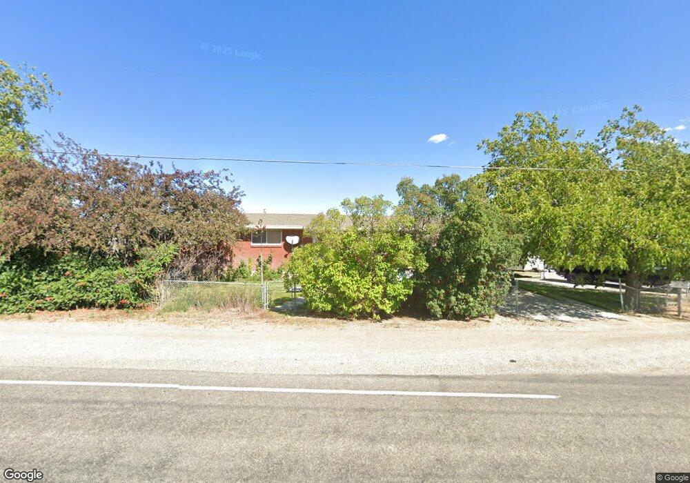
4540 W 11200 N Tremonton, UT 84337
Estimated Value: $401,000 - $545,000
--
Bed
--
Bath
1,828
Sq Ft
$257/Sq Ft
Est. Value
About This Home
This home is located at 4540 W 11200 N, Tremonton, UT 84337 and is currently estimated at $470,444, approximately $257 per square foot. 4540 W 11200 N is a home located in Box Elder County with nearby schools including North Park School, Bear River Middle School, and Alice C. Harris Intermediate School.
Ownership History
Date
Name
Owned For
Owner Type
Purchase Details
Closed on
Mar 15, 2012
Sold by
Bock Daniel J and Bock Deborah J
Bought by
Bock Daniel J
Current Estimated Value
Home Financials for this Owner
Home Financials are based on the most recent Mortgage that was taken out on this home.
Original Mortgage
$104,184
Outstanding Balance
$71,465
Interest Rate
3.84%
Mortgage Type
New Conventional
Estimated Equity
$398,979
Purchase Details
Closed on
Jan 29, 2007
Sold by
Hunsaker William L and Hunsaker Frances
Bought by
Bock Daniel J and Bock Deborah J
Purchase Details
Closed on
Aug 14, 2006
Sold by
Hunsaker William L and Hunsaker Frances
Bought by
Bock Daniel J and Bock Deborah J
Home Financials for this Owner
Home Financials are based on the most recent Mortgage that was taken out on this home.
Original Mortgage
$105,000
Interest Rate
6.76%
Mortgage Type
New Conventional
Create a Home Valuation Report for This Property
The Home Valuation Report is an in-depth analysis detailing your home's value as well as a comparison with similar homes in the area
Home Values in the Area
Average Home Value in this Area
Purchase History
| Date | Buyer | Sale Price | Title Company |
|---|---|---|---|
| Bock Daniel J | -- | Altas Title Salt Lake | |
| Bock Daniel J | -- | Phillips Hansesn Land Title | |
| Bock Daniel J | -- | None Available |
Source: Public Records
Mortgage History
| Date | Status | Borrower | Loan Amount |
|---|---|---|---|
| Open | Bock Daniel J | $104,184 | |
| Previous Owner | Bock Daniel J | $105,000 |
Source: Public Records
Tax History Compared to Growth
Tax History
| Year | Tax Paid | Tax Assessment Tax Assessment Total Assessment is a certain percentage of the fair market value that is determined by local assessors to be the total taxable value of land and additions on the property. | Land | Improvement |
|---|---|---|---|---|
| 2025 | -- | $458,178 | $135,000 | $323,178 |
| 2024 | -- | $460,540 | $135,000 | $325,540 |
| 2023 | $2,110 | $474,814 | $135,000 | $339,814 |
| 2022 | $0 | $214,806 | $16,500 | $198,306 |
| 2021 | $1,526 | $252,193 | $30,000 | $222,193 |
| 2020 | $1,373 | $252,193 | $30,000 | $222,193 |
| 2019 | $1,284 | $124,647 | $16,500 | $108,147 |
| 2018 | $0 | $83,812 | $16,500 | $67,312 |
| 2017 | $958 | $152,386 | $16,500 | $122,386 |
| 2016 | $914 | $80,607 | $16,500 | $64,107 |
| 2015 | -- | $74,779 | $16,500 | $58,279 |
| 2014 | -- | $72,004 | $16,500 | $55,504 |
| 2013 | -- | $72,004 | $16,005 | $55,999 |
Source: Public Records
Map
Nearby Homes
- 11990 N 4800 W
- 4979 W 12000 N
- 234 N 870 W Unit 19
- 137 N 870 W Unit 28
- 1183 S 1335 E Unit 76
- 408 N 775 E
- Auburn Plan at River's Edge - Tremonton
- Aberdeen Plan at River's Edge - Tremonton
- Glendale Plan at River's Edge - Tremonton
- Lyndhurst Plan at River's Edge - Tremonton
- Sumac Plan at River's Edge - Tremonton
- Redwood Plan at River's Edge - Tremonton
- Summerlyn Plan at River's Edge - Tremonton
- Fairview Plan at River's Edge - Tremonton
- 1286 E 240 N Unit 15
- 1118 E 1310 S
- 635 E 240 N Unit 9
- 635 E 240 N
- 1113 E 1230 S
- 518 E 40 S
- 4540 W 11200 N
- 4565 W 11200 N
- 4590 W 11200 N
- 4605 W 11200 N
- 4535 W 11200 N
- 4500 W 11200 N
- 4625 W 11200 N
- 11259 N 4400 W
- 11216 N 4400 W
- 11325 N 4400 W
- 11262 N 4400 W Unit 1
- 11290 N 4400 W
- 11290 N 4400 W Unit 2
- 11310 N 4400 W
- 11336 N 4400 W
- 92 N 4800 W
- 11410 N 4400 W
- 2228 E Main St
- 2227 E Main St
- 11457 N 4400 W