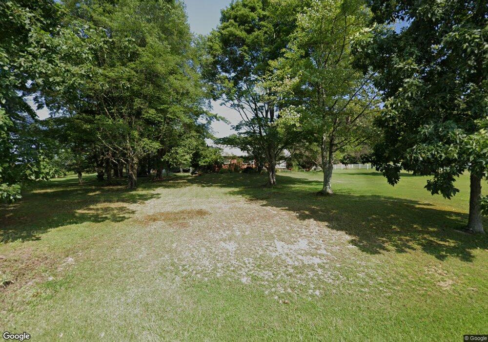
4541 Miola Rd Clarion, PA 16214
Estimated Value: $113,844 - $360,000
--
Bed
--
Bath
1,460
Sq Ft
$174/Sq Ft
Est. Value
About This Home
This home is located at 4541 Miola Rd, Clarion, PA 16214 and is currently estimated at $253,711, approximately $173 per square foot. 4541 Miola Rd is a home located in Clarion County with nearby schools including Clarion Area Elementary School and Clarion Area Junior/Senior High School.
Ownership History
Date
Name
Owned For
Owner Type
Purchase Details
Closed on
Dec 9, 2020
Sold by
Smith Travis K
Bought by
Smith Travis K and Smith Sarah C
Current Estimated Value
Home Financials for this Owner
Home Financials are based on the most recent Mortgage that was taken out on this home.
Original Mortgage
$115,000
Outstanding Balance
$93,202
Interest Rate
2.8%
Mortgage Type
New Conventional
Estimated Equity
$160,509
Purchase Details
Closed on
Mar 13, 2013
Sold by
Callihan David E and Pollnac Keri M
Bought by
Smith Travis K
Home Financials for this Owner
Home Financials are based on the most recent Mortgage that was taken out on this home.
Original Mortgage
$130,612
Interest Rate
3.58%
Mortgage Type
Purchase Money Mortgage
Purchase Details
Closed on
Jan 1, 2010
Sold by
Hartzell Marian L
Bought by
Hartzell Stephen G and Hartzell Tracey L
Purchase Details
Closed on
Dec 27, 2007
Sold by
Callihan David E and Callihan Virginia
Bought by
Callihan David E and Miller Barbara
Create a Home Valuation Report for This Property
The Home Valuation Report is an in-depth analysis detailing your home's value as well as a comparison with similar homes in the area
Home Values in the Area
Average Home Value in this Area
Purchase History
| Date | Buyer | Sale Price | Title Company |
|---|---|---|---|
| Smith Travis K | -- | None Available | |
| Smith Travis K | $128,000 | -- | |
| Hartzell Stephen G | -- | -- | |
| Callihan David E | -- | -- |
Source: Public Records
Mortgage History
| Date | Status | Borrower | Loan Amount |
|---|---|---|---|
| Open | Smith Travis K | $115,000 | |
| Closed | Smith Travis K | $130,612 |
Source: Public Records
Tax History Compared to Growth
Tax History
| Year | Tax Paid | Tax Assessment Tax Assessment Total Assessment is a certain percentage of the fair market value that is determined by local assessors to be the total taxable value of land and additions on the property. | Land | Improvement |
|---|---|---|---|---|
| 2025 | $2,950 | $31,874 | $1,460 | $30,414 |
| 2024 | $2,887 | $31,874 | $1,460 | $30,414 |
| 2023 | $2,887 | $31,874 | $1,460 | $30,414 |
| 2022 | $2,887 | $31,874 | $1,460 | $30,414 |
| 2021 | $2,902 | $31,874 | $1,460 | $30,414 |
| 2020 | $2,902 | $31,874 | $1,460 | $30,414 |
| 2019 | $2,902 | $31,874 | $1,460 | $30,414 |
| 2018 | $2,902 | $29,380 | $1,460 | $27,920 |
| 2017 | $2,685 | $29,380 | $1,460 | $27,920 |
| 2016 | $2,567 | $29,380 | $1,460 | $27,920 |
| 2014 | -- | $29,380 | $1,460 | $27,920 |
Source: Public Records
Map
Nearby Homes
- 50 Rebecca Dr
- 640 Jacks Mountain Ln
- 882 Jacks Mountain Ln
- 00 Miola Rd
- 113 Sawmill Rd
- 4733 Fisher Strattanville Rd
- 314 Booth Ln
- LOT B Waterworks Rd
- LOT A Waterworks Rd
- 240 Waterworks Rd
- 162 E Maple Ln
- 0 Old State Rd N Unit 161363
- 16194 Route 322
- 1037 Spring Dr
- 711 Ridge Rd
- 820 Main St
- 14804 Route 322
- 990 E Main St
- 1306 Eastwood Dr
- 208 Liberty St
