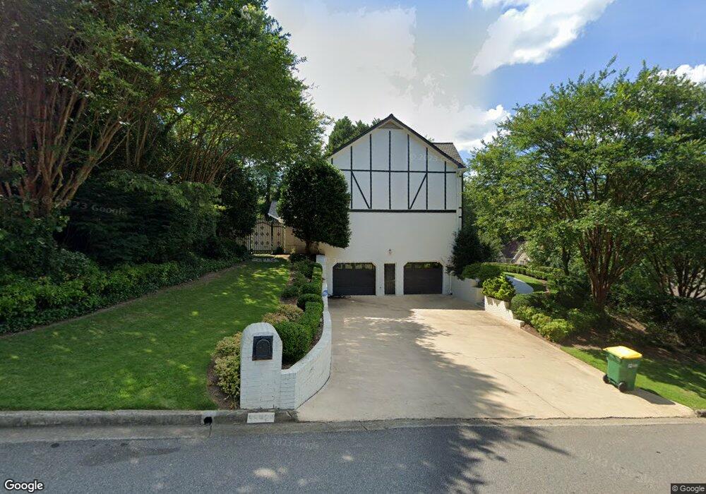
4542 Outer Bank Dr Unit 2 Norcross, GA 30092
Estimated Value: $873,000 - $1,038,000
5
Beds
5
Baths
5,106
Sq Ft
$179/Sq Ft
Est. Value
About This Home
This home is located at 4542 Outer Bank Dr Unit 2, Norcross, GA 30092 and is currently estimated at $915,823, approximately $179 per square foot. 4542 Outer Bank Dr Unit 2 is a home located in Gwinnett County with nearby schools including Simpson Elementary School, Pinckneyville Middle School, and Norcross High School.
Ownership History
Date
Name
Owned For
Owner Type
Purchase Details
Closed on
Mar 2, 2018
Sold by
Lodhia Nasreen R
Bought by
Bennett Patricia A
Current Estimated Value
Home Financials for this Owner
Home Financials are based on the most recent Mortgage that was taken out on this home.
Original Mortgage
$397,600
Outstanding Balance
$337,897
Interest Rate
4.22%
Mortgage Type
New Conventional
Estimated Equity
$577,926
Purchase Details
Closed on
Dec 23, 1999
Sold by
Lodhia Mohammed R
Bought by
Lodhia Nasreen R
Create a Home Valuation Report for This Property
The Home Valuation Report is an in-depth analysis detailing your home's value as well as a comparison with similar homes in the area
Home Values in the Area
Average Home Value in this Area
Purchase History
We collect this data history from publicly available records. To have your information removed, we recommend requesting removal directly through your county’s website.
| Date | Buyer | Sale Price | Title Company |
|---|---|---|---|
| Bennett Patricia A | $497,000 | -- | |
| Lodhia Nasreen R | -- | -- |
Source: Public Records
Mortgage History
We collect this data history from publicly available records. To have your information removed, we recommend requesting removal directly through your county’s website.
| Date | Status | Borrower | Loan Amount |
|---|---|---|---|
| Open | Bennett Patricia A | $397,600 |
Source: Public Records
Tax History
| Year | Tax Paid | Tax Assessment Tax Assessment Total Assessment is a certain percentage of the fair market value that is determined by local assessors to be the total taxable value of land and additions on the property. | Land | Improvement |
|---|---|---|---|---|
| 2025 | $3,630 | $314,360 | $50,160 | $264,200 |
| 2024 | $3,607 | $281,000 | $50,000 | $231,000 |
| 2023 | $3,607 | $281,000 | $50,000 | $231,000 |
| 2022 | $3,597 | $256,960 | $42,000 | $214,960 |
| 2021 | $3,223 | $212,640 | $35,520 | $177,120 |
| 2020 | $3,218 | $212,640 | $35,520 | $177,120 |
| 2019 | $6,968 | $198,800 | $30,000 | $168,800 |
| 2018 | $6,951 | $238,320 | $30,000 | $208,320 |
| 2016 | $6,298 | $209,960 | $24,000 | $185,960 |
| 2015 | $5,591 | $175,040 | $24,000 | $151,040 |
| 2014 | $5,482 | $175,040 | $24,000 | $151,040 |
Source: Public Records
Map
Nearby Homes
- 5545 Fitzpatrick Terrace
- 4731 Outer Bank Dr
- 4276 Springfield Dr
- 5368 Broadwood Ave
- 5518 Patrick Ct
- 5350 Wickershire Dr
- 5648 Shawn Terrace Unit 5
- 5715 Broad River View Unit 449
- 5230 Wickershire Dr
- 5697 Broad River View Unit 445
- 5736 Fairley Hall Ct
- 5695 Broad River View Unit 444
- 5693 Broad River View Unit 443
- 5692 Broad River View Unit 435
- 510 Covington Cove
- 5482 Bandolino Ln Unit 424
- 4706 Coleridge Ct
- 4706 Coleridge Ct Unit 432
- 4708 Coleridge Ct Unit 433
- 4701 Bandolino Ln Unit 425
- 4542 Outer Bank Dr
- 4542 4542 Outer Bank Dr
- 4532 Outer Bank Dr
- 4594 Capers Crossing W
- 4541 Outer Bank Dr
- 4562 Outer Bank Dr
- 0 Crossing W Unit 7701019
- 4531 Outer Bank Dr
- 4522 Outer Bank Dr
- 4583 Capers Crossing W
- 4563 Capers Crossing E Unit 2
- 4624 Capers Crossing W
- 4593 Capers Crossing E
- 4593 Capers Crossing W
- 4544 Capers Crossing E
- 4521 Outer Bank Dr
- 4553 Capers Crossing E
- 5455 Fort Fisher Way
- 4582 Outer Bank Dr Unit 2
- 4603 Capers Crossing W Unit 2
Your Personal Tour Guide
Ask me questions while you tour the home.