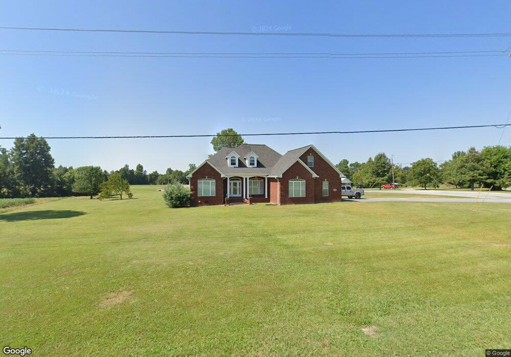
4543 Union Grove Rd Union Grove, AL 35175
Estimated Value: $262,000 - $349,000
--
Bed
1
Bath
2,042
Sq Ft
$155/Sq Ft
Est. Value
About This Home
This home is located at 4543 Union Grove Rd, Union Grove, AL 35175 and is currently estimated at $316,947, approximately $155 per square foot. 4543 Union Grove Rd is a home located in Marshall County with nearby schools including Brindlee Mountain Primary School, Brindlee Mountain Elementary School, and Brindlee Mt Middle School.
Ownership History
Date
Name
Owned For
Owner Type
Purchase Details
Closed on
May 18, 2015
Current Estimated Value
Purchase Details
Closed on
Oct 18, 2013
Sold by
Wilbanks James A and Wilbanks Sherry J
Bought by
Wilbanks James A and Wilbanks Sherry J
Home Financials for this Owner
Home Financials are based on the most recent Mortgage that was taken out on this home.
Original Mortgage
$163,240
Interest Rate
4.52%
Mortgage Type
Construction
Purchase Details
Closed on
Mar 19, 2007
Sold by
Wilbanks Jason P
Bought by
Wilbanks James A and Wilbanks Sherry J
Home Financials for this Owner
Home Financials are based on the most recent Mortgage that was taken out on this home.
Original Mortgage
$71,250
Interest Rate
9.49%
Mortgage Type
Adjustable Rate Mortgage/ARM
Create a Home Valuation Report for This Property
The Home Valuation Report is an in-depth analysis detailing your home's value as well as a comparison with similar homes in the area
Home Values in the Area
Average Home Value in this Area
Purchase History
| Date | Buyer | Sale Price | Title Company |
|---|---|---|---|
| -- | $169,800 | None Available | |
| Wilbanks James A | -- | None Available | |
| Wilbanks James A | -- | None Available |
Source: Public Records
Mortgage History
| Date | Status | Borrower | Loan Amount |
|---|---|---|---|
| Previous Owner | Wilbanks James A | $163,240 | |
| Previous Owner | Wilbanks James A | $71,250 |
Source: Public Records
Tax History Compared to Growth
Tax History
| Year | Tax Paid | Tax Assessment Tax Assessment Total Assessment is a certain percentage of the fair market value that is determined by local assessors to be the total taxable value of land and additions on the property. | Land | Improvement |
|---|---|---|---|---|
| 2024 | $2,103 | $56,080 | $0 | $0 |
| 2023 | $2,103 | $53,060 | $1,360 | $51,700 |
| 2022 | $1,925 | $51,340 | $0 | $0 |
| 2021 | $1,764 | $47,040 | $0 | $0 |
| 2020 | $1,550 | $41,340 | $0 | $0 |
| 2017 | $1,403 | $37,400 | $0 | $0 |
| 2015 | -- | $35,040 | $0 | $0 |
| 2014 | -- | $1,080 | $0 | $0 |
Source: Public Records
Map
Nearby Homes
- 476 Cedar Ridge Dr
- 6 Acres New Friendship Rd
- 201 Deer Trail
- 187 Deer Trail
- 803 Mobb Hill Rd
- 3145 Union Grove Rd
- 600 Mobb Hill Rd
- 0 Thurman Rd
- 269 Sue Nora Dr
- 3678 Friendship Rd
- 3582 Friendship Rd
- 1808 Union Grove Rd
- 58 Sweet Home Rd
- 83 Lions Dr
- 417 Dodd Rd
- 40 Abercrombie Place
- 173 Brock Chapel Rd
- 3629 Eddy Scant City Rd
- 2697 Friendship Rd
- 247 Scant City Rd
- 1724 Union Chapel Rd
- 35 Country Side Dr
- 3626 Union Chapel Rd
- 4596 Union Grove Rd
- 3649 Union Chapel Rd
- 4370 Union Grove Rd
- 4407 Union Grove Rd
- 1104200001 Union Grove Rd
- 110420000102000 Union Grove Rd
- 4556 Union Grove Rd
- 4691 Union Grove Rd
- 4381 Union Grove Rd
- 105 Country Side Dr
- 4345 Union Grove Rd
- 171 Country Side Dr
- 4321 Union Grove Rd
- 4774 Union Grove Rd
- 213 Country Side Dr
- 4276 Union Grove Rd
- 4231 Union Grove Rd