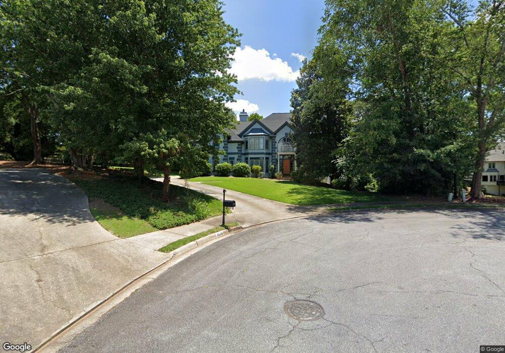
4545 Dairy Way Unit 7 Norcross, GA 30092
Estimated Value: $1,115,000 - $1,327,000
4
Beds
4
Baths
4,010
Sq Ft
$298/Sq Ft
Est. Value
About This Home
This home is located at 4545 Dairy Way Unit 7, Norcross, GA 30092 and is currently estimated at $1,193,719, approximately $297 per square foot. 4545 Dairy Way Unit 7 is a home located in Gwinnett County with nearby schools including Simpson Elementary School, Pinckneyville Middle School, and Norcross High School.
Ownership History
Date
Name
Owned For
Owner Type
Purchase Details
Closed on
Oct 15, 2004
Sold by
Corluoglu Murat and Corluoglu Eve
Bought by
Thanyawatpokin Parkorn
Current Estimated Value
Home Financials for this Owner
Home Financials are based on the most recent Mortgage that was taken out on this home.
Original Mortgage
$448,000
Outstanding Balance
$222,158
Interest Rate
6%
Mortgage Type
New Conventional
Estimated Equity
$971,561
Create a Home Valuation Report for This Property
The Home Valuation Report is an in-depth analysis detailing your home's value as well as a comparison with similar homes in the area
Home Values in the Area
Average Home Value in this Area
Purchase History
| Date | Buyer | Sale Price | Title Company |
|---|---|---|---|
| Thanyawatpokin Parkorn | $560,000 | -- |
Source: Public Records
Mortgage History
| Date | Status | Borrower | Loan Amount |
|---|---|---|---|
| Open | Thanyawatpokin Parkorn | $448,000 |
Source: Public Records
Tax History Compared to Growth
Tax History
| Year | Tax Paid | Tax Assessment Tax Assessment Total Assessment is a certain percentage of the fair market value that is determined by local assessors to be the total taxable value of land and additions on the property. | Land | Improvement |
|---|---|---|---|---|
| 2025 | $11,319 | $432,760 | $61,960 | $370,800 |
| 2024 | $11,353 | $410,480 | $71,200 | $339,280 |
| 2023 | $11,353 | $342,720 | $64,000 | $278,720 |
| 2022 | $9,160 | $302,880 | $52,000 | $250,880 |
| 2021 | $8,937 | $282,880 | $49,840 | $233,040 |
| 2020 | $9,002 | $282,880 | $49,840 | $233,040 |
| 2019 | $8,315 | $263,120 | $44,000 | $219,120 |
| 2018 | $7,640 | $230,520 | $36,000 | $194,520 |
| 2016 | $7,357 | $219,440 | $36,000 | $183,440 |
| 2015 | $7,441 | $219,440 | $36,000 | $183,440 |
| 2014 | -- | $219,440 | $36,000 | $183,440 |
Source: Public Records
Map
Nearby Homes
- 4575 Dairy Way
- 0 Hawk Run Unit 7571401
- 0 Hawk Run
- 4410 River Trail Dr Unit 383
- 4405 River Trail Dr
- 6040 Neely Farm Dr Unit 3
- 4291 River Bottom Dr
- 5970 Rachel Ridge Unit 2
- 5961 Ranger Ct
- 6169 Poplar Bluff Cir
- 225 Brassy Ct
- 0 Niblick Dr Unit 7655286
- 102 Hawkstone Way
- 9062 Riverbend Manor
- 5885 Match Point
- 420 Sandwedge Ln
- 917 Wentworth Ct
- 606 Cypress Pointe St
- 1003 Sandy Lane Dr
- 4555 Dairy Way
- 4500 River Bottom Dr
- 4510 River Bottom Dr Unit 5
- 4480 River Bottom Dr Unit 5
- 4544 Dairy Way Unit 18
- 4544 Dairy Way
- 4520 River Bottom Dr Unit 5
- 4470 River Bottom Dr
- 4550 River Bottom Dr
- 4554 Dairy Way
- 4565 Dairy Way Unit 7
- 4560 River Bottom Dr
- 0 Dairy Way Unit 3219875
- 0 Dairy Way Unit 7425619
- 0 Dairy Way Unit 7616288
- 0 Dairy Way Unit 8268048
- 4564 Dairy Way
- 4460 River Bottom Dr Unit 5
- 4504 Hawk Run
- 4501 River Bottom Dr