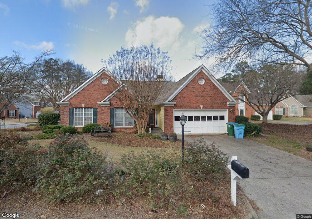
4545 Millerbrook Ct Duluth, GA 30096
Estimated Value: $452,144 - $492,000
3
Beds
2
Baths
2,296
Sq Ft
$205/Sq Ft
Est. Value
About This Home
This home is located at 4545 Millerbrook Ct, Duluth, GA 30096 and is currently estimated at $471,036, approximately $205 per square foot. 4545 Millerbrook Ct is a home located in Gwinnett County with nearby schools including Berkeley Lake Elementary School, Duluth Middle School, and Duluth High School.
Ownership History
Date
Name
Owned For
Owner Type
Purchase Details
Closed on
Jul 16, 2018
Sold by
Lydon Wanda B
Bought by
Maggart Holly Melisa
Current Estimated Value
Home Financials for this Owner
Home Financials are based on the most recent Mortgage that was taken out on this home.
Original Mortgage
$200,000
Outstanding Balance
$172,993
Interest Rate
4.6%
Mortgage Type
New Conventional
Estimated Equity
$298,043
Purchase Details
Closed on
Jun 24, 1996
Sold by
Pratt Jean B
Bought by
Cataldo John B Bonnie
Purchase Details
Closed on
Dec 17, 1994
Sold by
Old Norcross Inv Inc
Bought by
Pratt Jean B
Home Financials for this Owner
Home Financials are based on the most recent Mortgage that was taken out on this home.
Original Mortgage
$60,000
Interest Rate
9.23%
Create a Home Valuation Report for This Property
The Home Valuation Report is an in-depth analysis detailing your home's value as well as a comparison with similar homes in the area
Home Values in the Area
Average Home Value in this Area
Purchase History
| Date | Buyer | Sale Price | Title Company |
|---|---|---|---|
| Maggart Holly Melisa | $250,000 | -- | |
| Cataldo John B Bonnie | $166,800 | -- | |
| Pratt Jean B | $154,600 | -- |
Source: Public Records
Mortgage History
| Date | Status | Borrower | Loan Amount |
|---|---|---|---|
| Open | Maggart Holly Melisa | $200,000 | |
| Previous Owner | Pratt Jean B | $60,000 |
Source: Public Records
Tax History
| Year | Tax Paid | Tax Assessment Tax Assessment Total Assessment is a certain percentage of the fair market value that is determined by local assessors to be the total taxable value of land and additions on the property. | Land | Improvement |
|---|---|---|---|---|
| 2025 | $5,449 | $192,960 | $29,920 | $163,040 |
| 2024 | $5,380 | $182,320 | $33,200 | $149,120 |
| 2023 | $5,380 | $167,760 | $33,200 | $134,560 |
| 2022 | $4,456 | $139,200 | $24,000 | $115,200 |
| 2021 | $4,174 | $122,320 | $20,000 | $102,320 |
| 2020 | $4,095 | $117,360 | $20,000 | $97,360 |
| 2019 | $3,802 | $100,000 | $18,000 | $82,000 |
| 2018 | $854 | $103,400 | $18,000 | $85,400 |
| 2016 | $894 | $93,920 | $16,000 | $77,920 |
| 2015 | $911 | $83,080 | $16,000 | $67,080 |
| 2014 | $909 | $64,000 | $12,800 | $51,200 |
Source: Public Records
Map
Nearby Homes
- 4631 Leader Ln
- 4569 Iroquois Trail
- 2431 Player Ct
- 3927 Centennial Trail Unit III
- 2207 Hopkins Terrace
- 4242 Trail
- 4641 Broadwater Trail
- 2655 Cambridge Mews Dr
- 4300 Wildridge Dr
- 4270 Berkeley Mill Ln
- 4694 Fairway Rd
- 4240 Berkeley Mill Ln
- 4328 Buckingham Place
- 2082 Montgomery Trail
- 4870 Racquet Ct
- 4880 Racquet Ct
- 4633 Elsinore Cir
- 4767 Glenwhite Dr
- 4110 Megan Rd Unit 2
- 4091 Beaver Oaks Dr
- 4525 Millerbrook Ct
- 2455 Millerbrook Dr
- 2430 Millerbrook Dr
- 2420 Millerbrook Dr
- 4515 Millerbrook Ct
- 2440 Millerbrook Dr
- 4540 Millerbrook Ct
- 2410 Millerbrook Dr
- 4530 Millerbrook Ct
- 2475 Millerbrook Dr
- 4520 Millerbrook Ct
- 4505 Millerbrook Ct
- 2450 Millerbrook Dr
- 2400 Millerbrook Dr
- 4500 Millerbrook Ct
- 2485 Millerbrook Dr
- 2460 Millerbrook Dr
- 2480 Millerbrook Dr
- 4311 Claiborne Ct
- 4321 Claiborne Ct
Your Personal Tour Guide
Ask me questions while you tour the home.