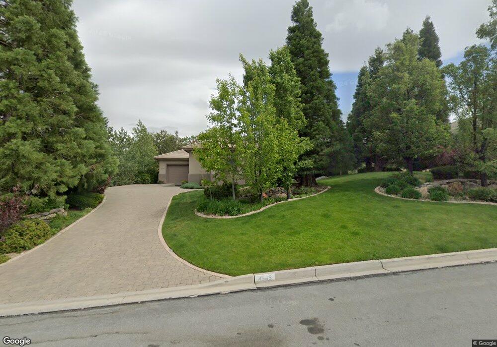
4545 Mountaingate Dr Reno, NV 89519
South Outer Reno NeighborhoodEstimated Value: $1,651,162 - $1,848,000
About This Home
This home is located at 4545 Mountaingate Dr, Reno, NV 89519 and is currently estimated at $1,756,541, approximately $546 per square foot. 4545 Mountaingate Dr is a home located in Washoe County with nearby schools including Roy Gomm Elementary School, Darrell C Swope Middle School, and Reno High School.
Ownership History
We collect this data history from publicly available records. To have your information removed, we recommend requesting removal directly through your county’s website.
Purchase Details
Purchase Details
Home Financials for this Owner
Home Financials are based on the most recent Mortgage that was taken out on this home.Purchase Details
Purchase Details
Purchase Details
Home Values in the Area
Average Home Value in this Area
Purchase History
We collect this data history from publicly available records. To have your information removed, we recommend requesting removal directly through your county’s website.
| Date | Buyer | Sale Price | Title Company |
|---|---|---|---|
| -- | None Listed On Document | ||
| $1,000,000 | Western Title Inc Ridge | ||
| -- | -- | ||
| -- | First American Title | ||
| $85,000 | First American Title Co |
Mortgage History
We collect this data history from publicly available records. To have your information removed, we recommend requesting removal directly through your county’s website.
| Date | Status | Borrower | Loan Amount |
|---|---|---|---|
| Previous Owner | $250,000 | ||
| Previous Owner | $400,000 | ||
| Previous Owner | $175,000 |
Tax History
We collect this data history from publicly available records. To have your information removed, we recommend requesting removal directly through your county’s website.
| Year | Tax Paid | Tax Assessment Tax Assessment Total Assessment is a certain percentage of the fair market value that is determined by local assessors to be the total taxable value of land and additions on the property. | Land | Improvement |
|---|---|---|---|---|
| 2026 | $7,178 | $341,031 | $131,250 | $209,781 |
| 2024 | $9,309 | $327,392 | $112,000 | $215,392 |
| 2023 | $9,044 | $309,238 | $105,000 | $204,238 |
| 2022 | $6,569 | $263,594 | $92,750 | $170,844 |
| 2021 | $8,522 | $248,914 | $78,750 | $170,164 |
| 2020 | $8,272 | $249,453 | $78,750 | $170,703 |
| 2019 | $8,030 | $237,603 | $70,000 | $167,603 |
| 2018 | $7,795 | $234,127 | $70,000 | $164,127 |
| 2017 | $7,377 | $234,531 | $70,000 | $164,531 |
| 2016 | $7,377 | $232,822 | $64,750 | $168,072 |
| 2015 | $7,368 | $208,127 | $39,235 | $168,892 |
| 2014 | $7,152 | $194,948 | $30,450 | $164,498 |
| 2013 | -- | $191,291 | $30,450 | $160,841 |
Map
- 0 Woodchuck Cir Unit 41-051-24
- 70 Bear Mountain Place
- 7440 W 4th St Unit 57
- 30 Francovich Ct
- 245 Anselmo Dr
- 270 Anselmo Dr
- 4755 Canyon Dr
- 4220 Christy Way
- 8155 Leroy St
- 4260 Longknife Rd
- 4387 Sharps Rd
- 65 Sharps Cir
- 60 Promontory Pointe
- 40 Greybull Ct
- 4130 Latigo Ct
- 6850 Sharlands Ave Unit 1132
- 6850 Sharlands Ave Unit AC1174
- 6850 Sharlands Ave Unit 1029
- 6850 Sharlands Ave Unit S-1107
- 6850 Sharlands Ave Unit M2074
- 4535 Mountaingate Dr
- 4555 Mountaingate Dr
- 4525 Mountaingate Dr
- 4565 Mountaingate Dr
- 4540 Mountaingate Dr
- 4550 Mountaingate Dr
- 4515 Mountaingate Dr
- 4560 Mountaingate Dr Unit 4
- 4575 Mountaingate Dr Unit 4
- 4445 Starwood Ct
- 4530 Mountaingate Dr
- 4435 Starwood Ct
- 4455 Starwood Ct
- 4570 Mountaingate Dr
- 4520 Mountaingate Dr
- 4505 Mountaingate Dr
- 4585 Mountaingate Dr
- 4425 Starwood Ct
- 4580 Mountaingate Dr
- 4510 Mountaingate Dr Unit 4
Ask me questions while you tour the home.