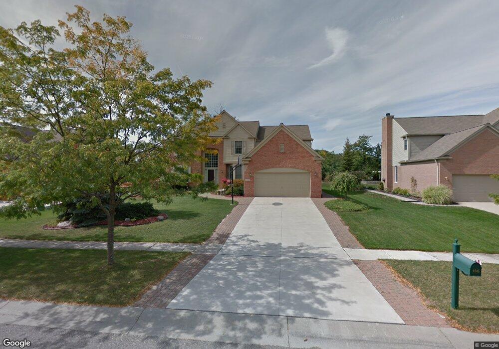
4546 Middledale Rd S Unit Bldg-Unit West Bloomfield, MI 48323
Estimated Value: $582,613 - $656,000
4
Beds
3
Baths
3,033
Sq Ft
$202/Sq Ft
Est. Value
About This Home
This home is located at 4546 Middledale Rd S Unit Bldg-Unit, West Bloomfield, MI 48323 and is currently estimated at $614,153, approximately $202 per square foot. 4546 Middledale Rd S Unit Bldg-Unit is a home located in Oakland County with nearby schools including Walled Lake Central High School, St. Matthew Lutheran School, and St. William School.
Ownership History
Date
Name
Owned For
Owner Type
Purchase Details
Closed on
Jun 5, 2019
Sold by
Lim John K and Lim Elen Y
Bought by
Najor Marvin J and Najor Ban
Current Estimated Value
Purchase Details
Closed on
Oct 27, 1999
Sold by
Pulte Land Dev Corp
Bought by
Lim John K
Create a Home Valuation Report for This Property
The Home Valuation Report is an in-depth analysis detailing your home's value as well as a comparison with similar homes in the area
Home Values in the Area
Average Home Value in this Area
Purchase History
| Date | Buyer | Sale Price | Title Company |
|---|---|---|---|
| Najor Marvin J | $395,400 | First American Title Ins Co | |
| Lim John K | $105,000 | -- |
Source: Public Records
Tax History Compared to Growth
Tax History
| Year | Tax Paid | Tax Assessment Tax Assessment Total Assessment is a certain percentage of the fair market value that is determined by local assessors to be the total taxable value of land and additions on the property. | Land | Improvement |
|---|---|---|---|---|
| 2024 | $4,183 | $215,100 | $0 | $0 |
| 2022 | $3,957 | $200,040 | $20,000 | $180,040 |
| 2021 | $6,513 | $189,500 | $0 | $0 |
| 2020 | $3,920 | $187,340 | $20,000 | $167,340 |
| 2018 | $4,814 | $174,800 | $20,000 | $154,800 |
| 2015 | -- | $152,900 | $0 | $0 |
| 2014 | -- | $139,460 | $0 | $0 |
| 2011 | -- | $121,400 | $0 | $0 |
Source: Public Records
Map
Nearby Homes
- 6980 Hambro St
- 4335 Crestdale Ave
- 7359 Woodlore Dr
- 4245 Bunker Ave
- 4442 Borland St
- 7381 Crestmore St
- 4212 Greendale Ave
- 7337 Richardson Rd
- 7065 Deerwood Trail Unit 27
- 4540 Rolling Pine Ct
- 6978 Colony Dr
- 7555 Windgate Cir
- 4066 Green Lake Rd
- 0000 Langtoft
- 6675 Langtoft St
- 3991 Fieldview Ave
- 6903 Dandison Blvd
- 3965 Carrick Ave
- 7841 Trailside Ct
- 3950 Bradmore Ave
- 4546 Middledale Rd S
- 4534 Middledale Rd S Unit 48
- 4558 Middledale Rd S
- 4509 Twin Beach Ct
- 4507 Twin Beach Ct
- 4511 Twin Beach Ct
- 4511 Twin Beach Ct
- 4522 Middledale Rd S
- 4570 Middledale Rd S
- 4529 Middledale Rd S
- 4509 Twin Beach Ct
- 4509 Twin Beach Ct Unit Bldg-Unit
- 4507 Twin Beach Ct Unit Bldg-Unit
- 4507 Twin Beach Ct
- 4513 Twin Beach Ct
- 4513 Twin Beach Ct
- 4505 Twin Beach Ct
- 4510 Middledale Rd S
- 4582 Middledale Rd S
- 4577 Middledale Rd S