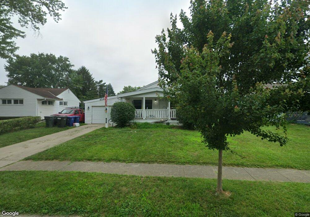
4548 Amesbury Rd Columbus, OH 43227
Shady Lane NeighborhoodEstimated Value: $203,000 - $243,000
3
Beds
2
Baths
1,056
Sq Ft
$210/Sq Ft
Est. Value
About This Home
This home is located at 4548 Amesbury Rd, Columbus, OH 43227 and is currently estimated at $221,980, approximately $210 per square foot. 4548 Amesbury Rd is a home located in Franklin County with nearby schools including Shady Lane Elementary School, Sherwood Middle School, and Walnut Ridge High School.
Ownership History
Date
Name
Owned For
Owner Type
Purchase Details
Closed on
Apr 26, 2010
Sold by
Harvey Mary Frances
Bought by
Harvey Mary Frances and Mary Frances Harvey Trust
Current Estimated Value
Purchase Details
Closed on
Apr 2, 2009
Sold by
Estate Of William A Harvey
Bought by
Harvey Mary Frances
Purchase Details
Closed on
Sep 5, 1973
Bought by
Harvey William A
Create a Home Valuation Report for This Property
The Home Valuation Report is an in-depth analysis detailing your home's value as well as a comparison with similar homes in the area
Home Values in the Area
Average Home Value in this Area
Purchase History
| Date | Buyer | Sale Price | Title Company |
|---|---|---|---|
| Harvey Mary Frances | -- | Attorney | |
| Harvey Mary Frances | -- | None Available | |
| Harvey William A | -- | -- |
Source: Public Records
Tax History Compared to Growth
Tax History
| Year | Tax Paid | Tax Assessment Tax Assessment Total Assessment is a certain percentage of the fair market value that is determined by local assessors to be the total taxable value of land and additions on the property. | Land | Improvement |
|---|---|---|---|---|
| 2024 | $3,270 | $68,080 | $15,960 | $52,120 |
| 2023 | $3,231 | $68,075 | $15,960 | $52,115 |
| 2022 | $1,698 | $31,960 | $5,990 | $25,970 |
| 2021 | $1,701 | $31,960 | $5,990 | $25,970 |
| 2020 | $1,704 | $31,960 | $5,990 | $25,970 |
| 2019 | $999 | $25,210 | $4,800 | $20,410 |
| 2018 | $959 | $25,210 | $4,800 | $20,410 |
| 2017 | $998 | $25,210 | $4,800 | $20,410 |
| 2016 | $1,016 | $24,080 | $4,690 | $19,390 |
| 2015 | $922 | $24,080 | $4,690 | $19,390 |
| 2014 | $924 | $24,080 | $4,690 | $19,390 |
| 2013 | $583 | $28,350 | $5,530 | $22,820 |
Source: Public Records
Map
Nearby Homes
- 4530 Amesbury Rd
- 4501 Amesbury Rd
- 1281 Maetzel Dr
- 4484 Grimsby Rd
- 4467 Grimsby Rd
- 4571 Aragon Ave
- 1563 Genoa Place
- 1571 Baxter Dr
- 4677 E Livingston Ave
- 1068 Ross Rd
- 1130 Little Plum Ln
- 1543 S Hamilton Rd
- 1607 Simpson Dr
- 1085 S Hamilton Rd
- 1607 Shady Lane Rd
- 1291 Westphal Ave
- 1618 S Hamilton Rd
- 4701 Janis Dr
- 1691 Shady Lane Rd
- 4181 Colby Ave
- 4554 Amesbury Rd
- 4540 Amesbury Rd
- 4562 Amesbury Rd
- 1301 Huntly Dr
- 4530 Amesbury Rd
- 1299 Huntly Dr
- 1303 Huntly Dr
- 4537 Amesbury Rd
- 4547 Amesbury Rd
- 4570 Amesbury Rd
- 4555 Amesbury Rd
- 1314 Thurston Dr
- 4529 Amesbury Rd
- 1322 Thurston Dr
- 1293 Huntly Dr
- 1305 Huntly Dr
- 1306 Thurston Dr
- 4561 Amesbury Rd
- 1332 Thurston Dr
- 4578 Amesbury Rd