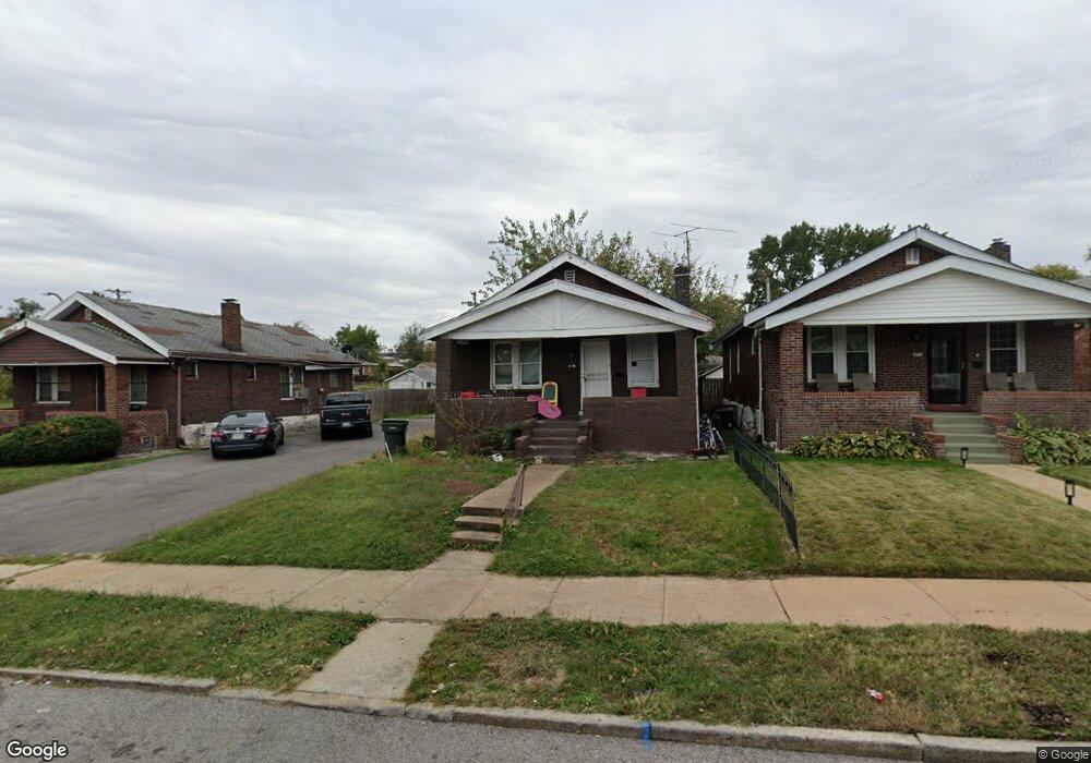
4548 Carter Ave Saint Louis, MO 63115
Penrose NeighborhoodEstimated Value: $39,303 - $60,000
--
Bed
1
Bath
1,344
Sq Ft
$38/Sq Ft
Est. Value
About This Home
This home is located at 4548 Carter Ave, Saint Louis, MO 63115 and is currently estimated at $51,576, approximately $38 per square foot. 4548 Carter Ave is a home located in St. Louis City with nearby schools including Ashland Elementary School, Yeatman-Liddell Middle School, and Vashon High School.
Ownership History
Date
Name
Owned For
Owner Type
Purchase Details
Closed on
Mar 22, 2016
Sold by
Land Reutilization Authority Of The City
Bought by
Gatefield Asia L
Current Estimated Value
Purchase Details
Closed on
Dec 9, 2014
Sold by
City Of St Louis
Bought by
The Land Reutilization Authority Of The
Purchase Details
Closed on
Oct 3, 2014
Sold by
Mccorriston David
Bought by
Wilder Melvin
Purchase Details
Closed on
Jun 24, 2014
Sold by
Scott Jaymay
Bought by
Mccorriston David
Purchase Details
Closed on
Nov 12, 2013
Sold by
Louis Rascoe A
Bought by
Scott Jaymay
Create a Home Valuation Report for This Property
The Home Valuation Report is an in-depth analysis detailing your home's value as well as a comparison with similar homes in the area
Home Values in the Area
Average Home Value in this Area
Purchase History
| Date | Buyer | Sale Price | Title Company |
|---|---|---|---|
| Gatefield Asia L | $1,000 | None Available | |
| The Land Reutilization Authority Of The | -- | None Available | |
| Wilder Melvin | -- | None Available | |
| Mccorriston David | -- | None Available | |
| Scott Jaymay | -- | None Available |
Source: Public Records
Tax History Compared to Growth
Tax History
| Year | Tax Paid | Tax Assessment Tax Assessment Total Assessment is a certain percentage of the fair market value that is determined by local assessors to be the total taxable value of land and additions on the property. | Land | Improvement |
|---|---|---|---|---|
| 2025 | $171 | $1,760 | $460 | $1,300 |
| 2024 | $164 | $1,710 | $460 | $1,250 |
| 2023 | $164 | $1,710 | $460 | $1,250 |
| 2022 | $168 | $1,690 | $460 | $1,230 |
| 2021 | $167 | $1,690 | $460 | $1,230 |
| 2020 | $168 | $1,710 | $460 | $1,250 |
| 2019 | $168 | $1,710 | $460 | $1,250 |
| 2018 | $161 | $1,580 | $460 | $1,120 |
| 2017 | $159 | $1,580 | $460 | $1,120 |
| 2016 | $369 | $3,800 | $860 | $2,950 |
| 2015 | $369 | $3,810 | $860 | $2,950 |
| 2014 | $369 | $3,810 | $860 | $2,950 |
| 2013 | -- | $4,510 | $860 | $3,650 |
Source: Public Records
Map
Nearby Homes
- 4556 Carter Ave
- 4418 Dryden Ave
- 4246 N Taylor Ave
- 4627 Korte Ave
- 4477 Bessie Ave
- 4449 Anderson Ave
- 4499 Lee Ave Unit B
- 4607 Lee Ave
- 4430 Sexauer Ave
- 4655 Lee Ave
- 4402 Clarence Ave
- 4253 Holly Ave
- 4237 Holly Ave
- 4341 Shreve Ave
- 4419 Holly Ave
- 4681 Kossuth Ave
- 4629 Farlin Ave
- 4608 Pope Ave
- 4610 Pope Ave
- 4429 Farlin Ave
- 4550 Carter Ave
- 4544 Carter Ave
- 4540 Carter Ave
- 4552 Carter Ave
- 4323 Dryden Ave
- 4568 Carter Ave
- 4558 Carter Ave
- 4528 Carter Ave
- 4317 Dryden Ave
- 4551 Carter Ave
- 4555 Carter Ave
- 4549 Carter Ave
- 4559 Carter Ave
- 4524 Carter Ave
- 4543 Carter Ave
- 4328 Dryden Ave
- 4565 Carter Ave
- 4324 Dryden Ave
- 4401 Dryden Ave
- 4311 Dryden Ave