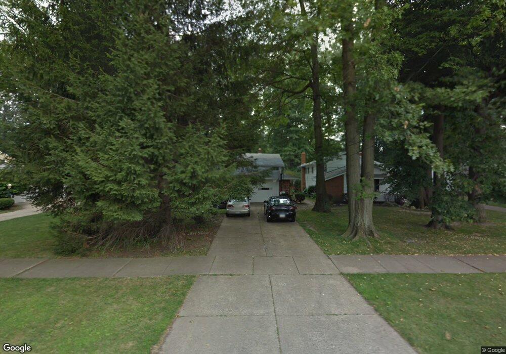
4549 Michael Ave North Olmsted, OH 44070
Estimated Value: $306,819 - $322,000
3
Beds
2
Baths
2,121
Sq Ft
$148/Sq Ft
Est. Value
About This Home
This home is located at 4549 Michael Ave, North Olmsted, OH 44070 and is currently estimated at $313,705, approximately $147 per square foot. 4549 Michael Ave is a home located in Cuyahoga County with nearby schools including Maple Intermediate Elementary School, Pine Intermediate School, and North Olmsted Middle School.
Ownership History
Date
Name
Owned For
Owner Type
Purchase Details
Closed on
Nov 19, 1999
Sold by
Durfeld William and Durfeld Frieda
Bought by
Strong Barry L
Current Estimated Value
Home Financials for this Owner
Home Financials are based on the most recent Mortgage that was taken out on this home.
Original Mortgage
$65,000
Outstanding Balance
$20,071
Interest Rate
7.9%
Estimated Equity
$293,634
Purchase Details
Closed on
Mar 29, 1985
Sold by
Durfeld William and Durfeld Frieda
Bought by
Durfeld William
Purchase Details
Closed on
Jan 1, 1975
Bought by
Durfeld William and Durfeld Frieda
Create a Home Valuation Report for This Property
The Home Valuation Report is an in-depth analysis detailing your home's value as well as a comparison with similar homes in the area
Home Values in the Area
Average Home Value in this Area
Purchase History
| Date | Buyer | Sale Price | Title Company |
|---|---|---|---|
| Strong Barry L | $135,000 | Prospect Title Agency Inc | |
| Durfeld William | -- | -- | |
| Durfeld William | -- | -- |
Source: Public Records
Mortgage History
| Date | Status | Borrower | Loan Amount |
|---|---|---|---|
| Open | Strong Barry L | $65,000 |
Source: Public Records
Tax History Compared to Growth
Tax History
| Year | Tax Paid | Tax Assessment Tax Assessment Total Assessment is a certain percentage of the fair market value that is determined by local assessors to be the total taxable value of land and additions on the property. | Land | Improvement |
|---|---|---|---|---|
| 2024 | $5,359 | $87,990 | $17,815 | $70,175 |
| 2023 | $4,494 | $64,200 | $16,490 | $47,710 |
| 2022 | $4,505 | $64,190 | $16,490 | $47,710 |
| 2021 | $4,077 | $64,190 | $16,490 | $47,710 |
| 2020 | $4,332 | $52,190 | $13,410 | $38,780 |
| 2019 | $4,216 | $149,100 | $38,300 | $110,800 |
| 2018 | $4,276 | $52,190 | $13,410 | $38,780 |
| 2017 | $4,041 | $45,400 | $10,990 | $34,410 |
| 2016 | $4,005 | $45,400 | $10,990 | $34,410 |
| 2015 | $3,950 | $45,400 | $10,990 | $34,410 |
| 2014 | $3,950 | $44,520 | $10,780 | $33,740 |
Source: Public Records
Map
Nearby Homes
- 4590 Brendan Ln
- 4666 Brendan Cir
- 4505 Oak Cir
- 4849 Grace Rd Unit 121
- 22895 Mastick Rd
- 22934 Mastick Rd Unit 102
- 22537 Lenox Dr
- 0 Mastick Rd Unit 5112571
- 22534 Bard Ave
- 22247 Mastick Rd
- 24326 Mastick Rd
- 4187 Columbia Rd Unit 126
- 22503 Sandy Ln
- 0 V L Clareshire Dr
- 24300 Mastick Rd
- 22506 Sharon Ln
- 23993 Fairlawn Dr
- 5951 Rockport Ln
- 4514 Orchard Rd
- 5308 Columbia Rd
- 4561 Michael Ave
- 4537 Michael Ave
- 4573 Michael Ave
- 4525 Michael Ave
- 4576 Brendan Ln
- 4562 Brendan Ln
- 4585 Michael Ave
- 4513 Michael Ave
- 4600 Brendan Ln
- 4548 Brendan Ln
- 4550 Michael Ave
- 4562 Michael Ave
- 4610 Brendan Ln
- 4538 Michael Ave
- 4534 Brendan Ln
- 4501 Michael Ave
- 4574 Michael Ave
- 4526 Michael Ave
- 4586 Michael Ave
- 4514 Michael Ave