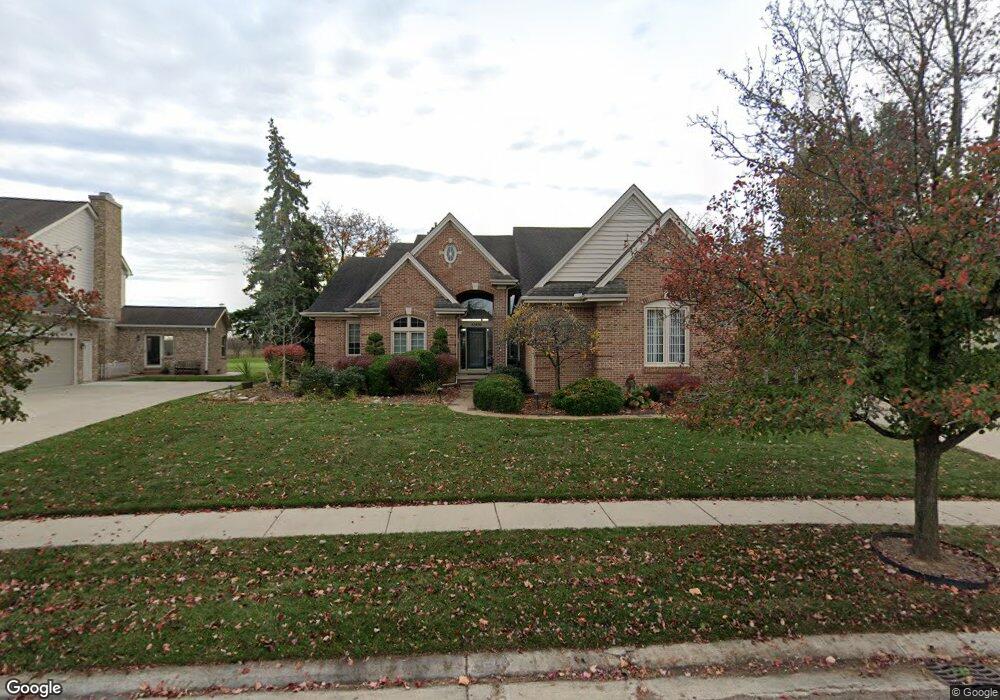
45495 Muirfield Dr Canton, MI 48188
Estimated Value: $563,907 - $652,000
3
Beds
4
Baths
2,687
Sq Ft
$229/Sq Ft
Est. Value
About This Home
This home is located at 45495 Muirfield Dr, Canton, MI 48188 and is currently estimated at $615,227, approximately $228 per square foot. 45495 Muirfield Dr is a home located in Wayne County with nearby schools including Canton High School, Plymouth High School, and Salem High School.
Ownership History
Date
Name
Owned For
Owner Type
Purchase Details
Closed on
Sep 22, 2016
Sold by
Wallace Nanci and Wallace Nanci L
Bought by
Wallace Nanci L
Current Estimated Value
Purchase Details
Closed on
Aug 3, 2010
Sold by
Wallace Scott
Bought by
Wallace Nanci
Home Financials for this Owner
Home Financials are based on the most recent Mortgage that was taken out on this home.
Original Mortgage
$225,000
Outstanding Balance
$149,945
Interest Rate
4.7%
Mortgage Type
New Conventional
Estimated Equity
$465,282
Purchase Details
Closed on
Jul 7, 1999
Sold by
Mcki John W and Mcki Madaline S
Bought by
Wallace Nanci and Wallace Scott
Create a Home Valuation Report for This Property
The Home Valuation Report is an in-depth analysis detailing your home's value as well as a comparison with similar homes in the area
Home Values in the Area
Average Home Value in this Area
Purchase History
| Date | Buyer | Sale Price | Title Company |
|---|---|---|---|
| Wallace Nanci L | -- | None Available | |
| Wallace Nanci | -- | Continental Title Agency | |
| Wallace Nanci | $370,000 | -- |
Source: Public Records
Mortgage History
| Date | Status | Borrower | Loan Amount |
|---|---|---|---|
| Open | Wallace Nanci | $225,000 |
Source: Public Records
Tax History Compared to Growth
Tax History
| Year | Tax Paid | Tax Assessment Tax Assessment Total Assessment is a certain percentage of the fair market value that is determined by local assessors to be the total taxable value of land and additions on the property. | Land | Improvement |
|---|---|---|---|---|
| 2025 | $3,352 | $249,300 | $0 | $0 |
| 2024 | $3,352 | $236,100 | $0 | $0 |
| 2023 | $3,195 | $205,700 | $0 | $0 |
| 2022 | $6,914 | $200,500 | $0 | $0 |
| 2021 | $6,707 | $197,500 | $0 | $0 |
| 2020 | $6,625 | $194,800 | $0 | $0 |
| 2019 | $6,502 | $181,260 | $0 | $0 |
| 2018 | $2,716 | $172,190 | $0 | $0 |
| 2017 | $6,552 | $170,200 | $0 | $0 |
| 2016 | $5,906 | $171,300 | $0 | $0 |
| 2015 | $14,922 | $160,000 | $0 | $0 |
| 2013 | $14,456 | $156,820 | $0 | $0 |
| 2010 | -- | $137,570 | $70,600 | $66,970 |
Source: Public Records
Map
Nearby Homes
- 241 Country Club Ln
- 45400 William Ct
- 51026 Meadowlands
- 45242 Thornhill Rd
- 316 Queen Anne Dr
- 47078 Bing Dr
- 1752 Thistle Dr
- 1709 Thistle Dr Unit 51
- 45030 Glengarry Rd
- 46502 Killarney Cir Unit 191
- 1564 Crowndale Ln
- 1861 Stonebridge Way
- 288 Edington Cir Unit 61
- 500 Belvedere Ct N
- 227 Edington Cir
- 46449 Killarney Ct Unit Bldg-Unit160
- 45801 Henley Dr
- 2498 Cleveland Way
- 2304 Cleveland Way
- 1849 Wentworth Ct
- 45491 Muirfield Dr
- 45499 Muirfield Dr
- 45487 Muirfield Dr
- 45490 Muirfield Dr
- 45503 Muirfield Dr
- 45498 Muirfield Dr
- 45486 Muirfield Dr
- 45502 Muirfield Dr
- 45483 Muirfield Dr
- 45507 Muirfield Dr
- 45506 Muirfield Dr
- 45479 Muirfield Dr
- 45511 Muirfield Dr Unit 28
- 45478 Muirfield Dr
- 45510 Muirfield Dr
- 45475 Muirfield Dr
- 45474 Muirfield Dr
- 45515 Muirfield Dr
- 45514 Muirfield Dr
- 45471 Muirfield Dr