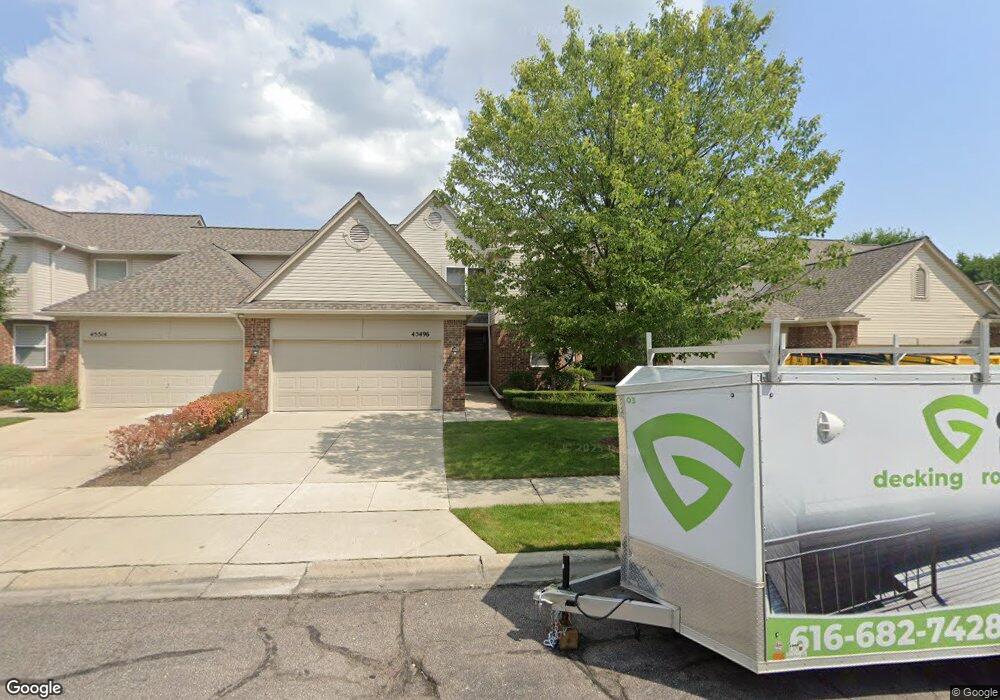
45496 Rathmore Dr Unit 281 Macomb, MI 48044
Estimated Value: $296,353 - $331,000
--
Bed
1
Bath
1,462
Sq Ft
$214/Sq Ft
Est. Value
About This Home
This home is located at 45496 Rathmore Dr Unit 281, Macomb, MI 48044 and is currently estimated at $313,588, approximately $214 per square foot. 45496 Rathmore Dr Unit 281 is a home located in Macomb County with nearby schools including Cherokee Elementary School, Wyandot Middle School, and Chippewa Valley High School.
Ownership History
Date
Name
Owned For
Owner Type
Purchase Details
Closed on
Oct 30, 2025
Sold by
Toutant William J and Toutant Dawn C
Bought by
Toutant William J and Toutant Dawn C
Current Estimated Value
Purchase Details
Closed on
Oct 14, 2025
Sold by
Toutant William J and Toutant Dawn C
Bought by
Toutant Revocable Trust
Purchase Details
Closed on
May 11, 2005
Sold by
Gtr Windemere Inc
Bought by
Toutant William J and Toutant Dawn C
Create a Home Valuation Report for This Property
The Home Valuation Report is an in-depth analysis detailing your home's value as well as a comparison with similar homes in the area
Home Values in the Area
Average Home Value in this Area
Purchase History
| Date | Buyer | Sale Price | Title Company |
|---|---|---|---|
| Toutant William J | -- | None Listed On Document | |
| Toutant William J | -- | None Listed On Document | |
| Toutant Revocable Trust | -- | None Listed On Document | |
| Toutant William J | $200,705 | First American Title Ins Co |
Source: Public Records
Tax History Compared to Growth
Tax History
| Year | Tax Paid | Tax Assessment Tax Assessment Total Assessment is a certain percentage of the fair market value that is determined by local assessors to be the total taxable value of land and additions on the property. | Land | Improvement |
|---|---|---|---|---|
| 2025 | -- | $137,800 | $0 | $0 |
| 2024 | -- | $133,800 | $0 | $0 |
| 2023 | -- | $0 | $0 | $0 |
| 2022 | $0 | $0 | $0 | $0 |
| 2021 | $0 | $0 | $0 | $0 |
| 2020 | $0 | $0 | $0 | $0 |
| 2019 | $1,825 | $0 | $0 | $0 |
| 2018 | $1,470 | $87,700 | $0 | $0 |
| 2017 | $1,924 | $79,860 | $18,500 | $61,360 |
| 2016 | $1,825 | $79,860 | $0 | $0 |
| 2015 | $1,801 | $78,780 | $0 | $0 |
| 2014 | $1,801 | $58,680 | $12,500 | $46,180 |
| 2011 | $338 | $60,200 | $10,500 | $49,700 |
Source: Public Records
Map
Nearby Homes
- 45550 Rathmore Dr Unit 278
- 45687 Cagney Dr Unit 70
- 20819 Burn Dr
- 20811 Burn Dr
- 20800 Burn Dr
- 20795 Burn Dr
- The Bradbury Plan at Windemere Farms
- The Glenbury Plan at Windemere Farms
- The Bradbury II Plan at Windemere Farms
- 45705 Cagney Dr Unit 63
- 20779 Burn Dr
- 20776 Burn Dr
- 20771 Burn Dr
- 20768 Burn Dr
- 20832 Burn Dr
- 45731 Beaufort Dr
- 45914 Portsville Dr
- 45130 Sheri Dr
- 45869 Bonaventure Dr
- 20346 Windham Dr
- 45478 Rathmore Dr Unit 282
- 45532 Rathmore Dr
- 45460 Rathmore Dr Unit 283
- 45514 Rathmore Dr Unit 280
- 45487 Rathmore Dr Unit 71
- 45523 Rathmore #73
- 45469 Rathmore Dr Unit 70
- 45568 Rathmore Dr Unit 277
- 45604 Rathmore Dr Unit 275
- 45523 Rathmore Dr Unit 73
- 45505 Rathmore Dr Unit 72
- 45559 Rathmore Dr Unit 75
- 45541 Rathmore Dr Unit 74
- 45586 Rathmore Dr Unit 57, 276
- 45586 Rathmore Dr Unit 276
- 45595 Rathmore Dr Unit 77
- 45510 Limerick Dr Unit 101
- 45474 Limerick Dr Unit 103
- 45492 Limerick Dr Unit 102
- 45528 Limerick Dr Unit 100