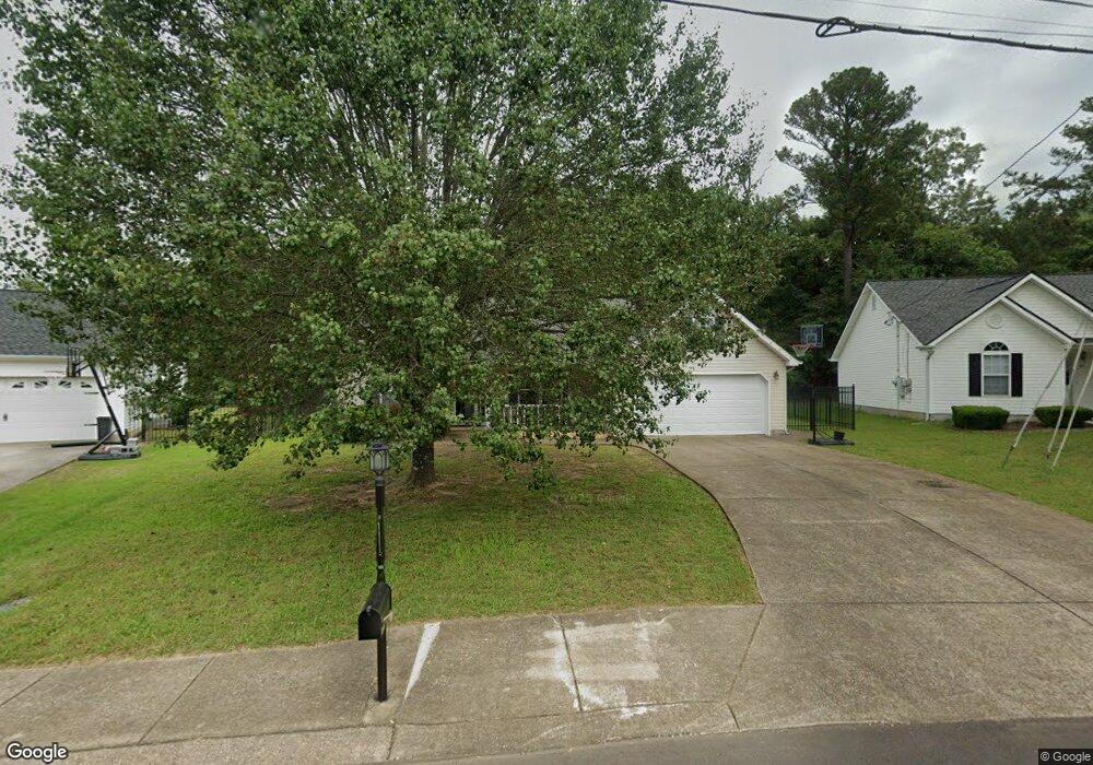
455 Colony Cir Fort Oglethorpe, GA 30742
Estimated Value: $263,539 - $306,000
3
Beds
2
Baths
1,374
Sq Ft
$205/Sq Ft
Est. Value
About This Home
This home is located at 455 Colony Cir, Fort Oglethorpe, GA 30742 and is currently estimated at $281,385, approximately $204 per square foot. 455 Colony Cir is a home located in Catoosa County with nearby schools including Cloud Springs Elementary School, Lakeview Middle School, and Lakeview-Fort Oglethorpe High School.
Ownership History
Date
Name
Owned For
Owner Type
Purchase Details
Closed on
Apr 22, 2010
Sold by
Best Land Investments Llc
Bought by
Fowler David E
Current Estimated Value
Home Financials for this Owner
Home Financials are based on the most recent Mortgage that was taken out on this home.
Original Mortgage
$85,000
Outstanding Balance
$55,697
Interest Rate
4.99%
Mortgage Type
New Conventional
Estimated Equity
$225,688
Purchase Details
Closed on
Jan 4, 2006
Sold by
Not Provided
Bought by
Fowler David E and Fowler Wren H
Create a Home Valuation Report for This Property
The Home Valuation Report is an in-depth analysis detailing your home's value as well as a comparison with similar homes in the area
Home Values in the Area
Average Home Value in this Area
Purchase History
| Date | Buyer | Sale Price | Title Company |
|---|---|---|---|
| Fowler David E | $119,500 | -- | |
| Fowler David E | -- | -- |
Source: Public Records
Mortgage History
| Date | Status | Borrower | Loan Amount |
|---|---|---|---|
| Open | Fowler David E | $85,000 |
Source: Public Records
Tax History
| Year | Tax Paid | Tax Assessment Tax Assessment Total Assessment is a certain percentage of the fair market value that is determined by local assessors to be the total taxable value of land and additions on the property. | Land | Improvement |
|---|---|---|---|---|
| 2025 | $2,108 | $100,829 | $11,000 | $89,829 |
| 2024 | $2,554 | $97,075 | $11,000 | $86,075 |
| 2023 | $2,117 | $75,363 | $11,000 | $64,363 |
| 2022 | $1,738 | $61,894 | $11,000 | $50,894 |
| 2021 | $1,648 | $61,894 | $11,000 | $50,894 |
| 2020 | $1,640 | $55,532 | $11,000 | $44,532 |
| 2019 | $1,597 | $53,532 | $9,000 | $44,532 |
| 2018 | $1,678 | $53,532 | $9,000 | $44,532 |
| 2017 | $1,585 | $50,587 | $7,200 | $43,387 |
| 2016 | $1,557 | $47,562 | $7,200 | $40,362 |
| 2015 | -- | $47,562 | $7,200 | $40,362 |
| 2014 | -- | $47,562 | $7,200 | $40,362 |
| 2013 | -- | $45,659 | $6,912 | $38,747 |
Source: Public Records
Map
Nearby Homes
- 47 Spring Place Dr
- 180 Gem Dr
- 699 Colony Cir
- 128 Franklin Cir
- 351 Franklin Cir
- 2003 Cedar Creek Dr
- 792 Colony Cir
- 54 Franklin Cir
- 425 Franklin Cir
- 304 Cedar Creek Dr
- 875 Colony Cir
- 74 Flagstone Dr
- 239 Flagstone Dr
- 344 Flagstone Dr
- 329 Flagstone Dr
- 250 Steele Rd
- 14 Evergreen Cir
- 72 Anchor Dr
- 151 Sharon Cir
- 127 Evergreen Cir
- 445 Colony Cir
- 435 Colony Cir
- 438 Colony Cir
- 464 Colony Cir
- 489 Colony Cir
- 478 Colony Cir
- 427 Colony Cir
- 412 Colony Cir
- 464 Linda Ln
- 490 Colony Cir
- 503 Colony Cir
- 48 Stone Edge Ct
- 398 Colony Cir
- 444 Linda Ln
- 504 Colony Cir
- 517 Colony Cir
- 12 McDonald Dr
- 38 Stone Edge Ct
- 45 Stone Edge Ct
- 386 Colony Cir
Your Personal Tour Guide
Ask me questions while you tour the home.