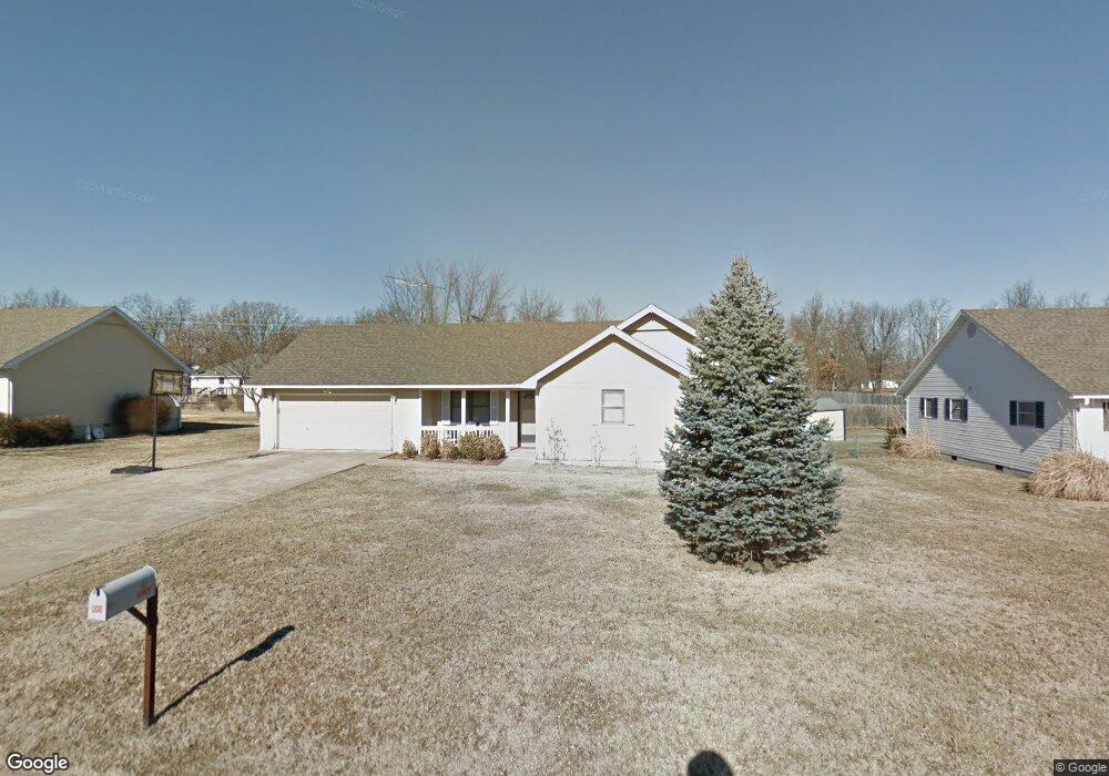
455 Farmers Ln Lebanon, MO 65536
Estimated Value: $205,000 - $265,000
3
Beds
1
Bath
1,803
Sq Ft
$124/Sq Ft
Est. Value
About This Home
This home is located at 455 Farmers Ln, Lebanon, MO 65536 and is currently estimated at $223,937, approximately $124 per square foot. 455 Farmers Ln is a home located in Laclede County with nearby schools including Joe D. Esther Elementary School, Maplecrest Elementary School, and Boswell Elementary School.
Ownership History
Date
Name
Owned For
Owner Type
Purchase Details
Closed on
Oct 4, 2020
Sold by
Kinnett Janet R and Revcoable Liv Tr Agreemtent Of
Bought by
Williamson Jason Dean and Williamson Jamie Lynn
Current Estimated Value
Home Financials for this Owner
Home Financials are based on the most recent Mortgage that was taken out on this home.
Original Mortgage
$60,000
Interest Rate
2.8%
Mortgage Type
Purchase Money Mortgage
Purchase Details
Closed on
Sep 11, 2012
Sold by
Lucas Tony Silveria and Lucas Tony S
Bought by
Lucas Julie Ann
Purchase Details
Closed on
Apr 4, 2006
Sold by
Newman Daniel J
Bought by
Lucas Tony S and Kinnett Janet
Home Financials for this Owner
Home Financials are based on the most recent Mortgage that was taken out on this home.
Original Mortgage
$96,831
Interest Rate
6.21%
Mortgage Type
FHA
Create a Home Valuation Report for This Property
The Home Valuation Report is an in-depth analysis detailing your home's value as well as a comparison with similar homes in the area
Home Values in the Area
Average Home Value in this Area
Purchase History
| Date | Buyer | Sale Price | Title Company |
|---|---|---|---|
| Williamson Jason Dean | -- | None Available | |
| Lucas Julie Ann | -- | None Available | |
| Lucas Tony S | -- | None Available |
Source: Public Records
Mortgage History
| Date | Status | Borrower | Loan Amount |
|---|---|---|---|
| Previous Owner | Williamson Jason Dean | $60,000 | |
| Previous Owner | Lucas Tony S | $96,831 |
Source: Public Records
Tax History Compared to Growth
Tax History
| Year | Tax Paid | Tax Assessment Tax Assessment Total Assessment is a certain percentage of the fair market value that is determined by local assessors to be the total taxable value of land and additions on the property. | Land | Improvement |
|---|---|---|---|---|
| 2025 | $916 | $18,110 | $0 | $0 |
| 2024 | $916 | $16,070 | $0 | $0 |
| 2023 | $944 | $16,070 | $0 | $0 |
| 2022 | $880 | $16,070 | $0 | $0 |
| 2021 | $921 | $15,276 | $1,919 | $13,357 |
| 2020 | $926 | $15,276 | $1,919 | $13,357 |
| 2019 | $887 | $15,280 | $1,920 | $13,360 |
| 2018 | $832 | $15,280 | $1,920 | $13,360 |
| 2017 | $789 | $15,280 | $0 | $0 |
| 2016 | $789 | $15,280 | $0 | $0 |
| 2015 | $789 | $15,280 | $0 | $0 |
| 2014 | $789 | $15,280 | $0 | $0 |
| 2013 | -- | $15,280 | $0 | $0 |
Source: Public Records
Map
Nearby Homes
- 1954 Donna Cir
- 531 E Bland Rd
- 290 Jessie St
- 257 Parkway Ave
- 1524 Tekary St
- 1432 Lana Dr
- 1932 Mimosa Ct
- 815 Mountrose St
- 1501 Danielle Dr
- 1341 Deadra Dr
- 836 Stella St
- 1161 Enfield Dr
- 22835 Patton Ln
- 22807 Pioneer Dr
- 1122 Beverly Dr
- 216 Coach Rd
- 2421 Candlebark Ln
- 2401 Copperwood Dr
- 2444 Copperwood Dr
- 345 Coach Rd