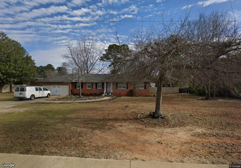
455 Loring Mill Rd Sumter, SC 29150
Estimated Value: $194,000 - $372,000
3
Beds
2
Baths
2,065
Sq Ft
$127/Sq Ft
Est. Value
About This Home
This home is located at 455 Loring Mill Rd, Sumter, SC 29150 and is currently estimated at $263,141, approximately $127 per square foot. 455 Loring Mill Rd is a home located in Sumter County with nearby schools including Millwood Elementary School, Alice Drive Middle School, and Sumter High School.
Ownership History
Date
Name
Owned For
Owner Type
Purchase Details
Closed on
Feb 1, 2018
Sold by
Mccants Robert L
Bought by
Mccants Robert L
Current Estimated Value
Purchase Details
Closed on
May 9, 2005
Sold by
Lawson Mabel N
Bought by
Mccants Robert L
Home Financials for this Owner
Home Financials are based on the most recent Mortgage that was taken out on this home.
Original Mortgage
$61,760
Interest Rate
5.99%
Mortgage Type
Purchase Money Mortgage
Create a Home Valuation Report for This Property
The Home Valuation Report is an in-depth analysis detailing your home's value as well as a comparison with similar homes in the area
Purchase History
| Date | Buyer | Sale Price | Title Company |
|---|---|---|---|
| Mccants Robert L | -- | None Available | |
| Mccants Robert L | $66,600 | -- |
Source: Public Records
Mortgage History
| Date | Status | Borrower | Loan Amount |
|---|---|---|---|
| Closed | Mccants Robert L | $61,760 |
Source: Public Records
Tax History
| Year | Tax Paid | Tax Assessment Tax Assessment Total Assessment is a certain percentage of the fair market value that is determined by local assessors to be the total taxable value of land and additions on the property. | Land | Improvement |
|---|---|---|---|---|
| 2025 | $74 | -- | -- | -- |
| 2024 | $74 | $0 | $0 | $0 |
| 2023 | $74 | $5,410 | $450 | $4,960 |
| 2022 | $72 | $5,410 | $450 | $4,960 |
| 2021 | $69 | $5,410 | $450 | $4,960 |
| 2020 | $69 | $4,780 | $450 | $4,330 |
| 2019 | $67 | $4,780 | $450 | $4,330 |
| 2018 | $2,483 | $4,780 | $450 | $4,330 |
| 2017 | $2,472 | $7,160 | $670 | $6,490 |
| 2016 | $2,471 | $7,160 | $670 | $6,490 |
| 2015 | $2,333 | $6,970 | $670 | $6,300 |
| 2014 | $2,333 | $6,970 | $670 | $6,300 |
| 2013 | -- | $6,970 | $670 | $6,300 |
Source: Public Records
Map
Nearby Homes
- 520 Mallard Dr
- 545 Loring Mill Rd
- 35 Whitetail Cir
- 155 Whitetail Cir
- 200 Whitetail Cir
- 350 Chesapeake Dr
- 486 Mallard Roost
- 1130 Curlew Cir Unit Lot 116
- 1275 Curlew Cir
- 1315 Curlew Cir
- 1305 Curlew Cir
- 140 Windjammer Way Unit Lot 87
- 140 Windjammer Way
- 165 Windjammer Way Unit Lot 149
- 175 Windjammer Way Unit Lot 150
- 175 Windjammer Way
- 1325 Curlew Cir
- 1110 Curlew Cir
- 175 Hidden Bay Dr
- 2140 Watersong Run Unit Lot 48
- 435 Loring Mill Rd
- 201 Muscovy Trail
- 215 Muscovy Trail
- 215 Muscovy Trail
- 225 Muscovy Trail
- 460 Loring Mill Rd
- 2710 Bonnell Dr
- 235 Muscovy Trail
- 200 Muscovy Trail
- 210 Muscovy Trail
- 245 Muscovy Trail
- 490 Loring Mill Rd
- 230 Muscovy Trail
- 491 Loring Mill Rd
- 2730 Bonnell Dr
- 60 Gadwall Cir
- 240 Muscovy Trail
- 495 Loring Mill Rd
- 2740 Bonnell Dr
- 255 Muscovy Trail
Your Personal Tour Guide
Ask me questions while you tour the home.