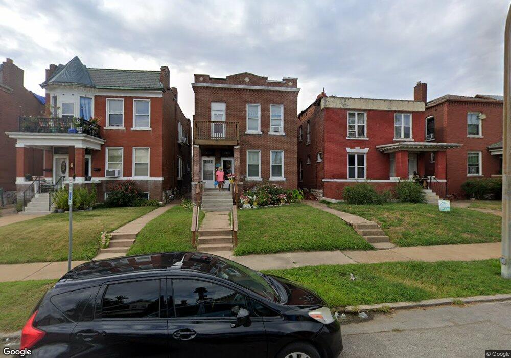
4551 Harris Ave Saint Louis, MO 63115
O'Fallon NeighborhoodEstimated Value: $57,000 - $96,836
--
Bed
2
Baths
2,656
Sq Ft
$29/Sq Ft
Est. Value
About This Home
This home is located at 4551 Harris Ave, Saint Louis, MO 63115 and is currently estimated at $78,209, approximately $29 per square foot. 4551 Harris Ave is a home located in St. Louis City with nearby schools including Hickey Elementary School, Yeatman-Liddell Middle School, and Vashon High School.
Ownership History
Date
Name
Owned For
Owner Type
Purchase Details
Closed on
Oct 15, 2019
Sold by
Parcels Of Land Encumbered With Delinque
Bought by
Harvey Eric
Current Estimated Value
Purchase Details
Closed on
Apr 28, 2005
Sold by
Carey Wesley L and Pittman Wesley L
Bought by
Pittman Wesley L
Home Financials for this Owner
Home Financials are based on the most recent Mortgage that was taken out on this home.
Original Mortgage
$76,000
Interest Rate
6.95%
Mortgage Type
Stand Alone Refi Refinance Of Original Loan
Create a Home Valuation Report for This Property
The Home Valuation Report is an in-depth analysis detailing your home's value as well as a comparison with similar homes in the area
Home Values in the Area
Average Home Value in this Area
Purchase History
| Date | Buyer | Sale Price | Title Company |
|---|---|---|---|
| Harvey Eric | $7,700 | None Available | |
| Pittman Wesley L | -- | Nations Title Agency Mo Inc |
Source: Public Records
Mortgage History
| Date | Status | Borrower | Loan Amount |
|---|---|---|---|
| Previous Owner | Pittman Wesley L | $76,000 |
Source: Public Records
Tax History Compared to Growth
Tax History
| Year | Tax Paid | Tax Assessment Tax Assessment Total Assessment is a certain percentage of the fair market value that is determined by local assessors to be the total taxable value of land and additions on the property. | Land | Improvement |
|---|---|---|---|---|
| 2025 | $303 | $3,400 | $460 | $2,940 |
| 2024 | $290 | $3,290 | $460 | $2,830 |
| 2023 | $290 | $3,290 | $460 | $2,830 |
| 2022 | $295 | $3,230 | $460 | $2,770 |
| 2021 | $295 | $3,230 | $460 | $2,770 |
| 2020 | $293 | $3,230 | $460 | $2,770 |
| 2019 | $292 | $3,230 | $460 | $2,770 |
| 2018 | $303 | $3,270 | $460 | $2,810 |
| 2017 | $299 | $3,270 | $460 | $2,810 |
| 2016 | $367 | $4,050 | $860 | $3,190 |
| 2015 | $335 | $4,050 | $860 | $3,190 |
| 2014 | $417 | $4,050 | $860 | $3,190 |
| 2013 | -- | $5,140 | $860 | $4,280 |
Source: Public Records
Map
Nearby Homes
- 4535 Holly Ave
- 4454 Holly Ave
- 4450 Holly Ave
- 4210 E Carter Ave
- 4550 Adelaide Ave
- 4537 Clarence Ave
- 4419 Holly Ave
- 4648 Pope Ave
- 4610 Pope Ave
- 4608 Pope Ave
- 4219 Red Bud Ave
- 4402 Clarence Ave
- 2032 E Adelaide Ave
- 4224 Penrose St
- 4253 Holly Ave
- 4142 E Penrose St
- 4237 Holly Ave
- 4356 College Ave
- 4110 Red Bud Ave
- 1912 E Adelaide Ave
- 4547 Harris Ave
- 4553 Harris Ave
- 4545 Harris Ave
- 4557 Harris Ave
- 4543 Harris Ave
- 4561 Harris Ave
- 4541 Harris Ave
- 4567 Harris Ave
- 4537 Harris Ave
- 4550 Red Bud Ave
- 4554 Red Bud Ave
- 4548 Red Bud Ave
- 4535 Harris Ave
- 4571 Harris Ave
- 4558 Red Bud Ave
- 4544 Red Bud Ave
- 4560 Red Bud Ave
- 4540 Red Bud Ave
- 4548 Harris Ave
- 4531 Harris Ave