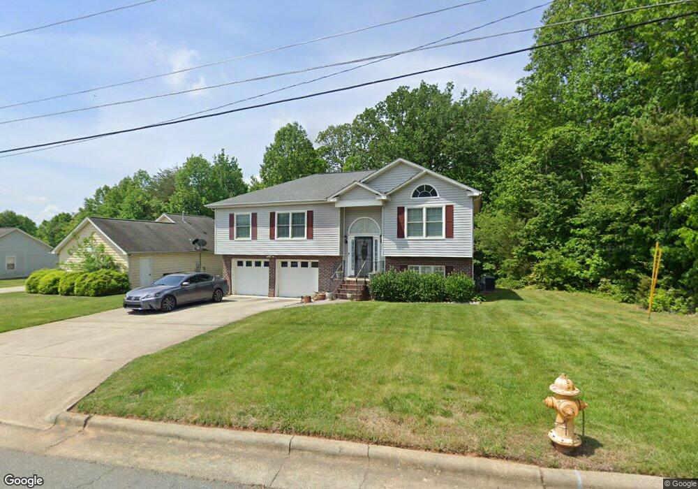
4552 Lasley Dr Winston Salem, NC 27105
Estimated Value: $242,000 - $275,000
6
Beds
6
Baths
3,000
Sq Ft
$87/Sq Ft
Est. Value
About This Home
This home is located at 4552 Lasley Dr, Winston Salem, NC 27105 and is currently estimated at $261,762, approximately $87 per square foot. 4552 Lasley Dr is a home located in Forsyth County with nearby schools including Ibraham Elementary School, Mineral Springs Middle School, and Carver High.
Ownership History
Date
Name
Owned For
Owner Type
Purchase Details
Closed on
Oct 21, 2021
Sold by
Paul Rosa C and Hairston Rosa
Bought by
Paul Rosa C and Hairston Jasmine Denise
Current Estimated Value
Home Financials for this Owner
Home Financials are based on the most recent Mortgage that was taken out on this home.
Original Mortgage
$116,366
Outstanding Balance
$106,115
Interest Rate
2.8%
Mortgage Type
New Conventional
Estimated Equity
$155,647
Purchase Details
Closed on
Sep 16, 2009
Sold by
Paul Reginald J
Bought by
Paul Rosa C and Hairston Rosa
Purchase Details
Closed on
Apr 25, 2002
Sold by
Topflow Company
Bought by
Hairston Rosa and Paul Reginald J
Home Financials for this Owner
Home Financials are based on the most recent Mortgage that was taken out on this home.
Original Mortgage
$123,750
Interest Rate
7.07%
Create a Home Valuation Report for This Property
The Home Valuation Report is an in-depth analysis detailing your home's value as well as a comparison with similar homes in the area
Home Values in the Area
Average Home Value in this Area
Purchase History
| Date | Buyer | Sale Price | Title Company |
|---|---|---|---|
| Paul Rosa C | -- | Amrock | |
| Paul Rosa C | -- | None Available | |
| Hairston Rosa | $137,500 | -- |
Source: Public Records
Mortgage History
| Date | Status | Borrower | Loan Amount |
|---|---|---|---|
| Open | Paul Rosa C | $116,366 | |
| Closed | Hairston Rosa | $123,750 |
Source: Public Records
Tax History Compared to Growth
Tax History
| Year | Tax Paid | Tax Assessment Tax Assessment Total Assessment is a certain percentage of the fair market value that is determined by local assessors to be the total taxable value of land and additions on the property. | Land | Improvement |
|---|---|---|---|---|
| 2025 | $2,472 | $254,000 | $37,000 | $217,000 |
| 2024 | $2,359 | $176,200 | $30,000 | $146,200 |
| 2023 | $2,359 | $176,200 | $30,000 | $146,200 |
| 2022 | $2,315 | $176,200 | $30,000 | $146,200 |
| 2021 | $2,273 | $176,200 | $30,000 | $146,200 |
| 2020 | $1,846 | $133,700 | $15,500 | $118,200 |
| 2019 | $1,860 | $133,700 | $15,500 | $118,200 |
| 2018 | $1,766 | $133,700 | $15,500 | $118,200 |
| 2016 | $1,500 | $113,954 | $19,000 | $94,954 |
| 2015 | $1,477 | $113,954 | $19,000 | $94,954 |
| 2014 | $1,433 | $113,954 | $19,000 | $94,954 |
Source: Public Records
Map
Nearby Homes
- 4504 Lasley Dr
- 165 Lasley Ct
- 157 Lasley Ct
- 149 Lasley Ct
- 4513 Lasley Dr
- 4869 Monte Vista St
- 4601 Oak Ridge Dr
- 0 Carver School Rd Unit 1174703
- 4372 Oak Ridge Dr
- 4239 Carver School Rd
- 4944 Davis Rd
- 3924 Oak Ridge Dr
- 3990 Logan Ln
- 0 Old Walkertown Rd
- 4957 Davis Rd
- 4965 Davis Rd
- 4980 Davis Rd
- 0 Oakdale Dr
- 0 Northwest Dr
- Montclaire Plan at Covington