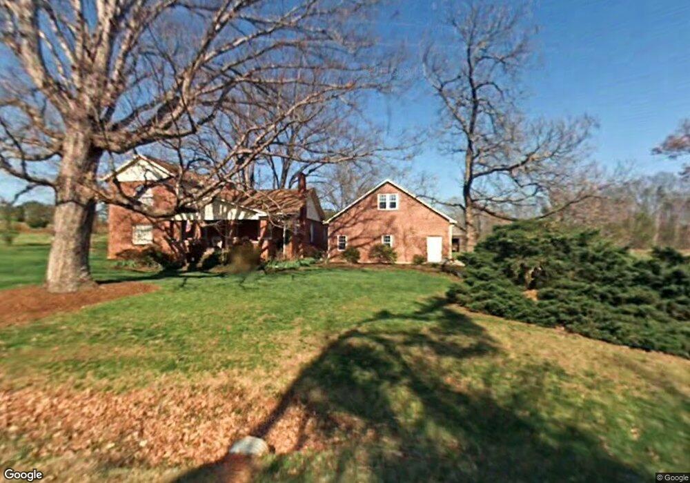
4552 Rifle Range Rd Conover, NC 28613
Estimated Value: $488,000 - $603,000
3
Beds
3
Baths
3,138
Sq Ft
$170/Sq Ft
Est. Value
About This Home
This home is located at 4552 Rifle Range Rd, Conover, NC 28613 and is currently estimated at $534,205, approximately $170 per square foot. 4552 Rifle Range Rd is a home located in Catawba County with nearby schools including Lyle Creek Elementary School, River Bend Middle School, and Bunker Hill High School.
Ownership History
Date
Name
Owned For
Owner Type
Purchase Details
Closed on
Feb 26, 2021
Sold by
Drum Theron Evans and Drum Stephanie H
Bought by
Drum Theron Evans and Drum Stephanie H
Current Estimated Value
Purchase Details
Closed on
Jan 25, 2021
Sold by
Drum Theron Evans and Drum Stephanie H
Bought by
Drum Kent David
Purchase Details
Closed on
Feb 1, 1984
Bought by
Drum Theron Evans and Drum Stephan
Create a Home Valuation Report for This Property
The Home Valuation Report is an in-depth analysis detailing your home's value as well as a comparison with similar homes in the area
Home Values in the Area
Average Home Value in this Area
Purchase History
| Date | Buyer | Sale Price | Title Company |
|---|---|---|---|
| Drum Theron Evans | -- | None Available | |
| Drum Kent David | -- | None Listed On Document | |
| Drum Theron Evans | $28,000 | -- |
Source: Public Records
Tax History Compared to Growth
Tax History
| Year | Tax Paid | Tax Assessment Tax Assessment Total Assessment is a certain percentage of the fair market value that is determined by local assessors to be the total taxable value of land and additions on the property. | Land | Improvement |
|---|---|---|---|---|
| 2025 | $2,239 | $428,500 | $38,400 | $390,100 |
| 2024 | $2,239 | $428,500 | $38,400 | $390,100 |
| 2023 | $2,153 | $252,100 | $38,400 | $213,700 |
| 2022 | $1,752 | $252,100 | $38,400 | $213,700 |
| 2021 | $1,644 | $236,500 | $23,600 | $212,900 |
| 2020 | $1,644 | $236,500 | $23,600 | $212,900 |
| 2019 | $1,644 | $236,500 | $0 | $0 |
| 2018 | $1,460 | $210,000 | $23,500 | $186,500 |
| 2017 | $1,460 | $0 | $0 | $0 |
| 2016 | $1,397 | $0 | $0 | $0 |
| 2015 | $1,352 | $210,000 | $23,500 | $186,500 |
| 2014 | $1,352 | $225,300 | $25,300 | $200,000 |
Source: Public Records
Map
Nearby Homes
- 4645 Rifle Range Rd
- 4874 Stone Dr Unit 125
- 1098 Remington Dr
- 4932 Sandstone Dr
- 4858 Water Wheel Dr
- 4073 Lee Cline Rd
- 1371 Millrace Dr
- 1862 Green Leaf Ct
- 4120 Village Blvd NW
- 3677 Charles St NW
- 3671 Charles St NW
- 3665 Charles St NW
- Aria Plan at Cline Village
- Hanover Plan at Cline Village
- Hamilton Plan at Cline Village
- Winston Plan at Cline Village
- Robie Plan at Cline Village
- Belhaven Plan at Cline Village
- Cali Plan at Cline Village
- Penwell Plan at Cline Village
- 4464 Rifle Range Rd
- 4573 Rifle Range Rd
- 4593 Rifle Range Rd
- 4482 Rifle Range Rd
- 4620 Rifle Range Rd
- 4615 Rifle Range Rd
- 4508 Rifle Range Rd
- 4633 Rifle Range Rd
- 4642 Rifle Range Rd
- 4480 Rifle Range Rd
- 4637 Rifle Range Rd
- 4654 Rifle Range Rd
- 4661 Rifle Range Rd
- 4670 Rifle Range Rd
- 4680 Rifle Range Rd
- 4684 Rifle Range Rd
- 4683 Rifle Range Rd
- 4694 Rifle Range Rd
- 4699 Rifle Range Rd
- 4484 Rifle Range Rd