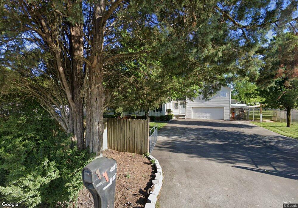
4553 Walpole Rd High Point, NC 27265
Sandy Ridge NeighborhoodEstimated Value: $439,000 - $1,420,000
3
Beds
3
Baths
2,120
Sq Ft
$442/Sq Ft
Est. Value
About This Home
This home is located at 4553 Walpole Rd, High Point, NC 27265 and is currently estimated at $937,548, approximately $442 per square foot. 4553 Walpole Rd is a home located in Guilford County with nearby schools including Southwest Elementary School, Southwest Guilford Middle School, and Southwest Guilford High School.
Ownership History
Date
Name
Owned For
Owner Type
Purchase Details
Closed on
Jun 2, 2025
Sold by
Cantara David Richard and Cantara Pamela Ann
Bought by
Bnfre Llc
Current Estimated Value
Home Financials for this Owner
Home Financials are based on the most recent Mortgage that was taken out on this home.
Original Mortgage
$2,500,000
Outstanding Balance
$2,490,339
Interest Rate
6.81%
Mortgage Type
New Conventional
Estimated Equity
-$1,552,791
Purchase Details
Closed on
Aug 27, 1998
Sold by
Czahor Richard Kirk and Czahor Judy
Bought by
Cantara David Richard and Cantara Pamela Ann
Home Financials for this Owner
Home Financials are based on the most recent Mortgage that was taken out on this home.
Original Mortgage
$137,917
Interest Rate
6.92%
Mortgage Type
VA
Create a Home Valuation Report for This Property
The Home Valuation Report is an in-depth analysis detailing your home's value as well as a comparison with similar homes in the area
Home Values in the Area
Average Home Value in this Area
Purchase History
| Date | Buyer | Sale Price | Title Company |
|---|---|---|---|
| Bnfre Llc | $1,400,000 | None Listed On Document | |
| Cantara David Richard | $134,000 | -- |
Source: Public Records
Mortgage History
| Date | Status | Borrower | Loan Amount |
|---|---|---|---|
| Open | Bnfre Llc | $2,500,000 | |
| Previous Owner | Cantara David Richard | $137,917 |
Source: Public Records
Tax History
| Year | Tax Paid | Tax Assessment Tax Assessment Total Assessment is a certain percentage of the fair market value that is determined by local assessors to be the total taxable value of land and additions on the property. | Land | Improvement |
|---|---|---|---|---|
| 2025 | $3,474 | $406,500 | $62,000 | $344,500 |
| 2024 | $3,474 | $406,500 | $62,000 | $344,500 |
| 2023 | $3,474 | $406,500 | $62,000 | $344,500 |
| 2022 | $3,474 | $406,500 | $62,000 | $344,500 |
| 2021 | $2,440 | $285,500 | $62,000 | $223,500 |
| 2020 | $2,354 | $285,500 | $62,000 | $223,500 |
| 2019 | $1,254 | $152,100 | $0 | $0 |
| 2018 | $1,248 | $152,100 | $0 | $0 |
| 2017 | $1,254 | $152,100 | $0 | $0 |
| 2016 | $1,281 | $150,900 | $0 | $0 |
| 2015 | $1,289 | $150,900 | $0 | $0 |
| 2014 | $1,304 | $150,900 | $0 | $0 |
Source: Public Records
Map
Nearby Homes
- 4630 White Beard Rd
- 4743 Willowstone Dr
- 4725 Willowstone Dr
- 4723 Willowstone Dr
- 2459 Tannin Ct
- 4715 Willowstone Dr
- 1341 Grant Haven Ct
- 4713 Willowstone Dr
- 4711 Willowstone Dr
- 4722 Willowstone Dr
- 4716 Willowstone Dr
- 4714 Willowstone Dr
- 4712 Willowstone Dr
- 4710 Willowstone Dr
- 1351 Grant Haven Ct
- 715 Piedmont Crossing Dr Unit 14
- 748 Carneros Cir
- 4728 Sandy Camp Rd
- 4413 Edbury Ct
- 3477 Lilliefield Ln
- 4544 Walpole Rd
- 4555 Walpole Rd
- 8003 Clinard Farms Rd
- 8007 Clinard Farms Rd
- 4538 Walpole Rd
- 8005 Clinard Farms Rd
- 4536 Walpole Rd
- 4539 Walpole Rd
- 8006 Clinard Farms Rd
- 4532 Walpole Rd
- 4530 Walpole Rd
- 8009 Clinard Farms Rd
- 4528 & 4522 Walpole Rd
- 8011 Clinard Farms Rd
- 7913 Clinard Farms Rd
- 4522 Walpole Rd
- 8021 Clinard Farms Rd
- 4520 Walpole Rd
- 8019 Clinard Farms Rd Unit A
- 8019 Clinard Farms Rd
Your Personal Tour Guide
Ask me questions while you tour the home.