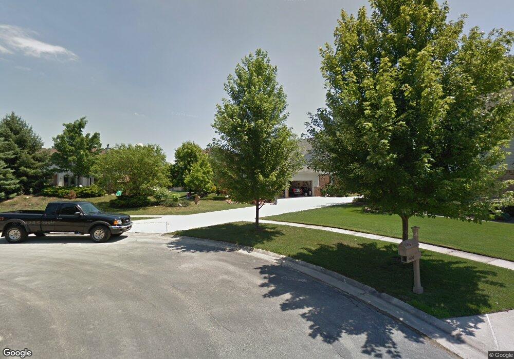
45545 Muirfield Ct Canton, MI 48188
Estimated Value: $557,450 - $661,000
--
Bed
4
Baths
2,655
Sq Ft
$230/Sq Ft
Est. Value
About This Home
This home is located at 45545 Muirfield Ct, Canton, MI 48188 and is currently estimated at $611,613, approximately $230 per square foot. 45545 Muirfield Ct is a home located in Wayne County with nearby schools including Canton High School, Plymouth High School, and Salem High School.
Ownership History
Date
Name
Owned For
Owner Type
Purchase Details
Closed on
Jan 6, 2022
Sold by
Ja Koch Hu
Bought by
Koch Family Revocable Living Trust
Current Estimated Value
Purchase Details
Closed on
Sep 15, 2006
Sold by
Koch Otto A and Koch Hu Ja
Bought by
Koch Otto
Purchase Details
Closed on
Aug 17, 1994
Sold by
Curti
Bought by
Koch Otto A and Koch Hu
Home Financials for this Owner
Home Financials are based on the most recent Mortgage that was taken out on this home.
Original Mortgage
$145,000
Interest Rate
8.72%
Mortgage Type
New Conventional
Purchase Details
Closed on
Mar 5, 1993
Sold by
Fairway Pines Ltd Ptns
Bought by
Co-Ptns Curtis Canon
Create a Home Valuation Report for This Property
The Home Valuation Report is an in-depth analysis detailing your home's value as well as a comparison with similar homes in the area
Home Values in the Area
Average Home Value in this Area
Purchase History
| Date | Buyer | Sale Price | Title Company |
|---|---|---|---|
| Koch Family Revocable Living Trust | -- | Land Title | |
| Koch Otto | -- | Greco | |
| Koch Otto A | $264,230 | -- | |
| Co-Ptns Curtis Canon | $55,000 | -- |
Source: Public Records
Mortgage History
| Date | Status | Borrower | Loan Amount |
|---|---|---|---|
| Previous Owner | Koch Otto A | $145,000 |
Source: Public Records
Tax History Compared to Growth
Tax History
| Year | Tax Paid | Tax Assessment Tax Assessment Total Assessment is a certain percentage of the fair market value that is determined by local assessors to be the total taxable value of land and additions on the property. | Land | Improvement |
|---|---|---|---|---|
| 2025 | $3,618 | $265,500 | $0 | $0 |
| 2024 | $3,618 | $251,000 | $0 | $0 |
| 2023 | $3,449 | $217,000 | $0 | $0 |
| 2022 | $7,451 | $212,500 | $0 | $0 |
| 2021 | $7,227 | $209,900 | $0 | $0 |
| 2020 | $7,139 | $207,000 | $0 | $0 |
| 2019 | $7,006 | $191,620 | $0 | $0 |
| 2018 | $2,932 | $179,750 | $0 | $0 |
| 2017 | $7,049 | $184,700 | $0 | $0 |
| 2016 | $6,363 | $185,700 | $0 | $0 |
| 2015 | $16,108 | $173,710 | $0 | $0 |
| 2013 | $15,605 | $170,120 | $0 | $0 |
| 2010 | -- | $151,460 | $92,543 | $58,917 |
Source: Public Records
Map
Nearby Homes
- 241 Country Club Ln
- 45400 William Ct
- 51026 Meadowlands
- 316 Queen Anne Dr
- 47078 Bing Dr
- 45242 Thornhill Rd
- 1564 Crowndale Ln
- 500 Belvedere Ct N
- 1861 Stonebridge Way
- 1752 Thistle Dr
- 1709 Thistle Dr Unit 51
- 288 Edington Cir Unit 61
- 45030 Glengarry Rd
- 46502 Killarney Cir Unit 191
- 45801 Henley Dr
- 227 Edington Cir
- 46449 Killarney Ct Unit Bldg-Unit160
- 2498 Cleveland Way
- 2304 Cleveland Way
- 685 N Beck Rd
- 45553 Muirfield Ct
- 45519 Muirfield Dr Unit Bldg-Unit
- 45519 Muirfield Dr
- 45523 Muirfield Dr
- 45515 Muirfield Dr
- 45551 Muirfield Ct
- 45511 Muirfield Dr Unit 28
- 45546 Muirfield Ct
- 45554 Muirfield Ct
- 45550 Muirfield Ct
- 45540 Muirfield Ct
- 45518 Muirfield Dr
- 45514 Muirfield Dr
- 45522 Muirfield Dr
- 45507 Muirfield Dr
- 45510 Muirfield Dr
- 45526 Muirfield Dr
- 45506 Muirfield Dr
- 45555 Glengarry Blvd
- 45547 Glengarry Blvd