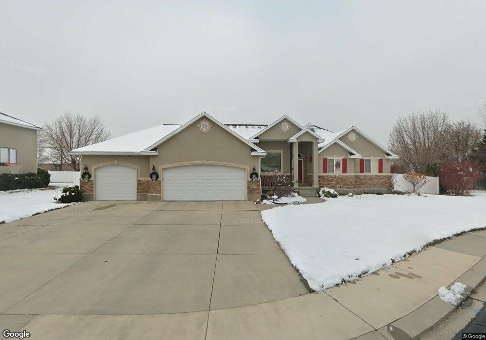
4555 Windsor Cir Pleasant Grove, UT 84062
Estimated Value: $731,000 - $811,000
6
Beds
3
Baths
1,902
Sq Ft
$407/Sq Ft
Est. Value
About This Home
This home is located at 4555 Windsor Cir, Pleasant Grove, UT 84062 and is currently estimated at $773,377, approximately $406 per square foot. 4555 Windsor Cir is a home located in Utah County with nearby schools including Deerfield Elementary School, Mountain Ridge Junior High School, and Lone Peak High School.
Ownership History
Date
Name
Owned For
Owner Type
Purchase Details
Closed on
Mar 17, 2015
Sold by
Morgan Robert C and Morgan Linda
Bought by
Morgan Robert C and Morgan Linda
Current Estimated Value
Purchase Details
Closed on
Nov 12, 2002
Sold by
Traveller Jon B and Traveller Kari L
Bought by
Morgan Robert and Morgan Linda
Home Financials for this Owner
Home Financials are based on the most recent Mortgage that was taken out on this home.
Original Mortgage
$260,900
Outstanding Balance
$147,315
Interest Rate
10.99%
Estimated Equity
$626,062
Purchase Details
Closed on
Oct 3, 2000
Sold by
Temple Shadows Llc
Bought by
Wilhite Wilbur D and Wilhite Louise P
Purchase Details
Closed on
Jun 9, 2000
Sold by
Temple Shadows Llc
Bought by
Traveller Jon B and Traveller Karl L
Create a Home Valuation Report for This Property
The Home Valuation Report is an in-depth analysis detailing your home's value as well as a comparison with similar homes in the area
Home Values in the Area
Average Home Value in this Area
Purchase History
| Date | Buyer | Sale Price | Title Company |
|---|---|---|---|
| Morgan Robert C | -- | None Available | |
| Morgan Robert | -- | Empire Land Title Company | |
| Wilhite Wilbur D | -- | Security Title & Abstract | |
| Traveller Jon B | -- | Security Title & Abstract |
Source: Public Records
Mortgage History
| Date | Status | Borrower | Loan Amount |
|---|---|---|---|
| Open | Morgan Robert | $260,900 | |
| Closed | Morgan Robert | $14,450 |
Source: Public Records
Tax History Compared to Growth
Tax History
| Year | Tax Paid | Tax Assessment Tax Assessment Total Assessment is a certain percentage of the fair market value that is determined by local assessors to be the total taxable value of land and additions on the property. | Land | Improvement |
|---|---|---|---|---|
| 2025 | $3,164 | $407,000 | $251,800 | $488,200 |
| 2024 | $3,164 | $374,660 | $0 | $0 |
| 2023 | $2,966 | $377,355 | $0 | $0 |
| 2022 | $2,947 | $366,300 | $0 | $0 |
| 2021 | $2,654 | $491,400 | $152,800 | $338,600 |
| 2020 | $2,471 | $446,500 | $141,500 | $305,000 |
| 2019 | $2,341 | $439,100 | $134,100 | $305,000 |
| 2018 | $2,309 | $408,200 | $126,600 | $281,600 |
| 2017 | $2,267 | $214,280 | $0 | $0 |
| 2016 | $2,251 | $197,835 | $0 | $0 |
| 2015 | $2,277 | $189,475 | $0 | $0 |
| 2014 | $2,192 | $181,115 | $0 | $0 |
Source: Public Records
Map
Nearby Homes
- 9681 N Peach Ct
- 4631 W Harvey Blvd
- 9587 N 4500 W
- 248 N Deerfield Ln
- 4441 W Bridgestone Dr
- 1172 Murdock Dr
- 4696 W Camellia Ln
- 10052 N Marigold Ln
- 9900 N Meadow Dr
- 9857 N Featherstone Dr
- 4811 Pocosin Ct
- 4947 Evergreen Ln
- 10022 N Loblobby Ln Unit 713
- 4821 W Pocosin Ct Unit 751
- 4812 W Pocosin Ct
- 4812 Pocosin Ct
- 4816 Pocosin Ct
- 4816 W Pocosin Ct
- 9748 N Caldwell Place
- 4822 W Pocosin Ct
- 4537 W Windsor Cir
- 4567 Windsor Cir
- 4537 Windsor Cir
- 4564 Windsor Cir
- 4525 Windsor Cir
- 4525 Windsor Cir Unit 9
- 4534 Windsor Cir
- 4552 W Windsor Cir
- 4567 W Windsor Cir
- 4552 W Windsor Cir
- 4522 Windsor Cir
- 4564 W Windsor Cir
- 4511 Windsor Cir
- 9772 N 4600 W
- 4508 Windsor Cir
- 4545 Cambridge Dr
- 4559 W 9820 N
- 4545 W 9820 N
- 9754 N 4600 W
- 9792 N 4600 W